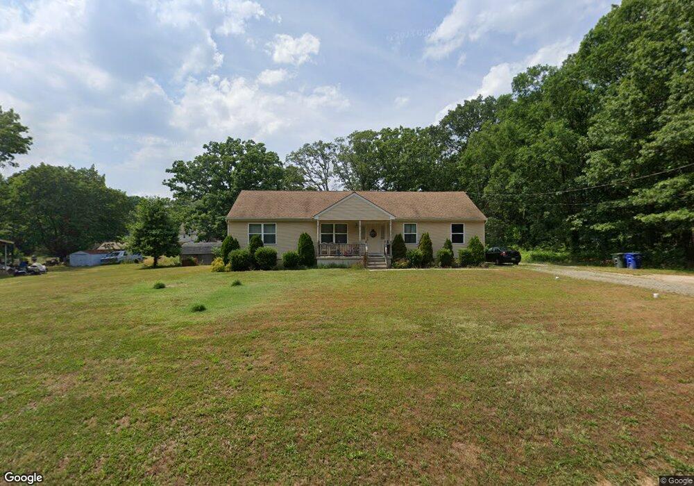
203 New York Ave Newfield, NJ 08344
Franklin Township NeighborhoodEstimated Value: $248,000 - $387,000
--
Bed
--
Bath
1,508
Sq Ft
$212/Sq Ft
Est. Value
About This Home
This home is located at 203 New York Ave, Newfield, NJ 08344 and is currently estimated at $319,846, approximately $212 per square foot. 203 New York Ave is a home with nearby schools including Delsea Regional Middle School, Delsea Regional High School, and Edgarton Christian Academy.
Ownership History
Date
Name
Owned For
Owner Type
Purchase Details
Closed on
Sep 9, 2009
Sold by
Jones Robert
Bought by
Holmes Robin
Current Estimated Value
Home Financials for this Owner
Home Financials are based on the most recent Mortgage that was taken out on this home.
Original Mortgage
$149,520
Interest Rate
5.12%
Mortgage Type
New Conventional
Create a Home Valuation Report for This Property
The Home Valuation Report is an in-depth analysis detailing your home's value as well as a comparison with similar homes in the area
Home Values in the Area
Average Home Value in this Area
Purchase History
| Date | Buyer | Sale Price | Title Company |
|---|---|---|---|
| Holmes Robin | -- | Mccollum Abstract & Title Ag |
Source: Public Records
Mortgage History
| Date | Status | Borrower | Loan Amount |
|---|---|---|---|
| Closed | Holmes Robin | $149,520 |
Source: Public Records
Tax History Compared to Growth
Tax History
| Year | Tax Paid | Tax Assessment Tax Assessment Total Assessment is a certain percentage of the fair market value that is determined by local assessors to be the total taxable value of land and additions on the property. | Land | Improvement |
|---|---|---|---|---|
| 2025 | $6,715 | $175,100 | $24,600 | $150,500 |
| 2024 | $6,558 | $175,100 | $24,600 | $150,500 |
| 2023 | $6,558 | $175,100 | $24,600 | $150,500 |
| 2022 | $6,382 | $175,100 | $24,600 | $150,500 |
| 2021 | $5,884 | $175,100 | $24,600 | $150,500 |
| 2020 | $6,197 | $175,100 | $24,600 | $150,500 |
| 2019 | $6,114 | $175,100 | $24,600 | $150,500 |
| 2018 | $6,025 | $175,100 | $24,600 | $150,500 |
| 2017 | $5,915 | $175,100 | $24,600 | $150,500 |
| 2016 | $5,892 | $175,100 | $24,600 | $150,500 |
| 2015 | $5,652 | $175,100 | $24,600 | $150,500 |
| 2014 | $5,433 | $175,100 | $24,600 | $150,500 |
Source: Public Records
Map
Nearby Homes
- 1701 West Blvd
- 2550 Harding Hwy
- 2840 Harding Hwy
- 4529 Robin Rd
- 200 Delsea Dr
- 5296 N Delsea Dr Unit 21
- 5296 N Delsea Dr Unit 17
- 1301 Old Lake Rd
- 1245 Old Lake Rd
- 3301 Dutch Mill Rd
- 0 Delsea Dr
- 260 Marshall Mill Rd
- 260 Marshall Mill Rd Unit 146
- 129 Malaga Park Dr
- 14 Sandy Dr
- 4191 Lake Rd Unit 5
- 4111 N Delsea Dr Unit 3
- 0 Rt 40 & Rosemont
- 0 Helena St
- 213 Church St
- 195 New York Ave
- New New York Ave
- 555 Fir Ave
- 0 New York Ave Unit 1006631386
- 0 New York Ave Unit 5582674
- 231 New York Ave
- 206 New York Ave
- 204 Grubb Rd
- 192 Grubb Rd
- 0 Larch Ave Unit 1006631418
- 0 Larch Ave Unit 1006631170
- 0 Larch Ave Unit 5582626
- 0 Larch Ave Unit 5582589
- 186 New York Ave
- 224 New York Ave
- 230 Grubb Rd
- 241 New York Ave
- 242 New York Ave
- 231 Delaware Ave
- 203 Grubb Rd