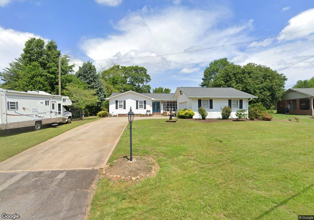
203 Patrick Ave Easley, SC 29642
Estimated Value: $252,000 - $316,000
3
Beds
3
Baths
1,896
Sq Ft
$151/Sq Ft
Est. Value
About This Home
This home is located at 203 Patrick Ave, Easley, SC 29642 and is currently estimated at $286,207, approximately $150 per square foot. 203 Patrick Ave is a home located in Pickens County with nearby schools including Forest Acres Elementary School, Richard H. Gettys Middle School, and Easley High School.
Ownership History
Date
Name
Owned For
Owner Type
Purchase Details
Closed on
Jul 27, 2009
Sold by
Brenda Young Real Estate Llc
Bought by
Cooper David and Cooper Genevieve
Current Estimated Value
Home Financials for this Owner
Home Financials are based on the most recent Mortgage that was taken out on this home.
Original Mortgage
$250,500
Outstanding Balance
$159,368
Interest Rate
5.14%
Mortgage Type
Reverse Mortgage Home Equity Conversion Mortgage
Estimated Equity
$126,839
Purchase Details
Closed on
Jun 19, 2007
Sold by
Dye Brenda W and Young Brenda W
Bought by
Brenda Young Real Estate Llc
Purchase Details
Closed on
May 24, 2006
Sold by
Knackstedt Wallace and Knackstedt Kim
Bought by
Dye Brenda W
Home Financials for this Owner
Home Financials are based on the most recent Mortgage that was taken out on this home.
Original Mortgage
$99,000
Interest Rate
6.44%
Mortgage Type
New Conventional
Create a Home Valuation Report for This Property
The Home Valuation Report is an in-depth analysis detailing your home's value as well as a comparison with similar homes in the area
Home Values in the Area
Average Home Value in this Area
Purchase History
| Date | Buyer | Sale Price | Title Company |
|---|---|---|---|
| Cooper David | -- | -- | |
| Brenda Young Real Estate Llc | -- | Attorney | |
| Dye Brenda W | $110,000 | None Available |
Source: Public Records
Mortgage History
| Date | Status | Borrower | Loan Amount |
|---|---|---|---|
| Open | Cooper David | $250,500 | |
| Previous Owner | Dye Brenda W | $99,000 |
Source: Public Records
Tax History
| Year | Tax Paid | Tax Assessment Tax Assessment Total Assessment is a certain percentage of the fair market value that is determined by local assessors to be the total taxable value of land and additions on the property. | Land | Improvement |
|---|---|---|---|---|
| 2025 | $583 | $6,510 | $1,040 | $5,470 |
| 2024 | $583 | $5,660 | $720 | $4,940 |
| 2023 | $487 | $5,660 | $720 | $4,940 |
| 2022 | $448 | $5,660 | $720 | $4,940 |
| 2021 | $0 | $5,660 | $720 | $4,940 |
| 2020 | $435 | $5,664 | $720 | $4,944 |
| 2019 | $0 | $5,660 | $720 | $4,940 |
| 2018 | $393 | $5,000 | $720 | $4,280 |
| 2017 | $366 | $5,000 | $720 | $4,280 |
| 2015 | $387 | $5,000 | $0 | $0 |
| 2008 | -- | $4,940 | $720 | $4,220 |
Source: Public Records
Map
Nearby Homes
- 200 Pleasant Dr
- 329 Prince Perry Rd
- 4875 Calhoun Memorial Hwy
- 108 Commons Dr
- 260 Audubon Acres Dr
- 406 Huntington Rd
- 00 Cardinal Dr
- 215 Chickadee Trail
- 107 Barrington Ct
- 103 Forest Dr
- 115 Rabbit Trail
- 203 Fledgling Way
- 107 S Dale Dr
- 1115 Crestview Rd
- 204 Muirfield Dr
- 132 Fledgling Way
- 0 Red Berry Ln
- 601 Cardinal Woods Way
- 108 Belmont Cir
- 222 Lake Forest Cir
- 201 Patrick Ave
- 205 Patrick Ave
- 202 Dayton School Rd
- 200 Dayton School Rd
- 204 Dayton School Rd
- 200 Patrick Ave
- 202 Patrick Ave
- 206 Dayton School Rd
- 104 Elrod St
- 106 Patrick Ave
- 102 Elrod St
- 213 Pleasant Dr
- 209 Patrick Ave
- 211 Pleasant Dr
- 104 Patrick Ave
- 209 Pleasant Dr
- 118 Dayton School Rd
- 118 Dayton School Rd Unit B
- 118 Dayton School Rd Unit A
- 116 Dayton School Rd
Your Personal Tour Guide
Ask me questions while you tour the home.