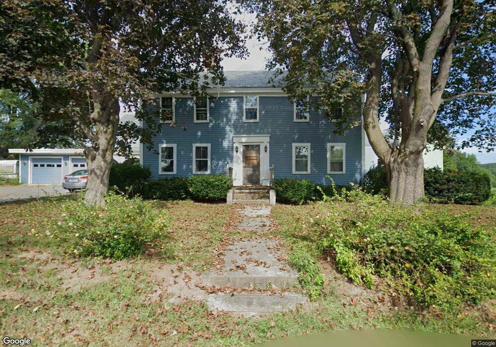
203 Pleasant St Lunenburg, MA 01462
Estimated Value: $520,000 - $676,077
5
Beds
3
Baths
3,656
Sq Ft
$160/Sq Ft
Est. Value
About This Home
This home is located at 203 Pleasant St, Lunenburg, MA 01462 and is currently estimated at $583,269, approximately $159 per square foot. 203 Pleasant St is a home located in Worcester County with nearby schools including Lunenburg Primary School, Lunenburg High School, and Sizer School, A North Central Charter Essential School.
Ownership History
Date
Name
Owned For
Owner Type
Purchase Details
Closed on
Dec 9, 1992
Sold by
Bingham Billie R and Bingham Eileen
Bought by
Parker Mack R and Parker Rosemary
Current Estimated Value
Home Financials for this Owner
Home Financials are based on the most recent Mortgage that was taken out on this home.
Original Mortgage
$159,900
Interest Rate
8.16%
Mortgage Type
Purchase Money Mortgage
Create a Home Valuation Report for This Property
The Home Valuation Report is an in-depth analysis detailing your home's value as well as a comparison with similar homes in the area
Home Values in the Area
Average Home Value in this Area
Purchase History
| Date | Buyer | Sale Price | Title Company |
|---|---|---|---|
| Parker Mack R | $199,900 | -- |
Source: Public Records
Mortgage History
| Date | Status | Borrower | Loan Amount |
|---|---|---|---|
| Closed | Parker Mack R | $159,900 | |
| Previous Owner | Parker Mack R | $50,000 |
Source: Public Records
Tax History Compared to Growth
Tax History
| Year | Tax Paid | Tax Assessment Tax Assessment Total Assessment is a certain percentage of the fair market value that is determined by local assessors to be the total taxable value of land and additions on the property. | Land | Improvement |
|---|---|---|---|---|
| 2025 | $9,134 | $636,100 | $155,800 | $480,300 |
| 2024 | $8,845 | $627,300 | $147,000 | $480,300 |
| 2023 | $8,640 | $591,000 | $133,600 | $457,400 |
| 2022 | $8,490 | $493,900 | $111,400 | $382,500 |
| 2020 | $8,129 | $448,600 | $111,200 | $337,400 |
| 2019 | $7,459 | $399,300 | $104,700 | $294,600 |
| 2018 | $7,328 | $372,000 | $104,200 | $267,800 |
| 2017 | $7,007 | $350,700 | $99,700 | $251,000 |
| 2016 | $6,754 | $344,400 | $94,800 | $249,600 |
| 2015 | $6,221 | $339,600 | $90,000 | $249,600 |
Source: Public Records
Map
Nearby Homes
- 141 Pleasant St
- 305 Pleasant St
- 819 West St
- 3 Rennie St
- 9 Pleasant St
- 363 Lunenburg St
- 23 Tilton Ave
- 44 Hamlin St
- 15 White St
- 276 Lunenburg St Unit 50
- 77 Electric Ave
- 62 Shawna St
- 36 Jackson Ave
- 0 Summer St
- 112 Boutelle St
- 183-185 Boutelle St
- 5 Harvard St
- 168 Lunenburg St
- 19 Boutelle St
- 21 Boutelle St
- 189 Pleasant St
- 217 Pleasant St
- 200 Pleasant St
- 223 Pleasant St
- 186 Pleasant St
- 175 Pleasant St
- 244 Pleasant St
- 227 Pleasant St
- 231 Pleasant St
- 241 Pleasant St
- 248 Pleasant St
- 77 Brown Ave
- 161 Pleasant St
- 161 Pleasant St
- 254 Pleasant St
- 237 Pleasant St
- 249 Pleasant St
- 258 Pleasant St
- 155 Pleasant St
- 255 Pleasant St