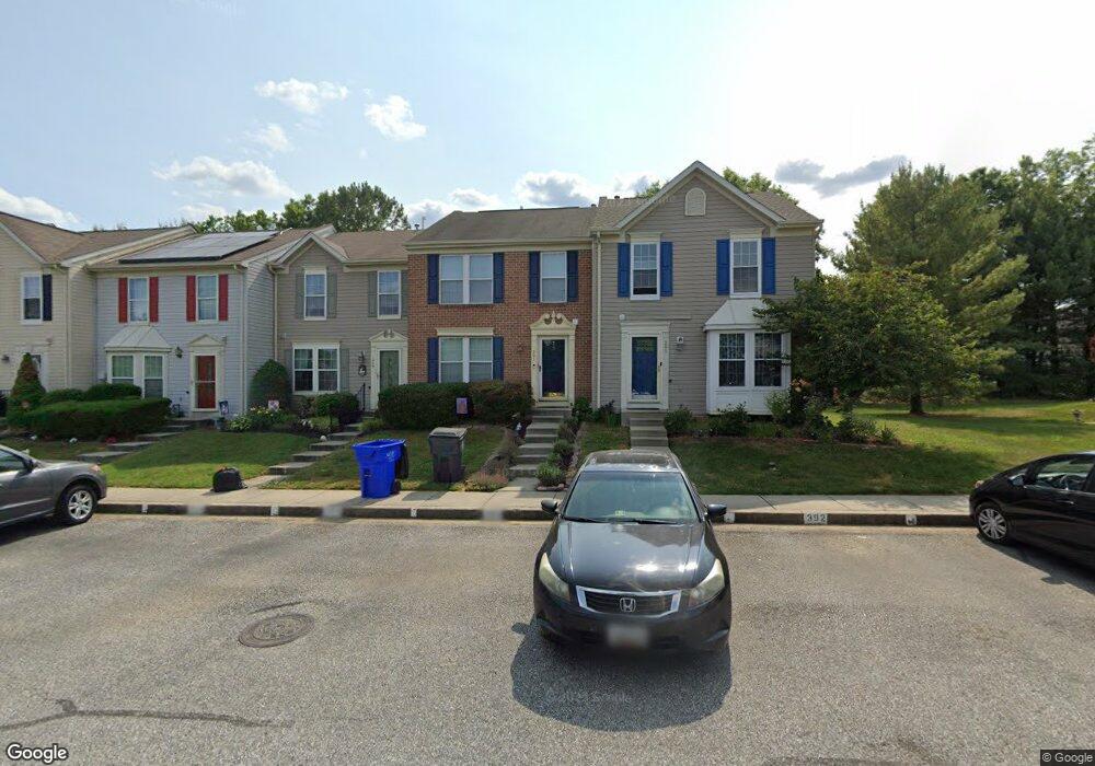
203 Point to Point Square Bel Air, MD 21015
Estimated Value: $318,509 - $347,000
3
Beds
3
Baths
1,252
Sq Ft
$269/Sq Ft
Est. Value
About This Home
This home is located at 203 Point to Point Square, Bel Air, MD 21015 and is currently estimated at $336,377, approximately $268 per square foot. 203 Point to Point Square is a home located in Harford County with nearby schools including Ring Factory Elementary School, Patterson Mill Middle School, and Patterson Mill High School.
Ownership History
Date
Name
Owned For
Owner Type
Purchase Details
Closed on
Oct 27, 2010
Sold by
Michocki Melinda C
Bought by
Mulvaney Michael
Current Estimated Value
Home Financials for this Owner
Home Financials are based on the most recent Mortgage that was taken out on this home.
Original Mortgage
$192,600
Outstanding Balance
$127,978
Interest Rate
4.41%
Mortgage Type
New Conventional
Estimated Equity
$208,399
Purchase Details
Closed on
Dec 18, 2002
Sold by
Golueke Matthew J
Bought by
Michocki Melinda C and Fratta Jon
Purchase Details
Closed on
Mar 4, 1996
Sold by
Nvr Homes Inc
Bought by
Golueke Matthew J
Create a Home Valuation Report for This Property
The Home Valuation Report is an in-depth analysis detailing your home's value as well as a comparison with similar homes in the area
Home Values in the Area
Average Home Value in this Area
Purchase History
| Date | Buyer | Sale Price | Title Company |
|---|---|---|---|
| Mulvaney Michael | $214,000 | -- | |
| Michocki Melinda C | $149,500 | -- | |
| Golueke Matthew J | $126,575 | -- |
Source: Public Records
Mortgage History
| Date | Status | Borrower | Loan Amount |
|---|---|---|---|
| Open | Mulvaney Michael | $192,600 | |
| Closed | Golueke Matthew J | -- |
Source: Public Records
Tax History Compared to Growth
Tax History
| Year | Tax Paid | Tax Assessment Tax Assessment Total Assessment is a certain percentage of the fair market value that is determined by local assessors to be the total taxable value of land and additions on the property. | Land | Improvement |
|---|---|---|---|---|
| 2025 | $2,321 | $229,300 | $0 | $0 |
| 2024 | $2,321 | $215,900 | $0 | $0 |
| 2023 | $2,207 | $202,500 | $70,000 | $132,500 |
| 2022 | $2,170 | $199,133 | $0 | $0 |
| 2021 | $2,220 | $195,767 | $0 | $0 |
| 2020 | $2,220 | $192,400 | $70,000 | $122,400 |
| 2019 | $2,159 | $187,067 | $0 | $0 |
| 2018 | $2,078 | $181,733 | $0 | $0 |
| 2017 | $2,017 | $176,400 | $0 | $0 |
| 2016 | $140 | $176,400 | $0 | $0 |
| 2015 | $2,294 | $176,400 | $0 | $0 |
| 2014 | $2,294 | $178,300 | $0 | $0 |
Source: Public Records
Map
Nearby Homes
- 220 Hunters Run Terrace
- 209 Hunters Run Terrace
- 234 Hunters Run Terrace
- 2104 Cameron Ct
- 306 Fox Hound Ct
- 43 Oak Crest Ct
- 25 Oak Crest Ct
- 130 Royal Oak Dr Unit L
- 100 Royal Oak Dr Unit I
- 2411 Grand Oaks Ct
- 233 Burkwood Ct
- 201 Burkwood Ct Unit 3B
- 202 Burkwood Ct
- 2414 Laurel Bush Rd
- 2332 Darby Ct
- 2302 Bell's Tower Ct
- 2310 Bell's Tower Ct Unit 5
- 214 Maple Wreath Ct
- Parkland Plan at Bell's Tower - Bell's Tower
- 2601 Merrick Way
- 205 Point to Point Square
- 201 Point to Point Square
- 207 Point to Point Square
- 209 Point to Point Square
- 211 Point to Point Square
- 213 Point to Point Square
- 215 Point to Point Square
- 200 Point to Point Square
- 202 Point to Point Square
- 204 Point to Point Square
- 206 Point to Point Square
- 208 Point to Point Square
- 210 Point to Point Square
- 212 Point to Point Square
- 214 Point to Point Square
- 2227 Old Emmorton Rd Unit 112
- 2227 Old Emmorton Rd Unit 222
- 217 Point to Point Square
- 219 Point to Point Square
- 233 Hunters Run Terrace