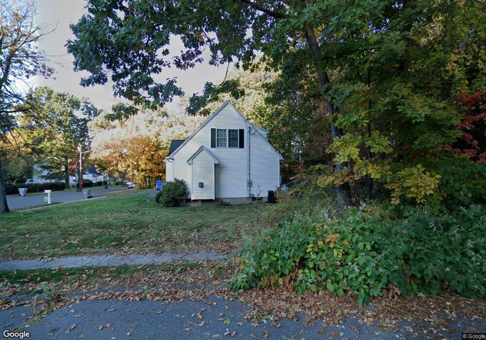
203 Redstone Hill Rd Bristol, CT 06010
Forestville NeighborhoodEstimated Value: $264,000 - $441,000
3
Beds
2
Baths
1,716
Sq Ft
$209/Sq Ft
Est. Value
About This Home
This home is located at 203 Redstone Hill Rd, Bristol, CT 06010 and is currently estimated at $359,063, approximately $209 per square foot. 203 Redstone Hill Rd is a home located in Hartford County with nearby schools including Bristol Central High School, Great Beginnings, and Central Christian Academy.
Ownership History
Date
Name
Owned For
Owner Type
Purchase Details
Closed on
Aug 28, 2017
Sold by
Vece Jacqueline A
Bought by
Tompkins Laurie and Tompkins Elmer J
Current Estimated Value
Purchase Details
Closed on
Feb 7, 2017
Sold by
Tompkins John and Tompkins Laurie A
Bought by
Tompkins John and Tompkins Laurie A
Create a Home Valuation Report for This Property
The Home Valuation Report is an in-depth analysis detailing your home's value as well as a comparison with similar homes in the area
Home Values in the Area
Average Home Value in this Area
Purchase History
| Date | Buyer | Sale Price | Title Company |
|---|---|---|---|
| Tompkins Laurie | $132,000 | -- | |
| Tompkins John | -- | -- |
Source: Public Records
Mortgage History
| Date | Status | Borrower | Loan Amount |
|---|---|---|---|
| Previous Owner | Tompkins John | $248,000 |
Source: Public Records
Tax History Compared to Growth
Tax History
| Year | Tax Paid | Tax Assessment Tax Assessment Total Assessment is a certain percentage of the fair market value that is determined by local assessors to be the total taxable value of land and additions on the property. | Land | Improvement |
|---|---|---|---|---|
| 2025 | $8,686 | $257,360 | $31,820 | $225,540 |
| 2024 | $8,197 | $257,360 | $31,820 | $225,540 |
| 2023 | $7,375 | $243,010 | $31,820 | $211,190 |
| 2022 | $7,438 | $193,940 | $25,030 | $168,910 |
| 2021 | $7,438 | $193,940 | $25,030 | $168,910 |
| 2020 | $9,008 | $234,890 | $49,460 | $185,430 |
| 2019 | $7,680 | $201,850 | $49,460 | $152,390 |
| 2018 | $7,893 | $214,030 | $49,460 | $164,570 |
| 2017 | $3,637 | $100,940 | $21,770 | $79,170 |
| 2016 | $3,637 | $100,940 | $21,770 | $79,170 |
| 2015 | $3,494 | $100,940 | $21,770 | $79,170 |
| 2014 | $3,494 | $100,940 | $21,770 | $79,170 |
Source: Public Records
Map
Nearby Homes
- 189 Redstone Hill Rd Unit 7
- 16 Brookside Dr
- 27 Brookside Dr
- 581 Village St
- 595 Village St
- 603 Village St
- 575 Village St
- 568 Village St
- 519 Village St
- 25 Zack Ln
- 26 Skyline Dr
- 132 Hollyberry Ln
- 452 East St
- 15 Charlies Way
- 2 Charlies Way
- 180 S Washington St Unit 12
- 138 Butler Ave
- 7 Meadow Rd
- 1985 West St Unit 11
- 1985 West St Unit 9
- 203 Red Stone Hill
- 199 Red Stone Hill
- 200 Red Stone Hill
- 202 Red Stone Hill
- 460 Village St
- 197 Red Stone Hill
- 11 Town Line Rd
- 198 Red Stone Hill
- 50 Field Rock Rd
- 3 Sunrise Terrace
- 195 Red Stone Hill
- 196 Red Stone Hill
- 100 Town Line Rd
- 64 Field Rock Rd
- 2 Eastview Rd
- 85 Field Rock Rd
- 194 Red Stone Hill
- 450 Town Line Rd
- 25 Field Rock Rd
- 108 Field Rock Rd