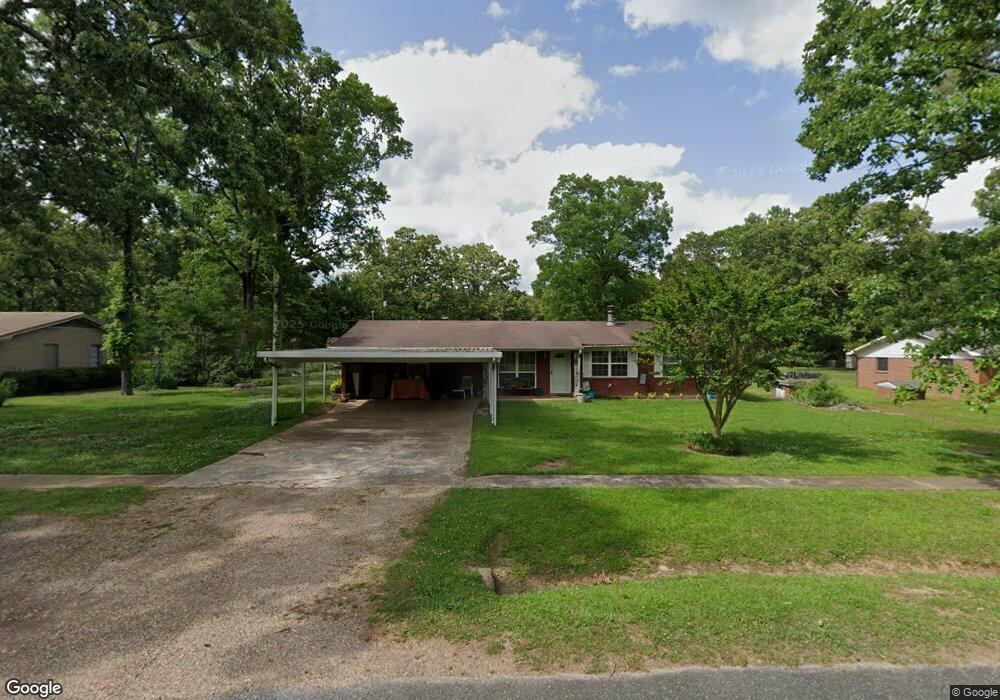
203 Redwood Dr Texarkana, TX 75501
Estimated Value: $197,000 - $259,000
--
Bed
--
Bath
1,776
Sq Ft
$126/Sq Ft
Est. Value
About This Home
This home is located at 203 Redwood Dr, Texarkana, TX 75501 and is currently estimated at $223,030, approximately $125 per square foot. 203 Redwood Dr is a home located in Bowie County with nearby schools including Liberty-Eylau Early Childhood Center, Liberty-Eylau Primary School, and Liberty-Eylau C.K. Bender Elementary Campus.
Ownership History
Date
Name
Owned For
Owner Type
Purchase Details
Closed on
Nov 4, 2024
Sold by
Chambers Charles R
Bought by
Self Todd and Self Vickie
Current Estimated Value
Home Financials for this Owner
Home Financials are based on the most recent Mortgage that was taken out on this home.
Original Mortgage
$42,000
Outstanding Balance
$40,292
Interest Rate
5.41%
Mortgage Type
Credit Line Revolving
Estimated Equity
$182,738
Purchase Details
Closed on
Feb 2, 2022
Sold by
Rex E Chambers Family Trust
Bought by
Chambers Charles R and Self Vickie
Create a Home Valuation Report for This Property
The Home Valuation Report is an in-depth analysis detailing your home's value as well as a comparison with similar homes in the area
Home Values in the Area
Average Home Value in this Area
Purchase History
| Date | Buyer | Sale Price | Title Company |
|---|---|---|---|
| Self Todd | -- | None Listed On Document | |
| Chambers Charles R | -- | Ross & Shoalmire Pllc |
Source: Public Records
Mortgage History
| Date | Status | Borrower | Loan Amount |
|---|---|---|---|
| Open | Self Todd | $42,000 |
Source: Public Records
Tax History Compared to Growth
Tax History
| Year | Tax Paid | Tax Assessment Tax Assessment Total Assessment is a certain percentage of the fair market value that is determined by local assessors to be the total taxable value of land and additions on the property. | Land | Improvement |
|---|---|---|---|---|
| 2025 | $1,715 | $162,613 | $16,000 | $146,613 |
| 2024 | $1,715 | $156,686 | $16,000 | $140,686 |
| 2023 | $2,193 | $146,737 | $16,000 | $130,737 |
| 2022 | $2,299 | $133,442 | $16,000 | $117,442 |
| 2021 | $2,033 | $110,939 | $14,500 | $96,439 |
| 2020 | $1,967 | $106,570 | $14,500 | $92,070 |
| 2019 | $1,989 | $102,413 | $14,500 | $87,913 |
| 2018 | $1,927 | $99,224 | $14,500 | $84,724 |
| 2017 | $1,911 | $98,747 | $14,500 | $84,247 |
| 2016 | $1,911 | $98,747 | $14,500 | $84,247 |
| 2015 | $564 | $97,965 | $14,500 | $83,465 |
| 2014 | $564 | $94,950 | $14,500 | $80,450 |
Source: Public Records
Map
Nearby Homes
- 101 Redwood Dr
- 6514 Buchanan Loop Rd
- 403 Brookfield St
- 194 W Starlite Dr
- 280 Patriot Way
- 6 Southridge St
- 2043 Randall Rd
- 6815 Buchanan Loop Rd
- 0 Randall Rd
- 6606 Us-59
- 6606 Us Highway 59 S
- lot15 B2 Quail Brook
- lot15 B1 Quail Brook
- lot14 B2 Quail Brook
- Lot 1 B2 Quail Brook
- 39 Quail Brook Dr
- 144 Joe Tyl Rd
- 7689 Us-59
- 7685 State Highway 59
- 5789 U S 59
- 201 Redwood Dr
- 205 Redwood Dr
- 207 Redwood Dr
- 206 Cummings Ln
- 111 Redwood Dr
- 204 Redwood Dr
- 206 Redwood Dr
- 202 Redwood Dr
- 208 Cummings Ln
- 209 Redwood Dr
- 200 Cummings Ln
- 112 Cummings Ln
- 208 Redwood Dr
- 112 Redwood Dr
- 109 Redwood Dr
- 210 Cummings Ln
- 210 Redwood Dr
- 110 Cummings Ln
- 211 Redwood Dr
- 110 Redwood Dr