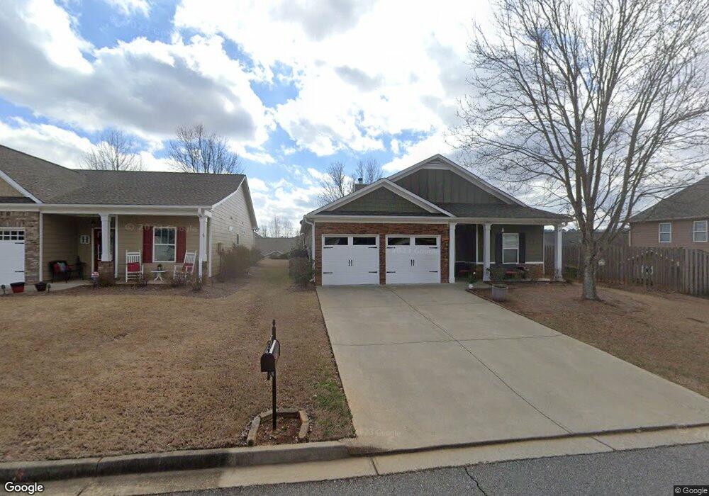
203 Renford Rd Ball Ground, GA 30107
Estimated Value: $366,000 - $376,048
3
Beds
2
Baths
1,674
Sq Ft
$222/Sq Ft
Est. Value
About This Home
This home is located at 203 Renford Rd, Ball Ground, GA 30107 and is currently estimated at $371,024, approximately $221 per square foot. 203 Renford Rd is a home located in Cherokee County with nearby schools including Hasty Elementary School Fine Arts Academy, Teasley Middle School, and Cherokee High School.
Ownership History
Date
Name
Owned For
Owner Type
Purchase Details
Closed on
Jul 21, 2008
Sold by
Owner Record
Bought by
Foster Dennis and Foster Janice D
Current Estimated Value
Home Financials for this Owner
Home Financials are based on the most recent Mortgage that was taken out on this home.
Original Mortgage
$113,000
Interest Rate
6.37%
Mortgage Type
Stand Alone Second
Purchase Details
Closed on
Jul 27, 2007
Sold by
Ballground Associates Llc
Bought by
Foster Dennis and Foster Janice P
Home Financials for this Owner
Home Financials are based on the most recent Mortgage that was taken out on this home.
Original Mortgage
$82,000
Interest Rate
6.62%
Mortgage Type
New Conventional
Create a Home Valuation Report for This Property
The Home Valuation Report is an in-depth analysis detailing your home's value as well as a comparison with similar homes in the area
Home Values in the Area
Average Home Value in this Area
Purchase History
| Date | Buyer | Sale Price | Title Company |
|---|---|---|---|
| Foster Dennis | -- | -- | |
| Foster Dennis | $172,000 | -- |
Source: Public Records
Mortgage History
| Date | Status | Borrower | Loan Amount |
|---|---|---|---|
| Previous Owner | Foster Dennis | $113,000 | |
| Previous Owner | Foster Dennis | $82,000 |
Source: Public Records
Tax History Compared to Growth
Tax History
| Year | Tax Paid | Tax Assessment Tax Assessment Total Assessment is a certain percentage of the fair market value that is determined by local assessors to be the total taxable value of land and additions on the property. | Land | Improvement |
|---|---|---|---|---|
| 2024 | $709 | $126,440 | $31,200 | $95,240 |
| 2023 | $586 | $131,800 | $31,200 | $100,600 |
| 2022 | $699 | $113,200 | $24,800 | $88,400 |
| 2021 | $661 | $87,480 | $20,800 | $66,680 |
| 2020 | $624 | $76,840 | $17,600 | $59,240 |
| 2019 | $606 | $72,120 | $17,600 | $54,520 |
| 2018 | $620 | $72,720 | $22,000 | $50,720 |
| 2017 | $561 | $157,100 | $15,600 | $47,240 |
| 2016 | $546 | $148,500 | $14,000 | $45,400 |
| 2015 | $530 | $140,500 | $11,600 | $44,600 |
| 2014 | $500 | $132,000 | $11,600 | $41,200 |
Source: Public Records
Map
Nearby Homes
- 317 Rippling Dr
- 250 Bethany Manor Ct
- 140 Renford Rd
- 312 Bloomfield Cir
- 316 Bloomfield Cir
- 324 Bloomfield Cir
- 334 Bloomfield Cir
- Poplar Plan at The Reserve at Willow Oaks
- Graham Plan at The Reserve at Willow Oaks
- Richmond Plan at The Reserve at Willow Oaks
- Woodbridge Plan at The Reserve at Willow Oaks
- Reynolds Plan at The Reserve at Willow Oaks
- Mayfield Plan at The Reserve at Willow Oaks
- Laurel Plan at The Reserve at Willow Oaks
- Brentwood Plan at The Reserve at Willow Oaks
- Turnbridge Plan at The Reserve at Willow Oaks
- Crofton Plan at The Reserve at Willow Oaks
- 213 Bloomfield Cir
- 209 Bloomfield Cir
- 145 Bloomfield Cir
- 105 Renford Rd
- 201 Renford Rd
- 103 Renford Rd
- 303 Rippling Dr
- 305 Rippling Dr
- 107 Renford Rd
- 305 Rippling Dr
- 248 Renford Rd
- 197 Renford Rd
- 307 Rippling Dr
- 250 Renford Rd
- 250 Renford Rd Unit 77
- 199 Renford Rd Unit 121
- 199 Renford Rd
- 246 Renford Rd
- 252 Renford Rd
- 244 Renford Rd Unit 80
- 244 Renford Rd
- 195 Renford Rd Unit 123
- 195 Renford Rd