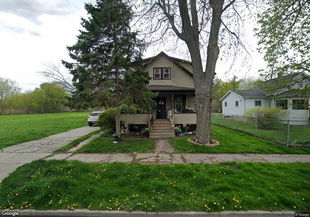
203 S 15th St Saginaw, MI 48601
Houghton Jones NeighborhoodEstimated Value: $49,000 - $60,000
--
Bed
--
Bath
1,368
Sq Ft
$40/Sq Ft
Est. Value
About This Home
This home is located at 203 S 15th St, Saginaw, MI 48601 and is currently estimated at $54,606, approximately $39 per square foot. 203 S 15th St is a home located in Saginaw County with nearby schools including Thompson Middle School, Saginaw United High School, and Saginaw Learn To Earn Academy.
Ownership History
Date
Name
Owned For
Owner Type
Purchase Details
Closed on
Jan 7, 2020
Sold by
Fifer Stacy L
Bought by
Anderson Donald and Anderson Barbara J
Current Estimated Value
Purchase Details
Closed on
May 9, 2016
Sold by
Fifer Dineka M and Fifer Dineka M
Bought by
Fifer Stacy L
Purchase Details
Closed on
Feb 19, 2014
Sold by
Anderson Donald and Anderson Barbara Kindred
Bought by
Fifer Dineka and Fifer Stacy
Purchase Details
Closed on
Aug 15, 2013
Sold by
Morris Myrine and Green Sharon
Bought by
Anderson Donald and Anderson Barbara Kindred
Create a Home Valuation Report for This Property
The Home Valuation Report is an in-depth analysis detailing your home's value as well as a comparison with similar homes in the area
Home Values in the Area
Average Home Value in this Area
Purchase History
| Date | Buyer | Sale Price | Title Company |
|---|---|---|---|
| Anderson Donald | $2,000 | None Available | |
| Fifer Stacy L | -- | -- | |
| Fifer Dineka | -- | -- | |
| Anderson Donald | $2,500 | -- | |
| Morris Myrine | -- | -- |
Source: Public Records
Tax History Compared to Growth
Tax History
| Year | Tax Paid | Tax Assessment Tax Assessment Total Assessment is a certain percentage of the fair market value that is determined by local assessors to be the total taxable value of land and additions on the property. | Land | Improvement |
|---|---|---|---|---|
| 2025 | $980 | $18,500 | $0 | $0 |
| 2024 | $801 | $16,400 | $0 | $0 |
| 2023 | $769 | $15,400 | $0 | $0 |
| 2022 | $899 | $13,100 | $0 | $0 |
| 2021 | $846 | $11,500 | $0 | $0 |
| 2020 | $527 | $8,300 | $0 | $0 |
| 2019 | $749 | $7,700 | $800 | $6,900 |
| 2018 | $458 | $4,498 | $0 | $0 |
| 2017 | $375 | $2,650 | $0 | $0 |
| 2016 | $512 | $8,069 | $0 | $0 |
| 2014 | -- | $7,920 | $0 | $7,292 |
| 2013 | -- | $7,924 | $0 | $0 |
Source: Public Records
Map
Nearby Homes
- 213 S 12th St
- 3361 Burt St
- 441 S 11th St
- 346 S 7th St
- 1919 Perkins St
- 2420 Bancroft St
- 514 N 8th St
- 631 Cathay St
- 924 Federal Ave
- 436 S 27th St
- 1346 Carlisle St
- 1103,1107,1111,1115 S Park Ave
- 1610 E Genesee Ave
- 3 Harmony Ct
- 915 Burt St
- 440 S 28th St
- 644 S 26th St
- 550 S Weadock Ave
- 523 S 29th St
- 2143 Whittier St