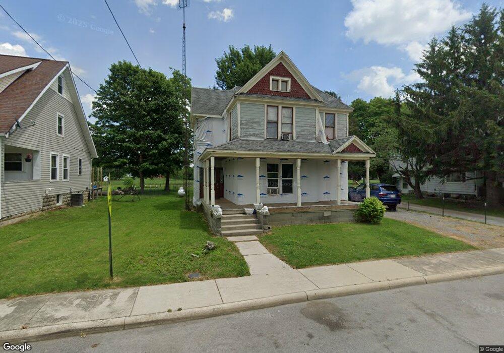
203 S Adams St Middle Point, OH 45863
Estimated Value: $56,000 - $164,000
3
Beds
1
Bath
2,288
Sq Ft
$41/Sq Ft
Est. Value
About This Home
This home is located at 203 S Adams St, Middle Point, OH 45863 and is currently estimated at $93,353, approximately $40 per square foot. 203 S Adams St is a home with nearby schools including Lincolnview Elementary School and Lincolnview Junior/Senior High School.
Ownership History
Date
Name
Owned For
Owner Type
Purchase Details
Closed on
Sep 29, 2025
Sold by
Carter Gavin Colin and Gaidon Carter Storm
Bought by
Neer Mackenzie G
Current Estimated Value
Home Financials for this Owner
Home Financials are based on the most recent Mortgage that was taken out on this home.
Original Mortgage
$49,500
Outstanding Balance
$49,500
Interest Rate
6.58%
Mortgage Type
New Conventional
Estimated Equity
$43,853
Purchase Details
Closed on
Sep 26, 2025
Sold by
Schrader Tara A
Bought by
Carter Gavin Colin and Gaidon Carter Storm
Home Financials for this Owner
Home Financials are based on the most recent Mortgage that was taken out on this home.
Original Mortgage
$49,500
Outstanding Balance
$49,500
Interest Rate
6.58%
Mortgage Type
New Conventional
Estimated Equity
$43,853
Purchase Details
Closed on
Sep 20, 2024
Sold by
Friemoth Landin Michael
Bought by
Carter Gavin Colin and Gaidon Carter Storm
Purchase Details
Closed on
Aug 10, 2021
Sold by
Schrader Tara A and Schrader Tara A
Bought by
Carter Gavin Colin and Carter Storm Gaidon
Purchase Details
Closed on
Jun 19, 2018
Sold by
Becxiner Harold R and Becker Harold R
Bought by
Scharadere Tara A
Purchase Details
Closed on
Nov 18, 2016
Sold by
Kill Etta and Kill David M
Bought by
Becker Harold R
Purchase Details
Closed on
Oct 3, 2010
Bought by
Kill Etta
Purchase Details
Closed on
Sep 30, 2005
Sold by
Crawford Charles W and Miller Cheryl L
Bought by
Kill Etta
Create a Home Valuation Report for This Property
The Home Valuation Report is an in-depth analysis detailing your home's value as well as a comparison with similar homes in the area
Purchase History
| Date | Buyer | Sale Price | Title Company |
|---|---|---|---|
| Neer Mackenzie G | $55,000 | Baker Mcclure Law & Title | |
| Carter Gavin Colin | -- | Baker Mcclure Law & Title | |
| Carter Gavin Colin | -- | None Listed On Document | |
| Carter Gavin Colin | $45,000 | None Available | |
| Scharadere Tara A | $30,000 | None Available | |
| Becker Harold R | $35,000 | Attorney | |
| Kill Etta | $4,000 | -- | |
| Kill Etta | $2,000 | None Available |
Source: Public Records
Mortgage History
| Date | Status | Borrower | Loan Amount |
|---|---|---|---|
| Open | Neer Mackenzie G | $49,500 |
Source: Public Records
Tax History
| Year | Tax Paid | Tax Assessment Tax Assessment Total Assessment is a certain percentage of the fair market value that is determined by local assessors to be the total taxable value of land and additions on the property. | Land | Improvement |
|---|---|---|---|---|
| 2025 | $1,211 | $35,950 | $1,720 | $34,230 |
| 2024 | $1,211 | $35,950 | $1,720 | $34,230 |
| 2023 | $1,202 | $35,950 | $1,720 | $34,230 |
| 2022 | $1,023 | $22,360 | $1,590 | $20,770 |
| 2021 | $1,029 | $22,360 | $1,590 | $20,770 |
| 2020 | $1,026 | $22,360 | $1,590 | $20,770 |
| 2019 | $831 | $19,050 | $1,590 | $17,460 |
| 2018 | $806 | $19,050 | $1,590 | $17,460 |
| 2017 | $819 | $19,050 | $1,590 | $17,460 |
| 2016 | $312 | $8,330 | $1,590 | $6,740 |
| 2015 | $308 | $8,330 | $1,590 | $6,740 |
| 2014 | $319 | $8,330 | $1,590 | $6,740 |
| 2013 | $376 | $8,330 | $1,590 | $6,740 |
Source: Public Records
Map
Nearby Homes
- 9750 Middle Point Rd
- 19195 State Rd
- 9450 Gamble Rd
- 15044 Main St
- 19059 Wittington St
- 415 Maple St
- 709 W 4th St
- 9750 Middle Point Rd
- 702 N Main St
- 424 S Canal St
- 221 S Main St
- 1109 Mendon Rd
- 610 N Washington St
- 201 E 5th St
- TBD Mendon Rd
- 483 S Franklin St
- 628 N Pierce St
- 404 E 3rd St
- 821 E 3rd St
- 904 E 2nd St
Your Personal Tour Guide
Ask me questions while you tour the home.