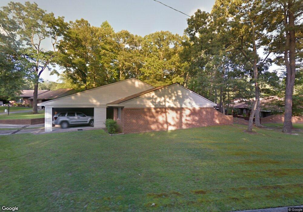
203 Santree Dr Unit E6 Williamston, NC 27892
Estimated Value: $105,000 - $140,431
1
Bed
1
Bath
933
Sq Ft
$135/Sq Ft
Est. Value
About This Home
This home is located at 203 Santree Dr Unit E6, Williamston, NC 27892 and is currently estimated at $125,608, approximately $134 per square foot. 203 Santree Dr Unit E6 is a home located in Martin County with nearby schools including Williamston Primary School, E.J. Hayes Elementary School, and Riverside Middle School.
Ownership History
Date
Name
Owned For
Owner Type
Purchase Details
Closed on
Mar 26, 2008
Sold by
Cowan Stuart Laton and Cowan Stuart Alton
Bought by
Cowan Sturat Alton
Current Estimated Value
Purchase Details
Closed on
Feb 13, 2007
Sold by
Edwards Rebecca A
Bought by
Williams Cindy B
Home Financials for this Owner
Home Financials are based on the most recent Mortgage that was taken out on this home.
Original Mortgage
$56,534
Interest Rate
6.08%
Mortgage Type
Purchase Money Mortgage
Create a Home Valuation Report for This Property
The Home Valuation Report is an in-depth analysis detailing your home's value as well as a comparison with similar homes in the area
Home Values in the Area
Average Home Value in this Area
Purchase History
| Date | Buyer | Sale Price | Title Company |
|---|---|---|---|
| Cowan Sturat Alton | -- | -- | |
| Cowan Sturat Alton | -- | -- | |
| Williams Cindy B | $55,000 | -- | |
| Williams Cindy B | $55,000 | -- |
Source: Public Records
Mortgage History
| Date | Status | Borrower | Loan Amount |
|---|---|---|---|
| Previous Owner | Williams Cindy B | $56,534 |
Source: Public Records
Tax History
| Year | Tax Paid | Tax Assessment Tax Assessment Total Assessment is a certain percentage of the fair market value that is determined by local assessors to be the total taxable value of land and additions on the property. | Land | Improvement |
|---|---|---|---|---|
| 2025 | $1,097 | $125,330 | $25,710 | $99,620 |
| 2024 | $779 | $72,080 | $20,630 | $51,450 |
| 2023 | $779 | $72,080 | $20,630 | $51,450 |
| 2022 | $766 | $72,080 | $20,630 | $51,450 |
| 2021 | $766 | $72,080 | $20,630 | $51,450 |
| 2020 | $756 | $72,080 | $20,630 | $51,450 |
| 2019 | $756 | $72,080 | $0 | $0 |
| 2018 | $741 | $72,080 | $0 | $0 |
| 2017 | $741 | $72,080 | $0 | $0 |
| 2015 | $578 | $55,240 | $0 | $0 |
| 2014 | $570 | $55,240 | $0 | $0 |
| 2012 | $532 | $55,240 | $0 | $0 |
Source: Public Records
Map
Nearby Homes
- 00 Santree Dr
- 107 S McCaskey Rd
- 1020 Dixie Trail
- 212 Sunset Dr
- 203 N Park Ave
- 200 1st St
- 1111 Prison Camp Rd
- 106 Carolina Ave
- 1005 Pinecrest St
- 303 Roberson Dr
- 203 Faulk St
- 817 W Main St
- 803 W Church St
- 1420 Lum Brown Rd
- 401 Jamesville Rd
- 607 W Main St
- 1046 Mockingbird Rd
- 105 N Pearl St
- 8001 W Main St
- 413 W Church St
- 200 Santree Dr Unit E9
- 200 Santree Dr Unit E5
- 200 Santree Dr Unit E7
- 200 Santree Dr Unit E10
- 208 Commons Cir
- 0 Santree Dr
- 160 Santree Dr
- 1536 Garrett Rd
- 100 Commons Dr
- 0 Commons Unit 100156042
- 1474 Garrett Rd
- 513 W Boulevard Blvd
- 517 W Boulevard Blvd
- 519 W Boulevard Blvd
- 515 W Boulevard Blvd
- 525 West Blvd
- 521 West Blvd
- 523 W Boulevard Blvd
- 1559 Garrett Rd
- 1585 Garrett Rd
Your Personal Tour Guide
Ask me questions while you tour the home.