--
Bed
--
Bath
5,995
Sq Ft
0.59
Acres
About This Home
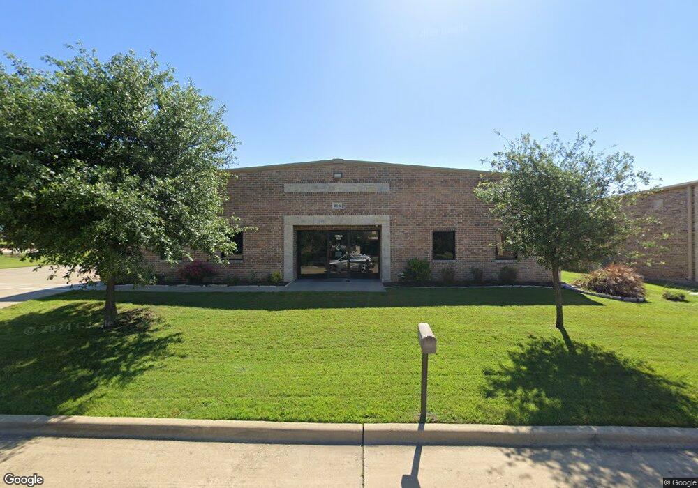
This home is located at 203 Security Ct, Wylie, TX 75098. 203 Security Ct is a home located in Collin County with nearby schools including Don Whitt Elementary School, Dr. Al Draper Intermediate Middle School, and Raymond B Cooper J High School.
Ownership History
Date
Name
Owned For
Owner Type
Purchase Details
Closed on
Oct 31, 2007
Sold by
Sargent Michael
Bought by
Hoosier Holdings Llc
Purchase Details
Closed on
Jun 20, 2007
Sold by
Maige Vincent
Bought by
Sargent Michael R
Home Financials for this Owner
Home Financials are based on the most recent Mortgage that was taken out on this home.
Original Mortgage
$284,000
Interest Rate
6.37%
Mortgage Type
Commercial
Purchase Details
Closed on
Dec 27, 2006
Sold by
Lyons Equities Inc
Bought by
Maige Vincent
Home Financials for this Owner
Home Financials are based on the most recent Mortgage that was taken out on this home.
Original Mortgage
$100,404
Interest Rate
6.2%
Mortgage Type
Commercial
Purchase Details
Closed on
May 1, 1998
Sold by
Quanset Corp
Bought by
Lyons Equities Inc
Create a Home Valuation Report for This Property
The Home Valuation Report is an in-depth analysis detailing your home's value as well as a comparison with similar homes in the area
Home Values in the Area
Average Home Value in this Area
Purchase History
| Date | Buyer | Sale Price | Title Company |
|---|---|---|---|
| Hoosier Holdings Llc | -- | Commonwealth Land Title | |
| Sargent Michael R | -- | Commonwealth Land Title Co | |
| Maige Vincent | -- | Reunion | |
| Lyons Equities Inc | -- | -- |
Source: Public Records
Mortgage History
| Date | Status | Borrower | Loan Amount |
|---|---|---|---|
| Previous Owner | Sargent Michael R | $284,000 | |
| Previous Owner | Maige Vincent | $100,404 |
Source: Public Records
Tax History Compared to Growth
Tax History
| Year | Tax Paid | Tax Assessment Tax Assessment Total Assessment is a certain percentage of the fair market value that is determined by local assessors to be the total taxable value of land and additions on the property. | Land | Improvement |
|---|---|---|---|---|
| 2025 | $12,963 | $732,573 | $206,400 | $526,173 |
| 2024 | $12,963 | $656,334 | $154,800 | $501,534 |
| 2023 | $12,963 | $621,525 | $141,900 | $479,625 |
| 2022 | $12,398 | $565,114 | $116,100 | $449,014 |
| 2021 | $11,614 | $493,601 | $116,100 | $377,501 |
| 2020 | $11,482 | $462,425 | $116,100 | $346,325 |
| 2019 | $11,832 | $450,247 | $116,100 | $334,147 |
| 2018 | $11,613 | $431,205 | $103,200 | $328,005 |
| 2017 | $11,382 | $422,652 | $103,200 | $319,452 |
| 2016 | $11,527 | $414,854 | $90,300 | $324,554 |
| 2015 | $8,345 | $388,151 | $64,500 | $323,651 |
Source: Public Records
Map
Nearby Homes
- 2710 W Fm 544
- 2722 W Fm 544
- Istanbul Plan at Woodbridge - Villas
- Prague Plan at Woodbridge - Villas
- Athens Plan at Woodbridge - Villas
- Dublin Plan at Woodbridge - Villas
- 613 Cloverleaf Dr
- 2724 Garden Gate Ln Unit 16
- 2812 Applewood Way
- 2114 Parkhurst Ct
- 301 Creekview Dr
- 2820 Applewood Way
- 207 Creekview Dr
- 628 Oakridge Dr
- 644 Oakridge Dr
- 650 Oakridge Dr
- 208 Lakefront Dr
- Ariel Plan at Woodbridge - Manors
- Jewel Plan at Woodbridge - Manors
- Andrew Plan at Woodbridge - Manors
- 205 Security Ct
- 210 Security Ct
- 201 Hooper Rd Unit 100
- 2608 W Fm 544
- 205 Hooper Rd Unit 100
- 120 Security Ct
- 110 Security Ct
- 331 Hooper Rd
- 326 Hooper Rd
- 2610 W Fm 544 Unit 105
- 2610 W Fm 544 Unit 107
- 2610 W Fm 544 Unit 110
- 2610 W Fm 544
- 2610 Wfm 544
- 124 Hooper Rd
- 51 Steel Rd
- 2131 Central Park Dr
- 2129 Central Park Dr
- 2127 Central Park Dr
- 2133 Central Park Dr