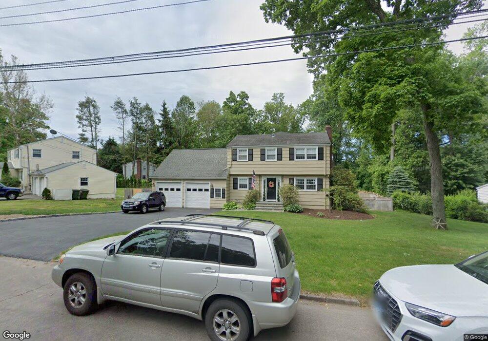
203 Shelter Rock Rd Fairfield, CT 06825
Lake Mohegan Hills NeighborhoodEstimated Value: $1,066,000 - $1,239,616
4
Beds
3
Baths
2,972
Sq Ft
$395/Sq Ft
Est. Value
About This Home
This home is located at 203 Shelter Rock Rd, Fairfield, CT 06825 and is currently estimated at $1,173,404, approximately $394 per square foot. 203 Shelter Rock Rd is a home located in Fairfield County with nearby schools including Jennings Elementary School, Fairfield Woods Middle School, and Fairfield Warde High School.
Ownership History
Date
Name
Owned For
Owner Type
Purchase Details
Closed on
Feb 11, 2021
Sold by
Richard Solaz Ret and Solaz
Bought by
Solaz David
Current Estimated Value
Purchase Details
Closed on
Jul 7, 1998
Sold by
Delise Antonio L and Delise Lori A
Bought by
Tartaglione Jsoeph and Tartaglione Lisa
Purchase Details
Closed on
Aug 20, 1993
Sold by
Strauss Michael H and Stauss Debra M
Bought by
Delise Antonio L and Delise Lori A
Create a Home Valuation Report for This Property
The Home Valuation Report is an in-depth analysis detailing your home's value as well as a comparison with similar homes in the area
Home Values in the Area
Average Home Value in this Area
Purchase History
| Date | Buyer | Sale Price | Title Company |
|---|---|---|---|
| Solaz David | -- | None Available | |
| Solaz David | -- | None Available | |
| Tartaglione Jsoeph | $375,000 | -- | |
| Delise Antonio L | $285,000 | -- | |
| Tartaglione Jsoeph | $375,000 | -- | |
| Delise Antonio L | $285,000 | -- |
Source: Public Records
Mortgage History
| Date | Status | Borrower | Loan Amount |
|---|---|---|---|
| Previous Owner | Delise Antonio L | $243,470 | |
| Previous Owner | Delise Antonio L | $250,000 |
Source: Public Records
Tax History Compared to Growth
Tax History
| Year | Tax Paid | Tax Assessment Tax Assessment Total Assessment is a certain percentage of the fair market value that is determined by local assessors to be the total taxable value of land and additions on the property. | Land | Improvement |
|---|---|---|---|---|
| 2025 | $13,911 | $490,000 | $245,560 | $244,440 |
| 2024 | $13,671 | $490,000 | $245,560 | $244,440 |
| 2023 | $13,480 | $490,000 | $245,560 | $244,440 |
| 2022 | $13,348 | $490,000 | $245,560 | $244,440 |
| 2021 | $13,220 | $490,000 | $245,560 | $244,440 |
| 2020 | $12,835 | $479,080 | $210,980 | $268,100 |
| 2019 | $12,835 | $479,080 | $210,980 | $268,100 |
| 2018 | $12,629 | $479,080 | $210,980 | $268,100 |
| 2017 | $12,370 | $479,080 | $210,980 | $268,100 |
| 2016 | $12,193 | $479,080 | $210,980 | $268,100 |
| 2015 | $10,958 | $442,050 | $222,460 | $219,590 |
| 2014 | $10,786 | $442,050 | $222,460 | $219,590 |
Source: Public Records
Map
Nearby Homes
- 31 High Ridge Rd
- 210 Pansy Rd
- 28 Stillson Place
- 706 Judd St
- 251 Winnepoge Dr
- 115 Mayfair Rd
- 79 Mayfair Rd
- 67 Campfield Dr
- 342 Fairfield Woods Rd
- 2107 N Benson Rd
- 1137 Stillson Rd
- 947 Galloping Hill Rd
- 1165 Stillson Rd
- 376 Knapps Hwy
- 180 Oakwood Dr
- 41 Pepperbush Ln
- 359 Reid St
- 1207 Stillson Rd
- 279 Knapps Hwy
- 92 Montauk St
- 185 Shelter Rock Rd
- 208 Shelter Rock Rd
- 251 Shelter Rock Rd
- 226 Shelter Rock Rd
- 258 Steiner St
- 202 Steiner St
- 250 Shelter Rock Rd
- 278 Steiner St
- 253 Shelter Rock Rd
- 205 Steiner St
- 237 Steiner St
- 271 Steiner St
- 183 Woodridge Ave
- 300 Steiner St
- 132 Shelter Rock Rd
- 265 Shelter Rock Rd
- 167 Woodridge Ave
- 211 Woodridge Ave
- 266 Shelter Rock Rd
- 291 Steiner St