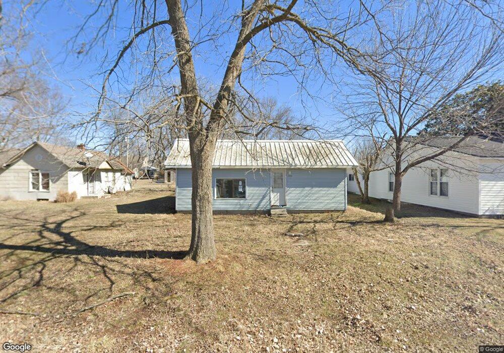
203 Skinner St Carl Junction, MO 64834
Estimated Value: $66,313 - $122,000
Studio
1
Bath
840
Sq Ft
$118/Sq Ft
Est. Value
About This Home
This home is located at 203 Skinner St, Carl Junction, MO 64834 and is currently estimated at $98,828, approximately $117 per square foot. 203 Skinner St is a home with nearby schools including Carl Junction Primary School (K-1), Carl Junction Intermediate School, and Carl Junction Primary School (2-3).
Ownership History
Date
Name
Owned For
Owner Type
Purchase Details
Closed on
Apr 23, 2024
Sold by
Eastplains Corporation
Bought by
County Care Properties Llc
Current Estimated Value
Purchase Details
Closed on
Feb 10, 2005
Sold by
Kropp Joseph J and Kropp Karen Kay
Bought by
Porter Barbara J
Home Financials for this Owner
Home Financials are based on the most recent Mortgage that was taken out on this home.
Original Mortgage
$15,465
Interest Rate
5.85%
Mortgage Type
Purchase Money Mortgage
Create a Home Valuation Report for This Property
The Home Valuation Report is an in-depth analysis detailing your home's value as well as a comparison with similar homes in the area
Purchase History
| Date | Buyer | Sale Price | Title Company |
|---|---|---|---|
| County Care Properties Llc | $21,000 | None Listed On Document | |
| County Care Properties Llc | $21,000 | None Listed On Document | |
| Porter Barbara J | -- | -- |
Source: Public Records
Mortgage History
| Date | Status | Borrower | Loan Amount |
|---|---|---|---|
| Previous Owner | Porter Barbara J | $15,465 |
Source: Public Records
Tax History
| Year | Tax Paid | Tax Assessment Tax Assessment Total Assessment is a certain percentage of the fair market value that is determined by local assessors to be the total taxable value of land and additions on the property. | Land | Improvement |
|---|---|---|---|---|
| 2025 | $269 | $5,170 | $670 | $4,500 |
| 2024 | $271 | $4,600 | $670 | $3,930 |
| 2023 | $271 | $4,600 | $670 | $3,930 |
| 2022 | $266 | $4,500 | $670 | $3,830 |
| 2021 | $228 | $4,500 | $670 | $3,830 |
| 2020 | $216 | $4,200 | $670 | $3,530 |
| 2019 | $205 | $4,200 | $670 | $3,530 |
| 2018 | $205 | $4,200 | $0 | $0 |
| 2016 | $204 | $4,200 | $0 | $0 |
Source: Public Records
Map
Nearby Homes
- 901 Aberdeen Ave
- 809 Aberdeen Ave
- TBD Temple St
- 604 Pennell St
- 503 S Main St
- 501 S Cowgill St
- 720 Sheridan Ave
- 505 N Broadway Ave
- 304 Belgian Blue Blvd
- 900 Aberdeen Ave
- 608 Valley View St
- 804 Aberdeen Ave
- 805 Aberdeen Ave
- 806 Aberdeen Ave
- 808 Aberdeen Ave
- 902 Aberdeen Ave
- 903 Aberdeen Ave
- 904 Aberdeen Ave
- 905 Aberdeen Ave
Your Personal Tour Guide
Ask me questions while you tour the home.