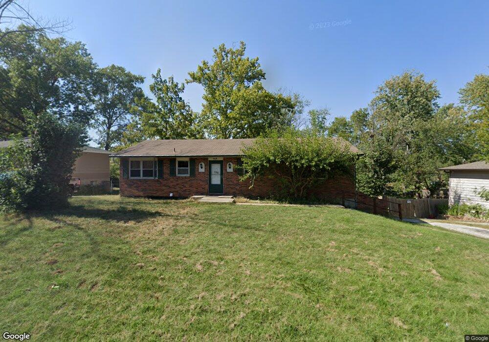
203 Snead Dr Columbia, MO 65202
Estimated Value: $214,000 - $287,000
3
Beds
2
Baths
1,872
Sq Ft
$131/Sq Ft
Est. Value
About This Home
This home is located at 203 Snead Dr, Columbia, MO 65202 and is currently estimated at $245,242, approximately $131 per square foot. 203 Snead Dr is a home located in Boone County with nearby schools including Eliot Battle Elementary School, John B. Lange Middle School, and Muriel W. Battle High School.
Ownership History
Date
Name
Owned For
Owner Type
Purchase Details
Closed on
Apr 5, 2019
Sold by
Trentman Jeff
Bought by
Ampong Dan and Tigas Ampong Lina
Current Estimated Value
Purchase Details
Closed on
May 28, 2008
Sold by
Shelton Adam M and Shelton Kacey N
Bought by
Trentman Jeff
Home Financials for this Owner
Home Financials are based on the most recent Mortgage that was taken out on this home.
Original Mortgage
$92,000
Interest Rate
5.89%
Mortgage Type
Purchase Money Mortgage
Purchase Details
Closed on
Mar 13, 2006
Sold by
Golden Marcela L
Bought by
Shelton Adam M and Shelton Kacey N
Home Financials for this Owner
Home Financials are based on the most recent Mortgage that was taken out on this home.
Original Mortgage
$104,199
Interest Rate
6.32%
Mortgage Type
FHA
Purchase Details
Closed on
Apr 20, 2005
Sold by
Walker David P
Bought by
Walker Angelica M
Create a Home Valuation Report for This Property
The Home Valuation Report is an in-depth analysis detailing your home's value as well as a comparison with similar homes in the area
Home Values in the Area
Average Home Value in this Area
Purchase History
| Date | Buyer | Sale Price | Title Company |
|---|---|---|---|
| Ampong Dan | -- | Boone Central Title Company | |
| Trentman Jeff | -- | None Available | |
| Shelton Adam M | -- | None Available | |
| Walker Angelica M | -- | None Available |
Source: Public Records
Mortgage History
| Date | Status | Borrower | Loan Amount |
|---|---|---|---|
| Previous Owner | Trentman Jeff | $92,000 | |
| Previous Owner | Shelton Adam M | $104,199 |
Source: Public Records
Tax History Compared to Growth
Tax History
| Year | Tax Paid | Tax Assessment Tax Assessment Total Assessment is a certain percentage of the fair market value that is determined by local assessors to be the total taxable value of land and additions on the property. | Land | Improvement |
|---|---|---|---|---|
| 2025 | $1,342 | $18,563 | $2,850 | $15,713 |
| 2024 | $1,342 | $18,563 | $2,850 | $15,713 |
| 2023 | $1,331 | $18,563 | $2,850 | $15,713 |
| 2022 | $1,330 | $18,563 | $2,850 | $15,713 |
| 2021 | $1,332 | $18,563 | $2,850 | $15,713 |
| 2020 | $1,307 | $17,195 | $2,850 | $14,345 |
| 2019 | $1,307 | $17,195 | $2,850 | $14,345 |
| 2018 | $1,316 | $0 | $0 | $0 |
| 2017 | $1,301 | $17,195 | $2,850 | $14,345 |
| 2016 | $1,298 | $17,195 | $2,850 | $14,345 |
| 2015 | $1,199 | $17,195 | $2,850 | $14,345 |
| 2014 | -- | $17,195 | $2,850 | $14,345 |
Source: Public Records
Map
Nearby Homes
- 6007 E Saint Charles Rd
- 6003 E St Charles Rd
- 1312 N Lake of the Woods Rd
- 1312 N Lake of the Wood
- 1537 N Lake of the Woods Rd
- 6077 E Locust Grove Dr
- 300 Searsport Dr
- 5800 Oswago Cir
- 5802 Islip Dr
- 1887 Waterfront Dr N Unit F
- 5724 Black Gum Ct
- 2032 Waterfront Dr N Unit C
- 1999 Waterfront Dr N Unit G
- 1999 Waterfront Dr N Unit H
- 1997 Waterfront Dr N Unit D
- 2009 Waterfront Dr N Unit E
- 2009 Waterfront Dr N Unit A1
- 5904 Freeport Way
- 5301 Gasconade Dr
- 1710 Kassem Dr
- 205 Snead Dr
- 201 Snead Dr
- 1200-1202 Player Place
- 1200 Player Place Unit 1202
- 207 Snead Dr
- 202 Snead Dr
- 204 Snead Dr
- 6212 E Saint Charles Rd
- 6208 E Saint Charles Rd
- 1201-1203 Player Place
- 1201 Player Place Unit 1203
- 200 Snead Dr
- 209 Snead Dr
- 6304 E Saint Charles Rd
- 210 Snead Dr
- 1204-1206 Player Place
- 1204 Player Place Unit 1206
- 6200 E Saint Charles Rd
- 307 Hogan Dr
- 305 Hogan Dr