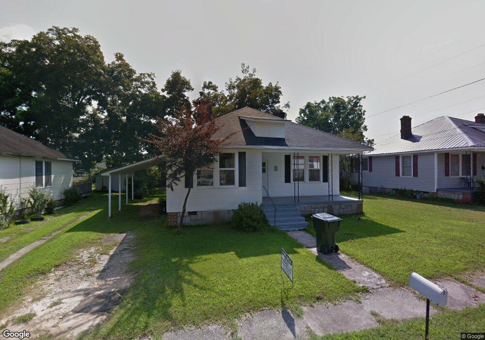
203 Snyder Ave Elberton, GA 30635
Estimated Value: $104,765 - $132,000
--
Bed
1
Bath
1,091
Sq Ft
$105/Sq Ft
Est. Value
About This Home
This home is located at 203 Snyder Ave, Elberton, GA 30635 and is currently estimated at $114,441, approximately $104 per square foot. 203 Snyder Ave is a home located in Elbert County with nearby schools including Elbert County Primary School, Elbert County Elementary School, and Elbert County Middle School.
Ownership History
Date
Name
Owned For
Owner Type
Purchase Details
Closed on
Mar 28, 2005
Sold by
Mize Jimmy
Bought by
Mize Property Holdings Ii Llc
Current Estimated Value
Purchase Details
Closed on
Dec 20, 2004
Sold by
Mize Property Holdings Ii Llc
Bought by
Watkins Jimmy and Watkins Mary
Purchase Details
Closed on
Nov 1, 1998
Purchase Details
Closed on
Jul 1, 1998
Purchase Details
Closed on
Jan 1, 1958
Create a Home Valuation Report for This Property
The Home Valuation Report is an in-depth analysis detailing your home's value as well as a comparison with similar homes in the area
Home Values in the Area
Average Home Value in this Area
Purchase History
| Date | Buyer | Sale Price | Title Company |
|---|---|---|---|
| Mize Property Holdings Ii Llc | -- | -- | |
| Watkins Jimmy | $36,500 | -- | |
| -- | $22,000 | -- | |
| -- | -- | -- | |
| -- | $4,000 | -- |
Source: Public Records
Tax History Compared to Growth
Tax History
| Year | Tax Paid | Tax Assessment Tax Assessment Total Assessment is a certain percentage of the fair market value that is determined by local assessors to be the total taxable value of land and additions on the property. | Land | Improvement |
|---|---|---|---|---|
| 2024 | $576 | $24,018 | $2,208 | $21,810 |
| 2023 | $576 | $24,018 | $2,208 | $21,810 |
| 2022 | $440 | $18,348 | $2,208 | $16,140 |
| 2021 | $441 | $18,348 | $2,208 | $16,140 |
| 2020 | $344 | $14,662 | $2,208 | $12,454 |
| 2019 | $358 | $14,662 | $2,208 | $12,454 |
| 2018 | $368 | $14,662 | $2,208 | $12,454 |
| 2017 | $366 | $12,467 | $2,208 | $10,259 |
| 2016 | $366 | $12,467 | $2,208 | $10,259 |
| 2015 | -- | $12,467 | $2,208 | $10,259 |
| 2014 | -- | $14,010 | $2,208 | $11,802 |
| 2013 | -- | $11,538 | $2,208 | $9,330 |
Source: Public Records
Map
Nearby Homes
- 0 Old Middleton Rd Unit 22775401
- 0 Old Middleton Rd Unit 10651016
- 349 Cook St
- 122 Parkwood Dr
- 135 Brookside Dr
- 173 Brookside Dr
- 214 Campbell St
- 181 Brookside Dr
- 136 Springdale Rd
- 120 S Tusten St
- 141 Wildwood Dr
- 1055 Country Manor Ln
- 252 Edwards St
- 245 Edwards St
- 1 Calhoun Falls Hwy
- 4 Calhoun Falls Hwy
- 3 Calhoun Falls Hwy
- 844 Sherwood Dr
- 105 S Thomas St
- 115 S Thomas St