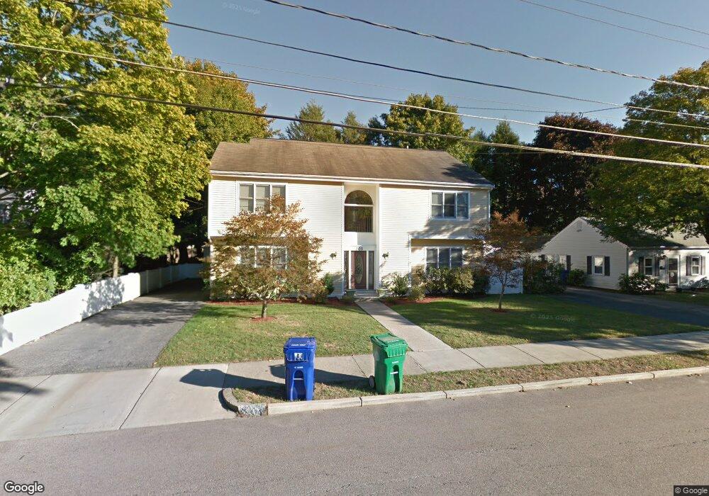
203 Spiers Rd Unit 1 Newton Center, MA 02459
Mount Ida NeighborhoodEstimated Value: $1,423,000 - $2,024,000
5
Beds
4
Baths
4,087
Sq Ft
$409/Sq Ft
Est. Value
About This Home
This home is located at 203 Spiers Rd Unit 1, Newton Center, MA 02459 and is currently estimated at $1,670,065, approximately $408 per square foot. 203 Spiers Rd Unit 1 is a home located in Middlesex County with nearby schools including Memorial Spaulding Elementary School, Oak Hill Middle School, and Newton South High School.
Ownership History
Date
Name
Owned For
Owner Type
Purchase Details
Closed on
Jul 21, 2016
Sold by
Vietri Enrico and Notaroberto Rosa
Bought by
203 Spiers Road Llc
Current Estimated Value
Purchase Details
Closed on
Aug 3, 2000
Sold by
Smullin Bernard
Bought by
Vietri Enrico and Notaroberto Rosa
Home Financials for this Owner
Home Financials are based on the most recent Mortgage that was taken out on this home.
Original Mortgage
$390,000
Interest Rate
8.1%
Mortgage Type
Purchase Money Mortgage
Purchase Details
Closed on
Jul 29, 1998
Sold by
Eaton Julian S
Bought by
Langston Anita Mae
Create a Home Valuation Report for This Property
The Home Valuation Report is an in-depth analysis detailing your home's value as well as a comparison with similar homes in the area
Home Values in the Area
Average Home Value in this Area
Purchase History
| Date | Buyer | Sale Price | Title Company |
|---|---|---|---|
| 203 Spiers Road Llc | -- | -- | |
| Vietri Enrico | $520,000 | -- | |
| Langston Anita Mae | $217,500 | -- |
Source: Public Records
Mortgage History
| Date | Status | Borrower | Loan Amount |
|---|---|---|---|
| Previous Owner | Langston Anita Mae | $391,923 | |
| Previous Owner | Langston Anita Mae | $330,000 | |
| Previous Owner | Langston Anita Mae | $390,000 |
Source: Public Records
Tax History Compared to Growth
Tax History
| Year | Tax Paid | Tax Assessment Tax Assessment Total Assessment is a certain percentage of the fair market value that is determined by local assessors to be the total taxable value of land and additions on the property. | Land | Improvement |
|---|---|---|---|---|
| 2025 | $10,183 | $1,039,100 | $608,800 | $430,300 |
| 2024 | $9,846 | $1,008,800 | $591,100 | $417,700 |
| 2023 | $9,392 | $922,600 | $444,200 | $478,400 |
| 2022 | $8,987 | $854,300 | $411,300 | $443,000 |
| 2021 | $8,671 | $805,900 | $388,000 | $417,900 |
| 2020 | $8,414 | $805,900 | $388,000 | $417,900 |
| 2019 | $8,176 | $782,400 | $376,700 | $405,700 |
| 2018 | $8,238 | $761,400 | $341,600 | $419,800 |
| 2017 | $7,987 | $718,300 | $322,300 | $396,000 |
| 2016 | $7,639 | $671,300 | $301,200 | $370,100 |
| 2015 | $7,284 | $627,400 | $281,500 | $345,900 |
Source: Public Records
Map
Nearby Homes
- 544 Saw Mill Brook Pkwy
- 30 Esty Farm Rd
- 141 Spiers Rd
- 22 Nightingale Path
- 30 K Roadway
- 579 Baker St Unit 579
- 577 Baker St Unit 577
- 931 Lagrange St
- 845 Lagrange St Unit 4
- 1206 Lagrange St Unit 1206
- 21 Lovett Rd
- 36 Ober Rd
- 44 Lovett Rd
- 17 Tirrell Crescent
- 331 Vermont St
- 210 Nahanton St Unit 404
- 63 Drumlin Rd
- 89 Dwinell St
- 23 Westgate Rd Unit 6
- 135 Hartman Rd
- 203 Spiers Rd
- 203 Spiers Rd
- 203 Spiers Rd Unit 203
- 203 Spiers Rd Unit SF
- 209 Spiers Rd
- 197 Spiers Rd
- 25 Cavanaugh Path
- 215 Spiers Rd
- 192 Spiers Rd
- 26 Cavanaugh Path
- 21 Cavanaugh Path
- 219 Spiers Rd
- 185 Spiers Rd
- 22 Tocci Path
- 184 Spiers Rd
- 15 Cavanaugh Path
- 15 Cavanaugh Path Unit 1
- 225 Spiers Rd
- 179 Spiers Rd
- 222 Spiers Rd