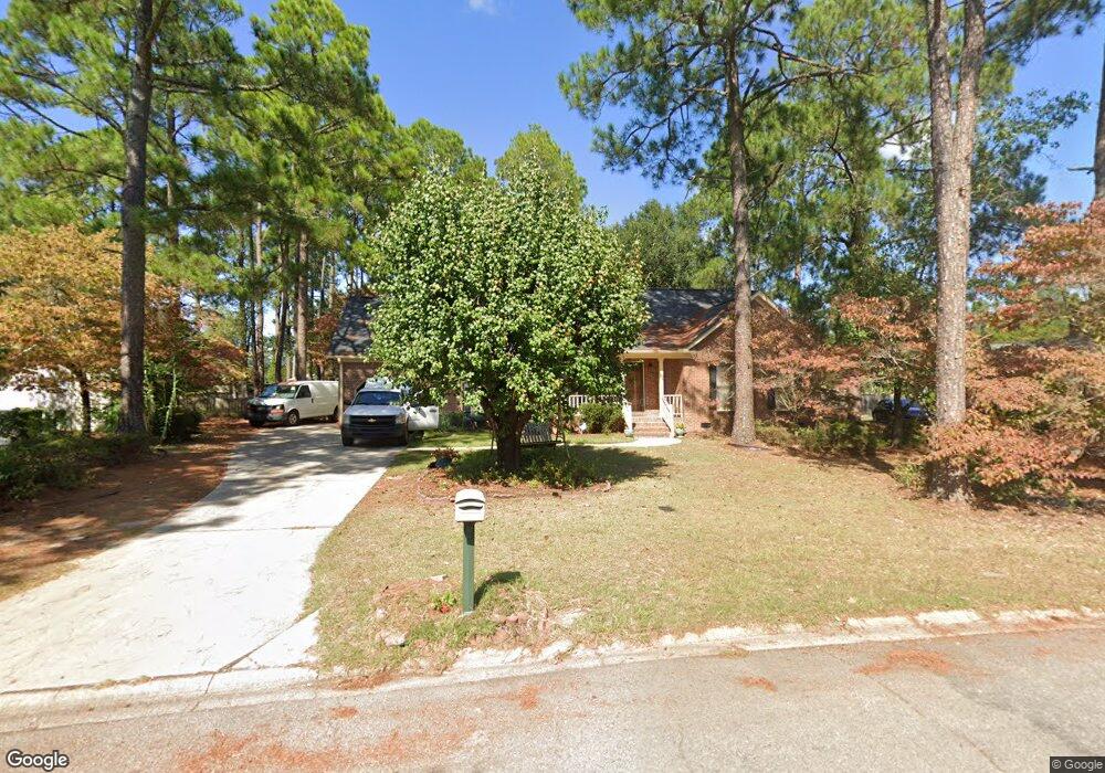
203 Springhurst Dr Columbia, SC 29223
Northeast Columbia NeighborhoodEstimated Value: $217,928 - $263,000
3
Beds
2
Baths
1,721
Sq Ft
$140/Sq Ft
Est. Value
About This Home
This home is located at 203 Springhurst Dr, Columbia, SC 29223 and is currently estimated at $241,232, approximately $140 per square foot. 203 Springhurst Dr is a home located in Richland County with nearby schools including L. B. Nelson Elementary School, E. L. Wright Middle School, and Spring Valley High School.
Ownership History
Date
Name
Owned For
Owner Type
Purchase Details
Closed on
May 8, 2023
Sold by
Stewart Eva T
Bought by
Stewart Emanuel T
Current Estimated Value
Purchase Details
Closed on
Jan 20, 2000
Sold by
Hud
Bought by
Stewart Emanuel T and Stewart Eva T
Home Financials for this Owner
Home Financials are based on the most recent Mortgage that was taken out on this home.
Original Mortgage
$88,400
Interest Rate
8.11%
Purchase Details
Closed on
Aug 26, 1998
Sold by
Martin Jan M and Chase Manhattan Mtg Corp
Bought by
Hud
Create a Home Valuation Report for This Property
The Home Valuation Report is an in-depth analysis detailing your home's value as well as a comparison with similar homes in the area
Home Values in the Area
Average Home Value in this Area
Purchase History
| Date | Buyer | Sale Price | Title Company |
|---|---|---|---|
| Stewart Emanuel T | -- | None Listed On Document | |
| Stewart Emanuel T | $104,000 | -- | |
| Hud | $2,500 | -- |
Source: Public Records
Mortgage History
| Date | Status | Borrower | Loan Amount |
|---|---|---|---|
| Previous Owner | Stewart Emanuel T | $88,400 |
Source: Public Records
Tax History
| Year | Tax Paid | Tax Assessment Tax Assessment Total Assessment is a certain percentage of the fair market value that is determined by local assessors to be the total taxable value of land and additions on the property. | Land | Improvement |
|---|---|---|---|---|
| 2024 | $4,522 | $128,100 | $0 | $0 |
| 2023 | $4,408 | $4,456 | $0 | $0 |
| 2022 | $1,262 | $111,400 | $16,200 | $95,200 |
| 2021 | $1,258 | $4,460 | $0 | $0 |
| 2020 | $1,274 | $4,460 | $0 | $0 |
| 2019 | $1,248 | $4,460 | $0 | $0 |
| 2018 | $1,110 | $3,880 | $0 | $0 |
| 2017 | $1,090 | $3,880 | $0 | $0 |
| 2016 | $1,087 | $3,880 | $0 | $0 |
| 2015 | $1,090 | $3,880 | $0 | $0 |
| 2014 | $1,089 | $96,900 | $0 | $0 |
| 2013 | -- | $3,880 | $0 | $0 |
Source: Public Records
Map
Nearby Homes
- 136 Mcneely Rd
- 329 Patrick Dr
- 231 Pond Ridge Rd E
- 213 Pond Ridge Rd E
- 313 Thornridge Rd
- 116 Fishers Shore Rd
- 31 Dove Park Cir
- 502 Dove Park Rd
- 27 Foxhill Ct
- 307 E Springs Rd
- 512 Humble Dr
- 308 Valley Springs Rd
- 505 Humble Dr
- 300 Valley Springs Rd
- 214 Woodlands Village Dr
- 501 Sheridan Dr
- 816 Kinlock Ct
- 2224 Westbranch Rd
- 117 Fire Thorn Ln
- 305 Concourse Dr
- 25 N Hillock Ct
- 29 N Hillock Ct
- 205 Springhurst Dr
- 21 N Hillock Ct
- 30 S Hillock Ct
- 204 Springhurst Dr
- 207 Springhurst Dr
- 17 N Hillock Ct
- 312 Risdon Way
- 316 Risdon Way
- 308 Risdon Way
- 208 Springhurst Dr
- 117 Springhurst Dr
- 26 S Hillock Ct
- 320 Risdon Way
- 304 Risdon Way
- 209 Springhurst Dr
- 324 Risdon Way
- 13 N Hillock Ct
- 300 Risdon Way
Your Personal Tour Guide
Ask me questions while you tour the home.