Estimated Value: $87,000 - $127,000
2
Beds
1
Bath
1,112
Sq Ft
$89/Sq Ft
Est. Value
About This Home
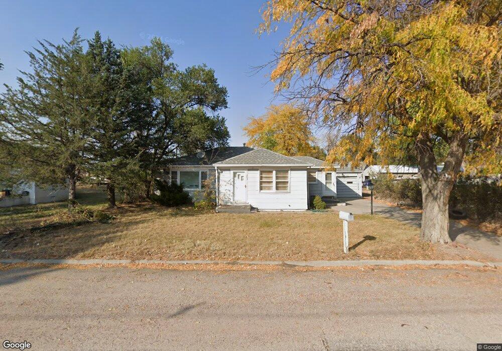
This home is located at 203 W Carroll St, Henry, NE 69358 and is currently estimated at $99,463, approximately $89 per square foot. 203 W Carroll St is a home located in Scotts Bluff County with nearby schools including Morrill Elementary School and Morrill High School.
Ownership History
Date
Name
Owned For
Owner Type
Purchase Details
Closed on
Mar 24, 2010
Sold by
Brodgon Cnthy and Brodgon Coy Max
Bought by
Wright Colby J
Current Estimated Value
Home Financials for this Owner
Home Financials are based on the most recent Mortgage that was taken out on this home.
Original Mortgage
$62,220
Outstanding Balance
$41,135
Interest Rate
4.93%
Mortgage Type
New Conventional
Estimated Equity
$58,328
Create a Home Valuation Report for This Property
The Home Valuation Report is an in-depth analysis detailing your home's value as well as a comparison with similar homes in the area
Home Values in the Area
Average Home Value in this Area
Purchase History
| Date | Buyer | Sale Price | Title Company |
|---|---|---|---|
| Wright Colby J | $61,000 | -- |
Source: Public Records
Mortgage History
| Date | Status | Borrower | Loan Amount |
|---|---|---|---|
| Open | Wright Colby J | $62,220 |
Source: Public Records
Tax History Compared to Growth
Tax History
| Year | Tax Paid | Tax Assessment Tax Assessment Total Assessment is a certain percentage of the fair market value that is determined by local assessors to be the total taxable value of land and additions on the property. | Land | Improvement |
|---|---|---|---|---|
| 2024 | $801 | $65,295 | $7,000 | $58,295 |
| 2023 | $820 | $47,870 | $1,190 | $46,680 |
| 2022 | $820 | $47,870 | $1,190 | $46,680 |
| 2021 | $824 | $47,870 | $1,190 | $46,680 |
| 2020 | $868 | $47,870 | $1,190 | $46,680 |
| 2019 | $831 | $47,870 | $1,190 | $46,680 |
| 2018 | $838 | $47,870 | $1,190 | $46,680 |
| 2017 | $844 | $47,870 | $1,190 | $46,680 |
| 2016 | $828 | $46,785 | $1,190 | $45,595 |
| 2015 | $747 | $42,358 | $1,190 | $41,168 |
| 2014 | $755 | $42,358 | $1,190 | $41,168 |
| 2012 | -- | $42,358 | $1,190 | $41,168 |
Source: Public Records
Map
Nearby Homes
- 413 Highway 26 E
- 20084 Holloway Rd
- 0 Tbd Holloway Rd
- 0 County Rd E
- 5779 Road 56
- 0 Tbd Railroad Rd
- 6156 Road 52
- 5198 Road 64
- 30057 County Road 7
- 30057 Cr 7
- 401 W P St
- 213 10th Ave
- 112 9th Ave
- 70141 Randall Ln
- 127 Arrowhead Rd
- 113 Arrowhead Rd
- 5887 & 5879 Maverick Ridge Rd
- 707 2nd Ave
- 315 Jackson Ct
- 5865 Lariat Loop
- . W Carroll St
- 202 W Carroll St
- 205 W Carroll St
- 205 W Carroll St Unit Main Street
- 1582 Yorick Ave
- 1580 Yorick Ave
- 1510 Anderson Ave
- 201 W Carroll St
- 1470 Anderson St
- 113 W Carroll St
- 1454 Yorick Ave
- 113 Carroll St
- 1590 Yorick Ave
- 1547 Yorick Ave
- 1551 Yorick Ave
- 1555 Yorick Ave
- 1455 Yorick Ave
- 1450 Yorick Ave
- 1452 Yorick Ave
- 1460 Anderson Ave