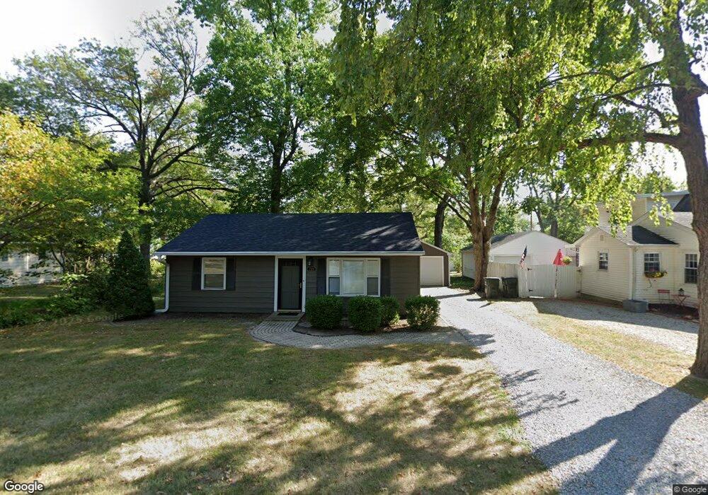
203 W Dunbar St Mahomet, IL 61853
Estimated Value: $149,553 - $189,000
--
Bed
1
Bath
819
Sq Ft
$205/Sq Ft
Est. Value
About This Home
This home is located at 203 W Dunbar St, Mahomet, IL 61853 and is currently estimated at $168,138, approximately $205 per square foot. 203 W Dunbar St is a home located in Champaign County with nearby schools including Middletown Prairie Elementary, First School, and Mahomet Christian School.
Ownership History
Date
Name
Owned For
Owner Type
Purchase Details
Closed on
Dec 23, 2021
Sold by
Preston Wilma Carol
Bought by
Brown Trevor Mack
Current Estimated Value
Home Financials for this Owner
Home Financials are based on the most recent Mortgage that was taken out on this home.
Original Mortgage
$122,727
Outstanding Balance
$113,264
Interest Rate
3.37%
Mortgage Type
New Conventional
Estimated Equity
$54,874
Create a Home Valuation Report for This Property
The Home Valuation Report is an in-depth analysis detailing your home's value as well as a comparison with similar homes in the area
Home Values in the Area
Average Home Value in this Area
Purchase History
| Date | Buyer | Sale Price | Title Company |
|---|---|---|---|
| Brown Trevor Mack | $120,000 | None Available |
Source: Public Records
Mortgage History
| Date | Status | Borrower | Loan Amount |
|---|---|---|---|
| Open | Brown Trevor Mack | $122,727 |
Source: Public Records
Tax History Compared to Growth
Tax History
| Year | Tax Paid | Tax Assessment Tax Assessment Total Assessment is a certain percentage of the fair market value that is determined by local assessors to be the total taxable value of land and additions on the property. | Land | Improvement |
|---|---|---|---|---|
| 2024 | $2,491 | $41,220 | $12,180 | $29,040 |
| 2023 | $2,491 | $37,470 | $11,070 | $26,400 |
| 2022 | $2,283 | $34,530 | $10,200 | $24,330 |
| 2021 | $2,146 | $32,640 | $9,640 | $23,000 |
| 2020 | $2,103 | $32,100 | $9,480 | $22,620 |
| 2019 | $2,044 | $31,590 | $9,330 | $22,260 |
| 2018 | $1,980 | $30,910 | $9,130 | $21,780 |
| 2017 | $1,885 | $29,430 | $8,690 | $20,740 |
| 2016 | $1,876 | $29,430 | $8,690 | $20,740 |
| 2015 | $1,841 | $29,430 | $8,690 | $20,740 |
| 2014 | $1,834 | $28,850 | $8,520 | $20,330 |
| 2013 | $1,739 | $27,700 | $8,180 | $19,520 |
Source: Public Records
Map
Nearby Homes
- 106 E Union St
- 305 S West St
- 204 W Oak St
- 403 E State St
- 401 N Tamula Dr
- 411 Weathering Dr
- 501 Richard Ct
- 502 Richard Ct
- 700 Eastwood Dr
- 605 N Craig Dr
- 1101 S Mcdougal Rd
- 1101 E Pin Oak Dr
- 200 Riverbend Blvd
- 1511 River Bluff Ct
- 1808 S Orchard Dr
- 1804 Horizon Ct
- 205 Ranch Ln
- Wellington 2117 Plan at Hunters Ridge
- Belmont 1638 Plan at Hunters Ridge
- Eldridge Plan at Whisper Meadow
- 205 W Dunbar St
- 107 W Dunbar St
- 300 S West St
- 302 S West St
- 105 W Dunbar St
- 204 W Union St
- 206 W Union St
- 202 W Union St
- 206 W Dunbar St
- 103 1/2 W Dunbar St
- 202 W Dunbar St
- 304 S West St
- 208 W Dunbar St
- 103 W Dunbar St
- 301 W Dunbar St
- 303 S West St
- 106 W Union St
- 108 W Dunbar St
- 104 W Union St
- 303 S Division St