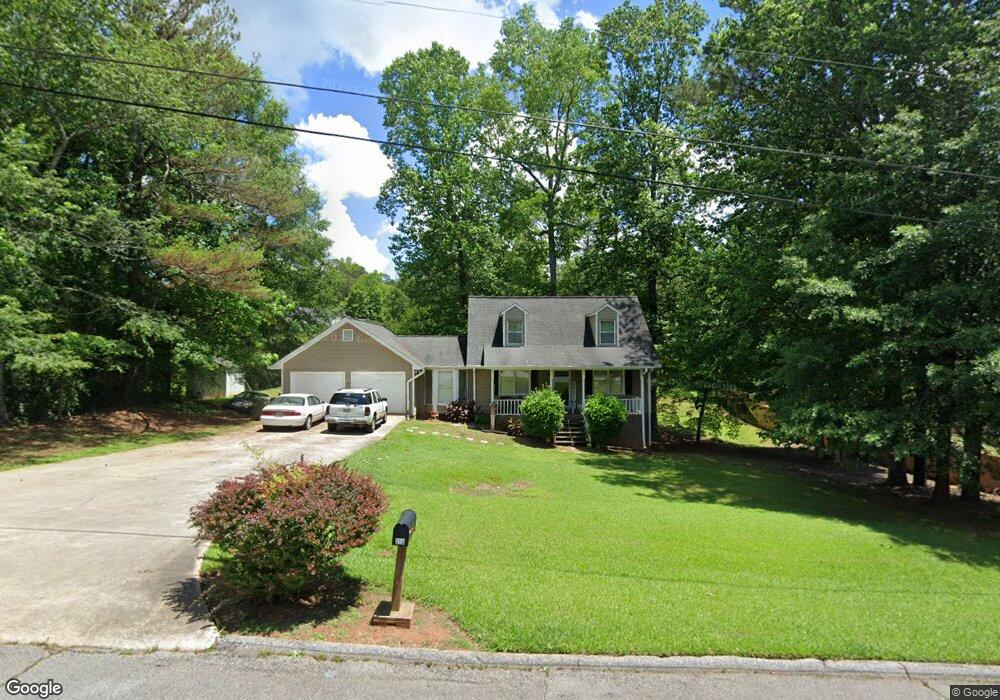
203 Wilson Dr Carrollton, GA 30117
Estimated Value: $259,993 - $298,000
3
Beds
2
Baths
1,566
Sq Ft
$183/Sq Ft
Est. Value
About This Home
This home is located at 203 Wilson Dr, Carrollton, GA 30117 and is currently estimated at $287,248, approximately $183 per square foot. 203 Wilson Dr is a home located in Carroll County with nearby schools including Carrollton Elementary School, Carrollton Upper Elementary School, and Carrollton Middle School.
Ownership History
Date
Name
Owned For
Owner Type
Purchase Details
Closed on
Oct 1, 1988
Sold by
Bearden Alan Eugene and Wanda Gene
Bought by
Holland Michael and Holland Debbie P
Current Estimated Value
Purchase Details
Closed on
Sep 1, 1986
Sold by
Rhodes Edgar L
Bought by
Bearden Alan Eugene and Wanda Gene
Purchase Details
Closed on
Jul 1, 1985
Sold by
First National Bank Of Haralso
Bought by
Rhodes Edgar L
Purchase Details
Closed on
Mar 1, 1984
Sold by
Wilson C L
Bought by
Warren Steve
Create a Home Valuation Report for This Property
The Home Valuation Report is an in-depth analysis detailing your home's value as well as a comparison with similar homes in the area
Home Values in the Area
Average Home Value in this Area
Purchase History
| Date | Buyer | Sale Price | Title Company |
|---|---|---|---|
| Holland Michael | -- | -- | |
| Bearden Alan Eugene | $75,000 | -- | |
| Rhodes Edgar L | $46,000 | -- | |
| First National Bank Of Haralson Co | $51,000 | -- | |
| Warren Steve | $6,700 | -- |
Source: Public Records
Tax History Compared to Growth
Tax History
| Year | Tax Paid | Tax Assessment Tax Assessment Total Assessment is a certain percentage of the fair market value that is determined by local assessors to be the total taxable value of land and additions on the property. | Land | Improvement |
|---|---|---|---|---|
| 2024 | $2,392 | $87,530 | $10,000 | $77,530 |
| 2023 | $2,392 | $86,554 | $10,000 | $76,554 |
| 2022 | $2,086 | $71,448 | $10,000 | $61,448 |
| 2021 | $1,831 | $62,736 | $10,000 | $52,736 |
| 2020 | $1,650 | $56,478 | $10,000 | $46,478 |
| 2019 | $1,574 | $53,380 | $10,000 | $43,380 |
| 2018 | $1,132 | $42,970 | $10,000 | $32,970 |
| 2017 | $1,137 | $42,970 | $10,000 | $32,970 |
| 2016 | $1,143 | $42,970 | $10,000 | $32,970 |
| 2015 | $1,048 | $37,912 | $6,000 | $31,912 |
| 2014 | $1,052 | $37,912 | $6,000 | $31,912 |
Source: Public Records
Map
Nearby Homes
- 121 Wilson Cir
- 816 Stewart St
- 111 Lakeview Dr
- 115 N Lake Dr
- 325 Almon Rd
- 123 Autumn Glen Dr
- 114 Green Point Way
- 123 Cedar Park Way
- 2580 Shady Grove Rd
- 231 N Lakeshore Dr
- 223 N Lakeshore Dr
- 131 Hunter Way
- 105 Providence Ct
- 221 Turtle Cove
- 777 College St
- 541 N White St
- 3 Burns Rd
- 2 Burns Rd
- 2930 Highway 113
- 119 Oxford Square
- 203 Wilson Dr
- 101 Kay Ln
- 108 Lumpkin Dr
- 105 Kay Ln
- 112 Lumpkin Dr
- 204 Wilson Dr
- 202 Wilson Dr
- 0 Wilson Dr Unit 9010206
- 0 Wilson Dr Unit 9017602
- 295 Wilson Dr
- 0 Wilson Dr Unit 8844146
- 0 Wilson Dr
- 129 Wilson Cir
- 100 Wilson Cir
- 107 Kay Ln
- 114 Lumpkin Dr
- 127 Wilson Cir
- 104 Kay Ln
- 103 Wilson Cir
- 104 Lumpkin Dr