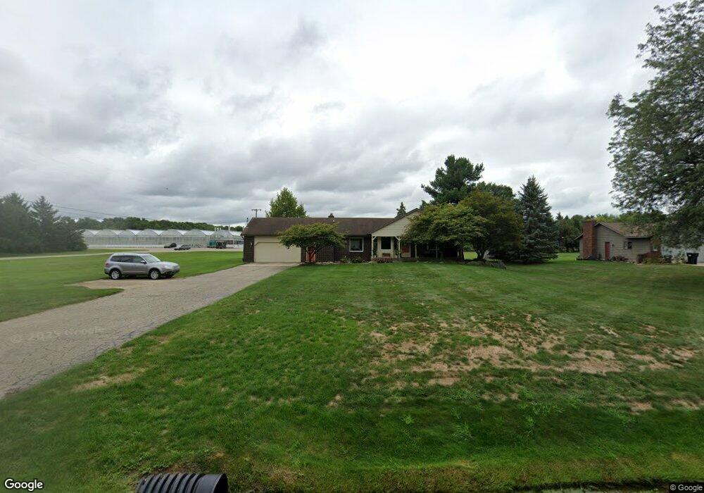
2030 72nd St SW Byron Center, MI 49315
Estimated Value: $373,000 - $538,000
3
Beds
2
Baths
1,537
Sq Ft
$296/Sq Ft
Est. Value
About This Home
This home is located at 2030 72nd St SW, Byron Center, MI 49315 and is currently estimated at $455,558, approximately $296 per square foot. 2030 72nd St SW is a home located in Kent County with nearby schools including Marshall Elementary School, Robert L. Nickels Intermediate School, and Byron Center West Middle School.
Ownership History
Date
Name
Owned For
Owner Type
Purchase Details
Closed on
Mar 5, 2008
Sold by
Obbink Ricky and Obbink Yvonne
Bought by
The Bank Of New York Trust Co Na and Jpmorgan Chase Bank Na
Current Estimated Value
Purchase Details
Closed on
Apr 5, 2005
Sold by
Henry Mast Real Estate Inc
Bought by
Obbink Ricky L
Home Financials for this Owner
Home Financials are based on the most recent Mortgage that was taken out on this home.
Original Mortgage
$140,000
Interest Rate
6.9%
Mortgage Type
Fannie Mae Freddie Mac
Create a Home Valuation Report for This Property
The Home Valuation Report is an in-depth analysis detailing your home's value as well as a comparison with similar homes in the area
Home Values in the Area
Average Home Value in this Area
Purchase History
| Date | Buyer | Sale Price | Title Company |
|---|---|---|---|
| The Bank Of New York Trust Co Na | $150,000 | None Available | |
| Obbink Ricky L | $175,000 | Devon Title |
Source: Public Records
Mortgage History
| Date | Status | Borrower | Loan Amount |
|---|---|---|---|
| Previous Owner | Obbink Ricky L | $140,000 | |
| Closed | Obbink Ricky L | $35,000 |
Source: Public Records
Tax History Compared to Growth
Tax History
| Year | Tax Paid | Tax Assessment Tax Assessment Total Assessment is a certain percentage of the fair market value that is determined by local assessors to be the total taxable value of land and additions on the property. | Land | Improvement |
|---|---|---|---|---|
| 2025 | $3,405 | $193,900 | $0 | $0 |
| 2024 | $3,405 | $183,600 | $0 | $0 |
| 2023 | $3,253 | $163,800 | $0 | $0 |
| 2022 | $5,028 | $135,700 | $0 | $0 |
| 2021 | $4,244 | $115,300 | $0 | $0 |
| 2020 | $2,592 | $116,700 | $0 | $0 |
| 2019 | $4,129 | $111,800 | $0 | $0 |
| 2018 | $3,991 | $106,200 | $19,600 | $86,600 |
| 2017 | $3,916 | $93,200 | $0 | $0 |
| 2016 | $3,824 | $88,200 | $0 | $0 |
| 2015 | $3,792 | $88,200 | $0 | $0 |
| 2013 | -- | $76,300 | $0 | $0 |
Source: Public Records
Map
Nearby Homes
- 1752 Springwind Dr SW
- 1645 Springwind Dr SW
- 7609 Clementine Ave
- The Preston Plan at Alden Grove
- The Marley Plan at Alden Grove
- The Grayson Plan at Alden Grove
- The Crestview Plan at Alden Grove
- The Hadley Plan at Alden Grove
- The Maxwell Plan at Alden Grove
- The Stockton Plan at Alden Grove
- The Mayfair Plan at Alden Grove
- The Balsam Plan at Alden Grove
- The Newport Plan at Alden Grove
- The Sebastian Plan at Alden Grove
- The Jamestown Plan at Alden Grove
- The Georgetown Plan at Alden Grove
- The Fitzgerald Plan at Alden Grove
- The Sanibel Plan at Alden Grove
- The Wisteria Plan at Alden Grove
- The Hearthside Plan at Alden Grove
- 2050 72nd St SW
- 2070 72nd St SW
- 2035 72nd St SW
- 2015 72nd St SW
- 2055 72nd St SW
- 2090 72nd St SW
- 1991 72nd St SW
- 1950 72nd St SW
- 1961 72nd St SW
- 7087 Country Springs Dr SW
- 1960 Lillypad Dr SW
- 1932 72nd St SW
- 1946 Lilypad Dr SW
- 1946 Lillypad Dr SW
- 7187 Cattail SW
- 7179 Cattail SW
- 7079 Country Springs Dr SW
- 2125 72nd St SW
- 2136 72nd St SW
- 7071 Country Springs Dr SW