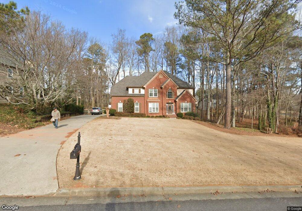
2030 Brookton Way Cumming, GA 30041
Big Creek NeighborhoodEstimated Value: $622,000 - $755,000
4
Beds
3
Baths
2,570
Sq Ft
$268/Sq Ft
Est. Value
About This Home
This home is located at 2030 Brookton Way, Cumming, GA 30041 and is currently estimated at $688,981, approximately $268 per square foot. 2030 Brookton Way is a home located in Forsyth County with nearby schools including Sharon Elementary School, South Forsyth Middle School, and South Forsyth High School.
Ownership History
Date
Name
Owned For
Owner Type
Purchase Details
Closed on
Sep 25, 1998
Sold by
Edw & Associates Inc
Bought by
Clonts Kenneth and Clonts Jacquelyn A
Current Estimated Value
Home Financials for this Owner
Home Financials are based on the most recent Mortgage that was taken out on this home.
Original Mortgage
$166,955
Interest Rate
6.47%
Mortgage Type
New Conventional
Create a Home Valuation Report for This Property
The Home Valuation Report is an in-depth analysis detailing your home's value as well as a comparison with similar homes in the area
Home Values in the Area
Average Home Value in this Area
Purchase History
| Date | Buyer | Sale Price | Title Company |
|---|---|---|---|
| Clonts Kenneth | $216,900 | -- |
Source: Public Records
Mortgage History
| Date | Status | Borrower | Loan Amount |
|---|---|---|---|
| Previous Owner | Clonts Kenneth | $166,955 |
Source: Public Records
Tax History Compared to Growth
Tax History
| Year | Tax Paid | Tax Assessment Tax Assessment Total Assessment is a certain percentage of the fair market value that is determined by local assessors to be the total taxable value of land and additions on the property. | Land | Improvement |
|---|---|---|---|---|
| 2025 | $652 | $241,572 | $68,000 | $173,572 |
| 2024 | $652 | $245,484 | $60,000 | $185,484 |
| 2023 | $566 | $224,992 | $60,000 | $164,992 |
| 2022 | $636 | $152,540 | $40,000 | $112,540 |
| 2021 | $624 | $152,540 | $40,000 | $112,540 |
| 2020 | $620 | $147,644 | $40,000 | $107,644 |
| 2019 | $625 | $146,788 | $40,000 | $106,788 |
| 2018 | $629 | $129,248 | $28,000 | $101,248 |
| 2017 | $625 | $117,828 | $28,000 | $89,828 |
| 2016 | $614 | $109,828 | $20,000 | $89,828 |
| 2015 | $614 | $109,828 | $20,000 | $89,828 |
| 2014 | $550 | $92,252 | $0 | $0 |
Source: Public Records
Map
Nearby Homes
- 2260 Thames Ct
- The Oxford Plan at Windsor Bluffs
- The Cambridge Plan at Windsor Bluffs
- The Berkshire Plan at Windsor Bluffs
- 2250 Thames Ct
- 2255 Windsor Bluffs Dr
- 2615 Hillandale Cir
- 2560 Hillandale Cir
- 2540 Hillandale Cir
- 1760 Commonwealth Trail
- Davis Plan at Sterling Pointe
- Ward Plan at Sterling Pointe
- Richmond Plan at Sterling Pointe
- Valley Plan at Sterling Pointe
- Waterstone Plan at Sterling Pointe
- 2545 Bertrand Way
- 2560 Bertrand Way
- 2380 Manor Creek Ct
- 1740 Cobble Creek Way
- 1430 Diplomat Dr
- 2120 Brookton Way Unit II
- 2005 Bentwood Ct
- 2015 Bentwood Ct
- 2115 Brookton Way
- 2115 Arbor Chase
- 2130 Brookton Way
- 2215 Bricker Ct
- 2015 Brookton Way
- 2120 Arbor Chase
- 2135 Arbor Chase
- 2175 Bricker Ct
- 2175 Bricker Ct Unit N/A
- 2235 Bricker Ct
- 2010 Bentwood Ct
- 1915 Bentwood Ct
- 2125 Westford Cove
- 2105 Westford Cove
- 2140 Arbor Chase
- 2135 Westford Cove
- 2020 Bentwood Ct