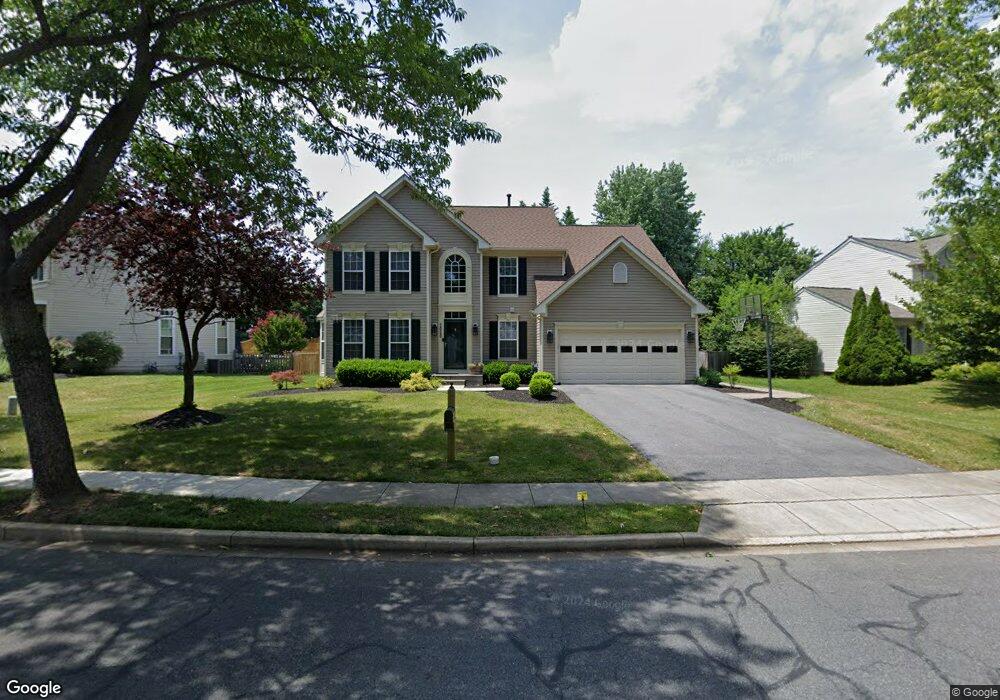
2030 Burnside Dr Frederick, MD 21702
Clover Hill NeighborhoodEstimated Value: $589,160 - $653,000
About This Home
This home is located at 2030 Burnside Dr, Frederick, MD 21702 and is currently estimated at $631,790, approximately $232 per square foot. 2030 Burnside Dr is a home located in Frederick County with nearby schools including Monocacy Elementary School, Monocacy Middle School, and Gov. Thomas Johnson High School.
Ownership History
We collect this data history from publicly available records. To have your information removed, we recommend requesting removal directly through your county’s website.
Purchase Details
Purchase Details
Purchase Details
Home Values in the Area
Average Home Value in this Area
Purchase History
We collect this data history from publicly available records. To have your information removed, we recommend requesting removal directly through your county’s website.
| Date | Buyer | Sale Price | Title Company |
|---|---|---|---|
| -- | None Available | ||
| $215,769 | -- | ||
| $50,000 | -- |
Tax History
We collect this data history from publicly available records. To have your information removed, we recommend requesting removal directly through your county’s website.
| Year | Tax Paid | Tax Assessment Tax Assessment Total Assessment is a certain percentage of the fair market value that is determined by local assessors to be the total taxable value of land and additions on the property. | Land | Improvement |
|---|---|---|---|---|
| 2025 | $7,727 | $522,100 | $115,400 | $406,700 |
| 2024 | $7,727 | $473,333 | $0 | $0 |
| 2023 | $7,136 | $424,567 | $0 | $0 |
| 2022 | $6,819 | $375,800 | $105,400 | $270,400 |
| 2021 | $6,493 | $366,167 | $0 | $0 |
| 2020 | $6,395 | $356,533 | $0 | $0 |
| 2019 | $4,027 | $346,900 | $95,400 | $251,500 |
| 2018 | $6,222 | $343,867 | $0 | $0 |
| 2017 | $6,106 | $346,900 | $0 | $0 |
| 2016 | $5,614 | $337,800 | $0 | $0 |
| 2015 | $5,614 | $327,033 | $0 | $0 |
| 2014 | $5,614 | $316,267 | $0 | $0 |
Map
- 90 Howard Ct
- 2063 Buell Dr
- 100 Sunlight Dr
- 100 Crossing Pointe Ct
- 2089 Buell Dr
- 106 Sunlight Dr
- 2002 Rosecrans Ct
- 218 Harpers Way
- 2039 Sumner Dr
- 248 Timber View Ct
- 107 Redcloud Ct
- 1920 Moran Dr
- 126 Wheeler Ln
- 1954 Moran Dr
- 7172 Meadowbrooke Dr
- 2472 Silver Leaf Dr
- 360 Shortleaf Cir
- 7176 Meadowbrooke Dr
- 222 Wild Rye Cir
- 7190 Meadowbrooke Dr
- 2031 Burnside Dr
- 2032 Burnside Dr
- 2028 Burnside Dr
- 2029 Burnside Dr
- 93 Cumberland Ct
- 2026 Burnside Dr
- 2035 Burnside Dr
- 95 Cumberland Ct
- 2034 Burnside Dr
- 2027 Burnside Dr
- 75 George Thomas Dr
- 2037 Burnside Dr
- 66 George Thomas Dr
- 97 Cumberland Ct
- 68 George Thomas Dr
- 68 George Thomas Dr Unit B
- 2025 Burnside Dr
- 2036 Burnside Dr
- 77 George Thomas Dr
- 99 Howard Ct
Ask me questions while you tour the home.