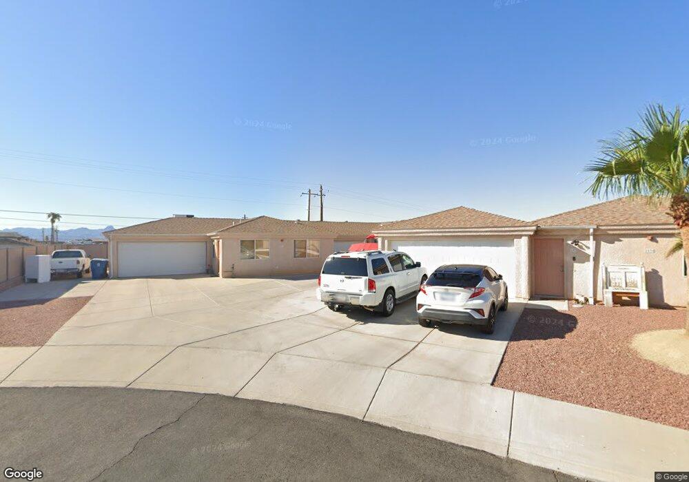
2030 Chaparral Cir Lake Havasu City, AZ 86403
Estimated Value: $690,398 - $901,000
4
Beds
4
Baths
3,175
Sq Ft
$247/Sq Ft
Est. Value
About This Home
This home is located at 2030 Chaparral Cir, Lake Havasu City, AZ 86403 and is currently estimated at $785,350, approximately $247 per square foot. 2030 Chaparral Cir is a home located in Mohave County with nearby schools including Havasupai Elementary School, Thunderbolt Middle School, and Lake Havasu High School.
Ownership History
Date
Name
Owned For
Owner Type
Purchase Details
Closed on
Nov 12, 2004
Sold by
Hanson Keith A and Hanson Cynthia L
Bought by
Hanson Keith A and Hanson Cynthia L
Current Estimated Value
Home Financials for this Owner
Home Financials are based on the most recent Mortgage that was taken out on this home.
Original Mortgage
$163,000
Outstanding Balance
$81,397
Interest Rate
5.79%
Mortgage Type
Stand Alone Refi Refinance Of Original Loan
Estimated Equity
$703,953
Purchase Details
Closed on
Jul 16, 2003
Sold by
Hanson Keith A and Hanson Cynthia L
Bought by
Hanson Keith A and Hanson Cynthia L
Home Financials for this Owner
Home Financials are based on the most recent Mortgage that was taken out on this home.
Original Mortgage
$157,500
Interest Rate
5.17%
Mortgage Type
Construction
Purchase Details
Closed on
Jan 2, 2002
Sold by
Schneider Frederick G
Bought by
Hanson Keith A and Hanson Cynthia L
Create a Home Valuation Report for This Property
The Home Valuation Report is an in-depth analysis detailing your home's value as well as a comparison with similar homes in the area
Home Values in the Area
Average Home Value in this Area
Purchase History
| Date | Buyer | Sale Price | Title Company |
|---|---|---|---|
| Hanson Keith A | -- | Transnation Title Ins Co | |
| Hanson Keith A | -- | Transnation Title Ins Co | |
| Hanson Keith A | $11,000 | Transnation Title Insurance |
Source: Public Records
Mortgage History
| Date | Status | Borrower | Loan Amount |
|---|---|---|---|
| Open | Hanson Keith A | $163,000 | |
| Closed | Hanson Keith A | $157,500 |
Source: Public Records
Tax History Compared to Growth
Tax History
| Year | Tax Paid | Tax Assessment Tax Assessment Total Assessment is a certain percentage of the fair market value that is determined by local assessors to be the total taxable value of land and additions on the property. | Land | Improvement |
|---|---|---|---|---|
| 2026 | $1,368 | -- | -- | -- |
| 2025 | $2,772 | $0 | $0 | $0 |
| 2024 | $2,772 | $51,634 | $0 | $0 |
| 2023 | $2,772 | $33,420 | $0 | $0 |
| 2022 | $2,653 | $31,370 | $0 | $0 |
| 2021 | $3,264 | $66,544 | $0 | $0 |
| 2019 | $3,095 | $32,956 | $0 | $0 |
| 2018 | $2,987 | $29,774 | $0 | $0 |
| 2017 | $3,000 | $28,916 | $0 | $0 |
| 2016 | $2,706 | $27,803 | $0 | $0 |
| 2015 | $2,588 | $28,156 | $0 | $0 |
Source: Public Records
Map
Nearby Homes
- 2100 Chaparral Dr
- 2090 San Juan Dr
- 2021 Industrial
- 1986 Bahama Ave
- 2030 Commander Dr
- 1960 Pirate Ln
- 1911 Holly Ave
- 1901 Holly Ave
- 1541 Holly Ave
- 2200 Clarke Dr
- 2301 Sahara Dr
- 2091 Holly Ave
- 640 Acoma Blvd N
- 2257 Barranca Dr
- 2162 Runabout Dr
- 1930 Bahama Ave
- 583 Robin Ln
- 2183 Runabout Dr
- 2285 Pennant Ln
- 1796 Bahama Ave Unit C
- 2020 Chaparral Cir Unit 101
- 2020 Chaparral Dr Unit 101
- 2040 Chaparral Cir
- 2040 Chaparral Cir Unit 103
- 2040 Chaparral Cir Unit 3
- 2040 Chaparral Cir Unit 102
- 2040 Chaparral Cir Unit 101
- 2040 Chaparral Dr Unit 3
- 2031 Chaparral Cir
- 2050 Chaparral Cir
- 2060 Chaparral Cir
- 2005 Acoma Blvd W Unit C
- 2005 Acoma Blvd W Unit H
- 2005 Acoma Blvd W Unit F
- 2005 Acoma Blvd W Unit J
- 2005 Acoma Blvd W Unit E
- 2005 Acoma Blvd W Unit G
- 2005 Acoma Blvd W
- 2029 Acoma Blvd W
- 2040 Sahara