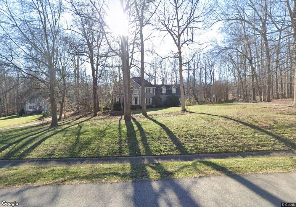
2030 Chartstone Dr Midlothian, VA 23113
Roxshire NeighborhoodEstimated Value: $776,000 - $823,000
4
Beds
4
Baths
3,620
Sq Ft
$221/Sq Ft
Est. Value
About This Home
This home is located at 2030 Chartstone Dr, Midlothian, VA 23113 and is currently estimated at $799,041, approximately $220 per square foot. 2030 Chartstone Dr is a home located in Chesterfield County with nearby schools including Robious Elementary School, Robious Middle School, and James River High School.
Ownership History
Date
Name
Owned For
Owner Type
Purchase Details
Closed on
Dec 4, 2009
Sold by
Moore Michael J
Bought by
Dietrich Timothy
Current Estimated Value
Home Financials for this Owner
Home Financials are based on the most recent Mortgage that was taken out on this home.
Original Mortgage
$417,000
Outstanding Balance
$273,662
Interest Rate
5.02%
Mortgage Type
New Conventional
Estimated Equity
$525,379
Purchase Details
Closed on
Jun 21, 2004
Sold by
Hill Kenneth
Bought by
Moore Michael
Home Financials for this Owner
Home Financials are based on the most recent Mortgage that was taken out on this home.
Original Mortgage
$230,000
Interest Rate
6.32%
Mortgage Type
New Conventional
Create a Home Valuation Report for This Property
The Home Valuation Report is an in-depth analysis detailing your home's value as well as a comparison with similar homes in the area
Home Values in the Area
Average Home Value in this Area
Purchase History
| Date | Buyer | Sale Price | Title Company |
|---|---|---|---|
| Dietrich Timothy | $467,000 | -- | |
| Moore Michael | $449,000 | -- |
Source: Public Records
Mortgage History
| Date | Status | Borrower | Loan Amount |
|---|---|---|---|
| Open | Dietrich Timothy | $417,000 | |
| Previous Owner | Moore Michael | $230,000 |
Source: Public Records
Tax History
| Year | Tax Paid | Tax Assessment Tax Assessment Total Assessment is a certain percentage of the fair market value that is determined by local assessors to be the total taxable value of land and additions on the property. | Land | Improvement |
|---|---|---|---|---|
| 2025 | $6,382 | $714,300 | $146,200 | $568,100 |
| 2024 | $6,382 | $683,200 | $136,100 | $547,100 |
| 2023 | $5,372 | $590,300 | $126,100 | $464,200 |
| 2022 | $5,188 | $556,700 | $116,100 | $440,600 |
| 2021 | $4,836 | $502,100 | $105,100 | $397,000 |
| 2020 | $4,643 | $481,900 | $105,100 | $376,800 |
| 2019 | $4,550 | $478,900 | $102,100 | $376,800 |
| 2018 | $4,439 | $460,600 | $100,100 | $360,500 |
| 2017 | $4,453 | $458,600 | $98,100 | $360,500 |
| 2016 | $4,375 | $455,700 | $98,100 | $357,600 |
| 2015 | $4,323 | $447,700 | $90,100 | $357,600 |
| 2014 | $4,160 | $430,700 | $83,000 | $347,700 |
Source: Public Records
Map
Nearby Homes
- 2101 Normandstone Dr
- 1860 Glamorgan Ln
- 12212 Deerhurst Dr
- 12111 Framar Dr
- 1407 Unison Dr
- 2303 Bream Dr
- 1303 Staffordshire Ct
- 12300 Little Pond Ln
- 11911 Kilrenny Rd
- 2711 Salisbury Rd
- 13607 Danwoods Rd
- 11823 N Briar Patch Dr
- 11803 N Briar Patch Dr
- 1510 Sycamore Square Dr Unit 1510
- 1522 Sycamore Square Dr
- 12606 Mill Lock Terrace
- 1434 Sycamore Mews Cir
- 008 Flying Cloud Aly Unit 8
- 0009 Flying Cloud Aly Unit 50
- 00 Flying Cloud Aly Unit 9
- 2020 Chartstone Dr
- 2040 Chartstone Dr
- 13202 Broncroft Ct
- 2031 Chartstone Dr
- 13200 Broncroft Ct
- 2010 Chartstone Dr
- 13204 Broncroft Ct
- 2011 Chartstone Dr
- 2050 Chartstone Dr
- 2041 Chartstone Dr
- 2020 Thornleigh Rd
- 12807 Kidbrook Ln
- 2001 Chartstone Dr
- 13201 Broncroft Ct
- 2203 Wadebridge Rd
- 2000 Chartstone Dr
- 13206 Broncroft Ct
- 1910 Thornleigh Rd
- 2201 Wadebridge Rd
- 12803 Kidbrook Ln
Your Personal Tour Guide
Ask me questions while you tour the home.