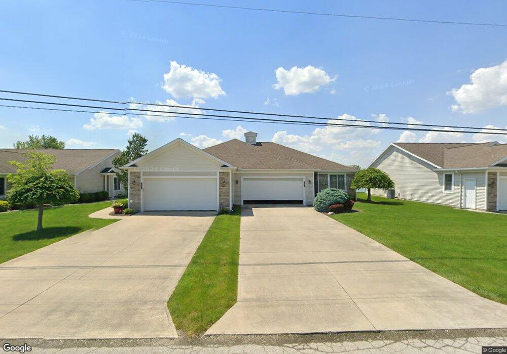
2030 Dickinson St Unit A Fremont, OH 43420
Estimated Value: $200,277 - $228,000
2
Beds
2
Baths
1,416
Sq Ft
$153/Sq Ft
Est. Value
About This Home
This home is located at 2030 Dickinson St Unit A, Fremont, OH 43420 and is currently estimated at $216,819, approximately $153 per square foot. 2030 Dickinson St Unit A is a home located in Sandusky County with nearby schools including Fremont Ross High School, St. Ann Catholic School, and Bishop Hoffman Catholic School - This is St Joe's School now.
Ownership History
Date
Name
Owned For
Owner Type
Purchase Details
Closed on
Sep 25, 2015
Sold by
Reed Rex W
Bought by
Prough Robert C and Prough Deborah A
Current Estimated Value
Purchase Details
Closed on
Dec 22, 2005
Sold by
Schrickel Custom Homes Inc
Bought by
Reed Peggy L
Home Financials for this Owner
Home Financials are based on the most recent Mortgage that was taken out on this home.
Original Mortgage
$153,000
Interest Rate
6.48%
Mortgage Type
Purchase Money Mortgage
Create a Home Valuation Report for This Property
The Home Valuation Report is an in-depth analysis detailing your home's value as well as a comparison with similar homes in the area
Home Values in the Area
Average Home Value in this Area
Purchase History
| Date | Buyer | Sale Price | Title Company |
|---|---|---|---|
| Prough Robert C | $122,500 | First American | |
| Reed Peggy L | -- | Culbert Title Agency |
Source: Public Records
Mortgage History
| Date | Status | Borrower | Loan Amount |
|---|---|---|---|
| Previous Owner | Reed Peggy L | $153,000 |
Source: Public Records
Tax History Compared to Growth
Tax History
| Year | Tax Paid | Tax Assessment Tax Assessment Total Assessment is a certain percentage of the fair market value that is determined by local assessors to be the total taxable value of land and additions on the property. | Land | Improvement |
|---|---|---|---|---|
| 2024 | $2,187 | $59,400 | $11,520 | $47,880 |
| 2023 | $2,187 | $46,770 | $9,070 | $37,700 |
| 2022 | $1,809 | $46,770 | $9,070 | $37,700 |
| 2021 | $1,868 | $46,770 | $9,070 | $37,700 |
| 2020 | $1,716 | $42,320 | $9,070 | $33,250 |
| 2019 | $1,714 | $42,320 | $9,070 | $33,250 |
| 2018 | $1,717 | $42,320 | $9,070 | $33,250 |
| 2017 | $1,639 | $40,260 | $9,070 | $31,190 |
| 2016 | $1,437 | $40,260 | $9,070 | $31,190 |
| 2015 | $1,106 | $40,260 | $9,070 | $31,190 |
| 2014 | $1,118 | $39,140 | $8,160 | $30,980 |
| 2013 | $1,094 | $39,140 | $8,160 | $30,980 |
Source: Public Records
Map
Nearby Homes
- 2219 Oak Harbor Rd
- 0 Sean Dr
- Outlot A Sean Dr
- 1441 White Ave
- 1720 North St
- 1707 North St
- 1227 White Ave
- 2100 Ohio 53
- 1730 Port Clinton Rd Unit 33
- 1730 Port Clinton Rd
- 1730 Port Clinton Rd Unit 41
- 927 Wolfe Ave
- 1823 W State St
- 816 Lime St
- 900 Spring St
- 711 Rawson Ave
- 2119 Lake St
- 520 Everett Rd
- 515 Everett Rd
- 2242 Napoleon Rd
- 2030 Dickinson St Unit B
- 2030 Dickinson St
- 2038 Dickinson St
- 2018 Dickinson St
- 2040 Dickinson St
- 2010 Dickinson St Unit C
- 2010 Dickinson St Unit B
- 2010 Dickinson St Unit 1A
- 2050 Dickinson St Unit 6A
- 2058 Dickinson St
- 2060 Dickinson St Unit 4A
- 1831 Dickinson St
- 1835 Dickinson St
- 2600 N Oak Harbor Hwy
- 1823 Dickinson St
- 1819 Dickinson St
- 1801 Dickinson St
- 1729 Dickinson St
- 149 Thomas Dr
- 145 Thomas Dr