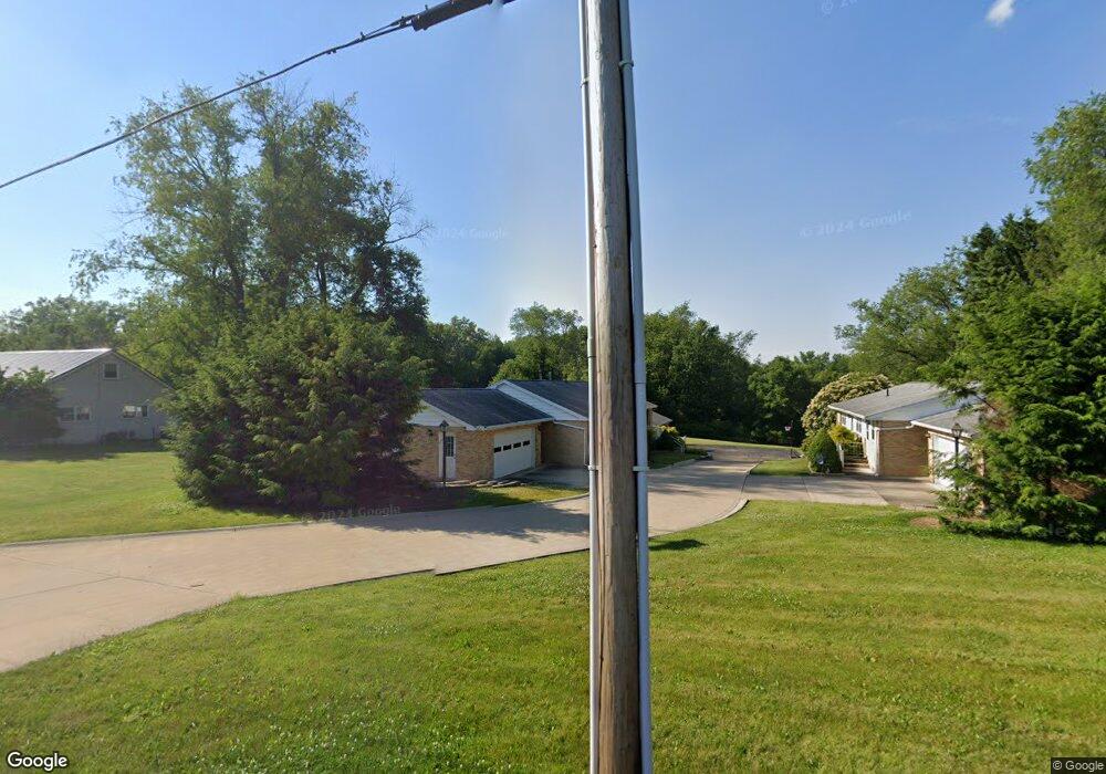
2030 Hankins Rd NW Massillon, OH 44646
Amherst Heights-Clearview NeighborhoodEstimated Value: $186,000 - $466,196
4
Beds
2
Baths
1,922
Sq Ft
$158/Sq Ft
Est. Value
About This Home
This home is located at 2030 Hankins Rd NW, Massillon, OH 44646 and is currently estimated at $304,299, approximately $158 per square foot. 2030 Hankins Rd NW is a home located in Stark County with nearby schools including Pfeiffer Intermediate School, Edison Middle School, and Perry High School.
Ownership History
Date
Name
Owned For
Owner Type
Purchase Details
Closed on
May 7, 2020
Sold by
Stancato Sandra J
Bought by
Sibila Family Llc
Current Estimated Value
Purchase Details
Closed on
Jun 16, 2015
Sold by
Stancato John J
Bought by
Pj Investment Group Llc
Purchase Details
Closed on
Mar 28, 1991
Create a Home Valuation Report for This Property
The Home Valuation Report is an in-depth analysis detailing your home's value as well as a comparison with similar homes in the area
Home Values in the Area
Average Home Value in this Area
Purchase History
| Date | Buyer | Sale Price | Title Company |
|---|---|---|---|
| Sibila Family Llc | $315,000 | None Available | |
| Sibila Family Llc | -- | None Available | |
| Pj Investment Group Llc | -- | None Available | |
| -- | -- | -- |
Source: Public Records
Tax History Compared to Growth
Tax History
| Year | Tax Paid | Tax Assessment Tax Assessment Total Assessment is a certain percentage of the fair market value that is determined by local assessors to be the total taxable value of land and additions on the property. | Land | Improvement |
|---|---|---|---|---|
| 2025 | -- | $64,330 | $12,670 | $51,660 |
| 2024 | -- | $64,330 | $12,670 | $51,660 |
| 2023 | $3,048 | $59,510 | $12,640 | $46,870 |
| 2022 | $3,059 | $59,510 | $12,640 | $46,870 |
| 2021 | $3,254 | $59,510 | $12,640 | $46,870 |
| 2020 | $2,422 | $51,560 | $10,640 | $40,920 |
| 2019 | $2,182 | $51,560 | $10,640 | $40,920 |
| 2018 | $2,157 | $51,560 | $10,640 | $40,920 |
| 2017 | $1,655 | $39,030 | $8,650 | $30,380 |
| 2016 | $1,664 | $39,030 | $8,650 | $30,380 |
| 2015 | $836 | $39,030 | $8,650 | $30,380 |
| 2014 | $1,543 | $36,230 | $8,020 | $28,210 |
| 2013 | $969 | $36,230 | $8,020 | $28,210 |
Source: Public Records
Map
Nearby Homes
- 840 Bittersweet Dr NE
- 1706 Jefferson Rd NE
- 845 16th St NE
- 727 Franklin Rd NE
- 719 17th St NE
- 2410 Tanglewood Dr NE
- 1001 27th St NE
- 937 27th St NE
- 740 Phillips Rd NE
- 1837 Lindbergh Ave NE
- 831 27th St NE
- 2554 Mary Lou St NW
- 1717 Chittenden Cir NE
- VL Mill Creek Run NE
- 1720 Lincoln Way E
- 932 Wales Rd NE
- 712 Harmon Place NE
- 1715 Jackson Ave NW
- 951 Mill Ridge Path NE
- 000 Jackson Ave NW
- 2036 Hankins Rd NW
- 2012 Hankins Rd NW
- 2014 Oak Hill Cir NE
- 2024 Oak Hill Cir NE
- 2006 Oak Hill Cir NE
- 1068 Brookwood St NE
- 1042 Orchard Hill Cir
- 1042 Orchard Hill Cir
- 1058 Brookwood St NE
- 1036 s/l 2 Orchard Hill Cir NE
- 1061 Cedarhill Cir NE
- 1036 Orchard Hill Cir
- 1036 Orchard Hill Cir
- 1051 Cedarhill Cir NE
- 2023 Oak Hill Cir NE
- 2013 Oak Hill Cir NE
- 1042 Oak Hill Dr NE
- 2003 Oak Hill Cir NE
- 1041 Oak Hill Dr NE
- 9 Orchard Hill Cir NE
