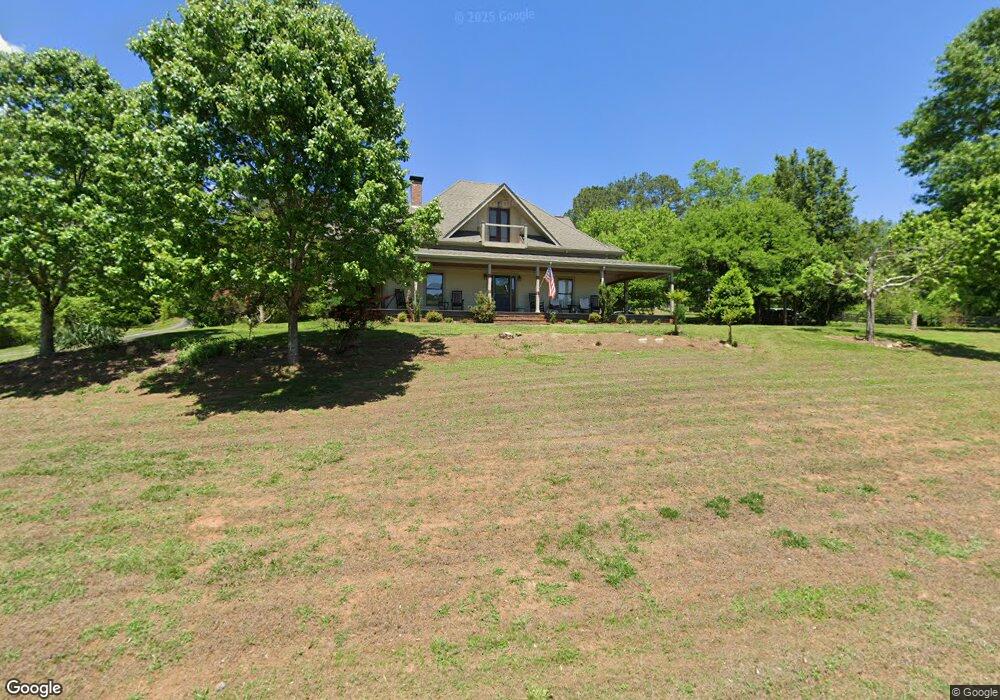
2030 Howell Bridge Rd Ball Ground, GA 30107
Estimated Value: $565,000 - $1,199,000
4
Beds
4
Baths
4,278
Sq Ft
$220/Sq Ft
Est. Value
About This Home
This home is located at 2030 Howell Bridge Rd, Ball Ground, GA 30107 and is currently estimated at $941,908, approximately $220 per square foot. 2030 Howell Bridge Rd is a home located in Cherokee County with nearby schools including Clayton Elementary School, Teasley Middle School, and Cherokee High School.
Ownership History
Date
Name
Owned For
Owner Type
Purchase Details
Closed on
Apr 23, 1999
Sold by
Norwest Mtg Inc
Bought by
Sayers James J and Sayers Joyce A
Current Estimated Value
Home Financials for this Owner
Home Financials are based on the most recent Mortgage that was taken out on this home.
Original Mortgage
$68,000
Interest Rate
6.9%
Mortgage Type
New Conventional
Purchase Details
Closed on
Dec 1, 1998
Sold by
Dean Diane D
Bought by
Norwest Mtg Inc
Purchase Details
Closed on
Jun 30, 1997
Sold by
Leffingwell Diane
Bought by
Dean Diane D
Home Financials for this Owner
Home Financials are based on the most recent Mortgage that was taken out on this home.
Original Mortgage
$122,350
Interest Rate
7.92%
Mortgage Type
New Conventional
Create a Home Valuation Report for This Property
The Home Valuation Report is an in-depth analysis detailing your home's value as well as a comparison with similar homes in the area
Home Values in the Area
Average Home Value in this Area
Purchase History
| Date | Buyer | Sale Price | Title Company |
|---|---|---|---|
| Sayers James J | $85,000 | -- | |
| Norwest Mtg Inc | $129,300 | -- | |
| Dean Diane D | $128,800 | -- |
Source: Public Records
Mortgage History
| Date | Status | Borrower | Loan Amount |
|---|---|---|---|
| Previous Owner | Sayers James J | $68,000 | |
| Previous Owner | Dean Diane D | $122,350 |
Source: Public Records
Tax History Compared to Growth
Tax History
| Year | Tax Paid | Tax Assessment Tax Assessment Total Assessment is a certain percentage of the fair market value that is determined by local assessors to be the total taxable value of land and additions on the property. | Land | Improvement |
|---|---|---|---|---|
| 2024 | $2,535 | $271,600 | $18,320 | $253,280 |
| 2023 | $1,289 | $227,760 | $15,440 | $212,320 |
| 2022 | $994 | $171,000 | $13,160 | $157,840 |
| 2021 | $974 | $143,040 | $11,440 | $131,600 |
| 2020 | $920 | $127,640 | $11,440 | $116,200 |
| 2019 | $954 | $131,720 | $11,440 | $120,280 |
| 2018 | $949 | $126,040 | $11,440 | $114,600 |
| 2017 | $980 | $319,300 | $11,440 | $116,280 |
| 2016 | $977 | $297,800 | $11,440 | $107,680 |
| 2015 | $674 | $176,500 | $11,440 | $59,160 |
| 2014 | $657 | $171,300 | $10,680 | $57,840 |
Source: Public Records
Map
Nearby Homes
- 1592 Howell Bridge Rd
- 1584 Howell Bridge Rd
- 1568 Howell Bridge Rd
- 2229 Long Rd
- 1560 Howell Bridge Rd
- LOT 13 N Olivia Ln
- 285 Old Hornage Rd
- 300 Hemlock Cove
- 134 Sharp Mountain Creek
- 410 N Sharp Mountain Church Ln
- 187 Long Rd
- 315 Upper Pheasant Ct
- 312 Upper Pheasant Ct
- 523 Pine Bough Rd
- 520 Pine Bough Rd
- 2050 Howell Bridge Rd
- 1970 Howell Bridge Rd
- 3139 Hornage Rd
- 3356 Hornage Rd
- 3099 Hornage Rd
- 2257 Long Rd
- 3158 Hornage Rd
- 1600 Howell Bridge Rd
- 3156 Hornage Rd
- 2229 Long Rd
- 1551 Howell Bridge Rd
- 1551 Howell Bridge Rd Unit 12 Acres
- 2952 Hornage Rd
- 1545 Howell Bridge Rd
- 2890 Hornage Rd
- 508 Olivia Ln
- 512 Olivia Ln
- 2876 Hornage Rd
- 2201 Long Rd
- 696 Old Hornage Rd