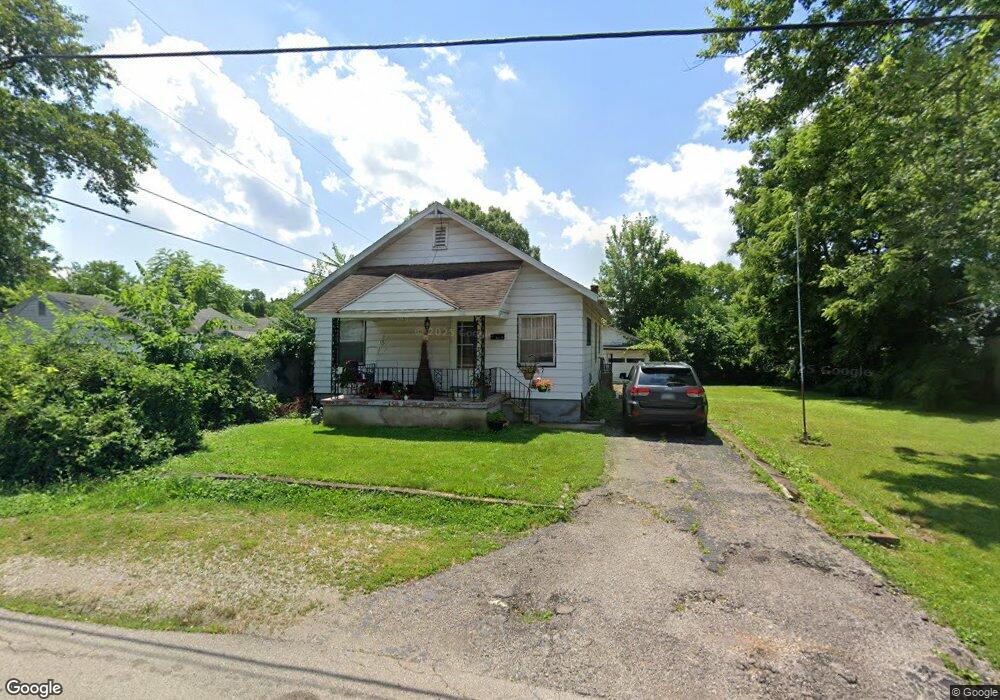
2030 Kildare Ave Dayton, OH 45414
Northridge NeighborhoodEstimated Value: $95,400 - $130,000
2
Beds
1
Bath
924
Sq Ft
$125/Sq Ft
Est. Value
About This Home
This home is located at 2030 Kildare Ave, Dayton, OH 45414 and is currently estimated at $115,100, approximately $124 per square foot. 2030 Kildare Ave is a home located in Montgomery County with nearby schools including Northridge High School, Horizon Science Academy-Dayton Elementary School, and Horizon Science Academy Dayton High School.
Ownership History
Date
Name
Owned For
Owner Type
Purchase Details
Closed on
Jan 18, 2018
Sold by
Monnin Joseph D and Monnin Terri L
Bought by
Daniel Anthony
Current Estimated Value
Purchase Details
Closed on
Dec 3, 2003
Sold by
Spreher Jean A
Bought by
Monnin Joseph D and Monnin Terri L
Purchase Details
Closed on
Aug 28, 2002
Sold by
Estate Of Douglas D Spreher Sr
Bought by
Spreher Jean A
Purchase Details
Closed on
Feb 27, 1998
Sold by
Wagner Richard N and Wagner Shirley A
Bought by
Spreher Douglas D
Home Financials for this Owner
Home Financials are based on the most recent Mortgage that was taken out on this home.
Original Mortgage
$44,450
Interest Rate
7.08%
Create a Home Valuation Report for This Property
The Home Valuation Report is an in-depth analysis detailing your home's value as well as a comparison with similar homes in the area
Home Values in the Area
Average Home Value in this Area
Purchase History
| Date | Buyer | Sale Price | Title Company |
|---|---|---|---|
| Daniel Anthony | $14,500 | Home Services Title Llc | |
| Monnin Joseph D | -- | -- | |
| Spreher Jean A | -- | -- | |
| Spreher Douglas D | $63,500 | -- | |
| Spreher Douglas D | $63,500 | -- |
Source: Public Records
Mortgage History
| Date | Status | Borrower | Loan Amount |
|---|---|---|---|
| Previous Owner | Spreher Douglas D | $44,450 |
Source: Public Records
Tax History Compared to Growth
Tax History
| Year | Tax Paid | Tax Assessment Tax Assessment Total Assessment is a certain percentage of the fair market value that is determined by local assessors to be the total taxable value of land and additions on the property. | Land | Improvement |
|---|---|---|---|---|
| 2024 | $1,497 | $17,970 | $4,920 | $13,050 |
| 2023 | $1,497 | $17,970 | $4,920 | $13,050 |
| 2022 | $1,397 | $12,840 | $3,520 | $9,320 |
| 2021 | $1,386 | $12,840 | $3,520 | $9,320 |
| 2020 | $1,401 | $12,840 | $3,520 | $9,320 |
| 2019 | $1,427 | $11,710 | $3,520 | $8,190 |
| 2018 | $1,429 | $11,710 | $3,520 | $8,190 |
| 2017 | $1,422 | $11,710 | $3,520 | $8,190 |
| 2016 | $1,347 | $11,030 | $3,520 | $7,510 |
| 2015 | $1,135 | $11,030 | $3,520 | $7,510 |
| 2014 | $1,135 | $11,030 | $3,520 | $7,510 |
| 2012 | -- | $13,850 | $4,820 | $9,030 |
Source: Public Records
Map
Nearby Homes
- 2024 Kildare Ave
- 2100 Harding Ave
- 2203 Arthur Ave
- 2160 Martin Ave
- 2021 Gipsy Dr
- 2010 Gipsy Dr
- 1657 Scenic Dr
- 6020 Volkman Dr
- 6114 Miller Ln
- 5586 Wadsworth Rd
- 2625 Secretariat Ct
- 2006 High Knoll Dr
- 2304 Homesite Dr
- 6027 Riva Ridge Dr
- 2127 Marker Ave
- 2246 Woodson Dr
- 6057 Riva Ridge Dr
- 3280 Benchwood Rd
- 1376 Bartley Rd
- 3320 Benchwood Rd
- 6715 Sennett Ave
- 2040 Kildare Ave
- 2025 Wilding Ave
- 6707 Sennett Ave
- 2020 Kildare Ave
- 2035 Kildare Ave
- 2029 Kildare Ave
- 2023 Kildare Ave
- 2045 Wilding Ave
- 2019 Kildare Ave
- 2019 Wilding Ave
- 2008 Kildare Ave
- 2017 Wilding Ave
- 6716 Sennett Ave
- 2146 Kildare Ave
- 6708 Sennett Ave
- 2118 Harding Ave
- 2110 Harding Ave
- 2112 Wilding Ave
- 2028 Wilding Ave