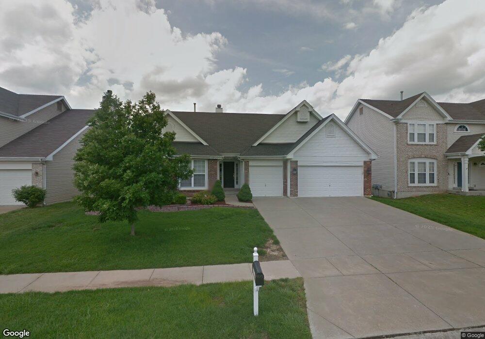
2030 Lunenburg Dr Saint Peters, MO 63376
Estimated Value: $412,000 - $440,000
3
Beds
2
Baths
2,245
Sq Ft
$190/Sq Ft
Est. Value
About This Home
This home is located at 2030 Lunenburg Dr, Saint Peters, MO 63376 and is currently estimated at $427,012, approximately $190 per square foot. 2030 Lunenburg Dr is a home located in St. Charles County with nearby schools including Progress South Elementary School, Fort Zumwalt South Middle School, and Fort Zumwalt South High School.
Ownership History
Date
Name
Owned For
Owner Type
Purchase Details
Closed on
Nov 29, 2005
Sold by
Wiegers Brenda J
Bought by
Locascio John Paul and Shepard Locascio Pamela S
Current Estimated Value
Home Financials for this Owner
Home Financials are based on the most recent Mortgage that was taken out on this home.
Original Mortgage
$206,000
Outstanding Balance
$114,091
Interest Rate
6.12%
Mortgage Type
Fannie Mae Freddie Mac
Estimated Equity
$312,921
Purchase Details
Closed on
Nov 4, 2002
Sold by
Wiegers Robert A
Bought by
Wiegers Brenda J
Purchase Details
Closed on
May 30, 2002
Sold by
Mayer Custom Homes Inc
Bought by
Wiegers Brenda
Home Financials for this Owner
Home Financials are based on the most recent Mortgage that was taken out on this home.
Original Mortgage
$185,000
Interest Rate
6.89%
Create a Home Valuation Report for This Property
The Home Valuation Report is an in-depth analysis detailing your home's value as well as a comparison with similar homes in the area
Home Values in the Area
Average Home Value in this Area
Purchase History
| Date | Buyer | Sale Price | Title Company |
|---|---|---|---|
| Locascio John Paul | $257,500 | Affordable Title Svcs Inc | |
| Wiegers Brenda J | -- | -- | |
| Wiegers Brenda | -- | -- |
Source: Public Records
Mortgage History
| Date | Status | Borrower | Loan Amount |
|---|---|---|---|
| Open | Locascio John Paul | $206,000 | |
| Previous Owner | Wiegers Brenda | $185,000 |
Source: Public Records
Tax History Compared to Growth
Tax History
| Year | Tax Paid | Tax Assessment Tax Assessment Total Assessment is a certain percentage of the fair market value that is determined by local assessors to be the total taxable value of land and additions on the property. | Land | Improvement |
|---|---|---|---|---|
| 2025 | $5,019 | $78,703 | -- | -- |
| 2023 | $5,021 | $76,051 | $0 | $0 |
| 2022 | $3,939 | $55,422 | $0 | $0 |
| 2021 | $3,942 | $55,422 | $0 | $0 |
| 2020 | $4,182 | $56,970 | $0 | $0 |
| 2019 | $4,191 | $56,970 | $0 | $0 |
| 2018 | $3,707 | $48,077 | $0 | $0 |
| 2017 | $3,664 | $48,077 | $0 | $0 |
| 2016 | $3,542 | $46,292 | $0 | $0 |
| 2015 | $3,293 | $46,292 | $0 | $0 |
| 2014 | $2,907 | $40,182 | $0 | $0 |
Source: Public Records
Map
Nearby Homes
- 2068 Williamstown Dr
- 2 Laura Hill Rd
- 114 Knaust Rd
- 2 Oak Point Ct
- 67 Oakridge West Dr
- 28 Steiert Dr
- 5 Wood Oaks Dr
- 42 Kingspointe Dr
- 8201 Bristol Valley Dr
- 9 Donna Dr
- Fairground - Interior Townhome Plan at Birdie Hill Crossing - Townhome Collection
- Fairground - Exterior Townhome Plan at Birdie Hill Crossing - Townhome Collection
- Dover Plan at Birdie Hill Crossing - Cottage Collection
- Windsor Plan at Birdie Hill Crossing - Cottage Collection
- Devonshire Plan at Birdie Hill Crossing - Cottage Collection
- Fairground Plan at Birdie Hill Crossing - Townhome Collection
- 619 Turtle Creek Ct
- 146 Huntington Crossing Dr
- 523 Coldstream Ct
- 613 Otter Creek Trail
- 2034 Lunenburg Dr
- 2026 Lunenburg Dr
- 14 Constable Ct
- 16 Constable Ct
- 12 Constable Ct
- 2038 Lunenburg Dr
- 18 Constable Ct
- 8 Constable Ct
- 2023 Lunenburg Dr
- 2018 Lunenburg Dr
- 2042 Lunenburg Dr
- 20 Constable Ct
- 2019 Lunenburg Dr
- 15 Constable Ct
- 13 Constable Ct
- 2014 Lunenburg Dr
- 17 Constable Ct
- 11 Constable Ct
- 2015 Lunenburg Dr
- 22 Constable Ct