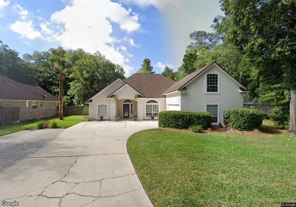
2030 Marye Brant Loop S Neptune Beach, FL 32266
Estimated Value: $530,000 - $912,000
3
Beds
2
Baths
2,307
Sq Ft
$324/Sq Ft
Est. Value
About This Home
This home is located at 2030 Marye Brant Loop S, Neptune Beach, FL 32266 and is currently estimated at $748,022, approximately $324 per square foot. 2030 Marye Brant Loop S is a home located in Duval County with nearby schools including Neptune Beach Elementary School, Duncan U. Fletcher Middle School, and Duncan U. Fletcher High School.
Ownership History
Date
Name
Owned For
Owner Type
Purchase Details
Closed on
May 8, 2023
Sold by
Gregg Spencer A and Gregg Andrea S
Bought by
Gregg Family Trust
Current Estimated Value
Purchase Details
Closed on
Feb 25, 1994
Sold by
Sturgeon Homes Inc
Bought by
Gregg Spencer A and Gregg Andrea S
Home Financials for this Owner
Home Financials are based on the most recent Mortgage that was taken out on this home.
Original Mortgage
$129,600
Interest Rate
7.02%
Create a Home Valuation Report for This Property
The Home Valuation Report is an in-depth analysis detailing your home's value as well as a comparison with similar homes in the area
Home Values in the Area
Average Home Value in this Area
Purchase History
| Date | Buyer | Sale Price | Title Company |
|---|---|---|---|
| Gregg Family Trust | $100 | Rock Solid Law & Title | |
| Gregg Spencer A | -- | -- |
Source: Public Records
Mortgage History
| Date | Status | Borrower | Loan Amount |
|---|---|---|---|
| Previous Owner | Gregg Spencer A | $129,600 |
Source: Public Records
Tax History Compared to Growth
Tax History
| Year | Tax Paid | Tax Assessment Tax Assessment Total Assessment is a certain percentage of the fair market value that is determined by local assessors to be the total taxable value of land and additions on the property. | Land | Improvement |
|---|---|---|---|---|
| 2025 | $4,085 | $276,662 | -- | -- |
| 2024 | $3,966 | $268,865 | -- | -- |
| 2023 | $3,966 | $261,034 | $0 | $0 |
| 2022 | $3,617 | $253,432 | $0 | $0 |
| 2021 | $3,591 | $246,051 | $0 | $0 |
| 2020 | $3,554 | $242,654 | $0 | $0 |
| 2019 | $3,512 | $237,199 | $0 | $0 |
| 2018 | $3,465 | $232,777 | $0 | $0 |
| 2017 | $3,420 | $227,990 | $0 | $0 |
| 2016 | $3,400 | $223,301 | $0 | $0 |
| 2015 | $3,436 | $221,749 | $0 | $0 |
| 2014 | $3,442 | $219,990 | $0 | $0 |
Source: Public Records
Map
Nearby Homes
- 2018 Rosewood Dr
- 1940 Tara Ct
- 961 Calypso Way Unit LOT 20
- 110 Sandy Beach Ln
- 113 Oceangate Dr
- 649 Goldenrod Ln S
- 106 Sunrise Ct
- 1114 Scheidel Ct Unit 6
- 724 Camellia Terrace Ct S
- 836 Cavalla Rd
- 2762 Seagate Ave
- 800 Stocks St
- 747 Jasmine St
- 714 Aquatic Dr
- 318 Royal Palms Dr
- 1833 Kings Ct
- 53 Tallwood Rd
- 954 Stocks St
- 2010 Shadow Ln
- 710 Cavalla Rd
- 2026 Marye Brant Loop S
- 2034 Marye Brant Loop S
- 2040 Sandpiper Point
- 2037 Sandpiper Point
- 2022 Marye Brant Loop S
- 2031 Marye Brant Loop S
- 2038 Marye Brant Loop S
- 2027 Marye Brant Loop S
- 2023 Marye Brant Loop S
- 2033 Sandpiper Point
- 2018 Marye Brant Loop S
- 1944 Seagull Cove
- 2042 Marye Brant Loop S
- 2024 Sandpiper Point
- 2035 Marye Brant Loop S
- 2019 Marye Brant Loop S
- 2029 Sandpiper Point
- 1936 Seagull Cove
- 2025 Sandpiper Point
- 2015 Marye Brant Loop S