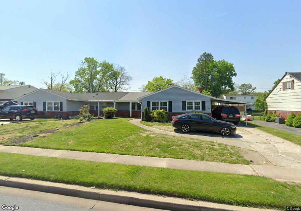
2030 N Rolling Rd Windsor Mill, MD 21244
Estimated Value: $270,036 - $372,000
3
Beds
2
Baths
1,504
Sq Ft
$206/Sq Ft
Est. Value
About This Home
This home is located at 2030 N Rolling Rd, Windsor Mill, MD 21244 and is currently estimated at $310,509, approximately $206 per square foot. 2030 N Rolling Rd is a home located in Baltimore County with nearby schools including Dogwood Elementary School, Windsor Mill Middle School, and Woodlawn High School.
Ownership History
Date
Name
Owned For
Owner Type
Purchase Details
Closed on
Jul 28, 2016
Sold by
Bank Of America Na
Bought by
Poindexter Walter O Riley
Current Estimated Value
Purchase Details
Closed on
Jan 28, 2016
Sold by
White Leanne
Bought by
Bank Of America Na
Purchase Details
Closed on
May 14, 1999
Sold by
White Robert L
Bought by
White Leanne M
Purchase Details
Closed on
Dec 16, 1993
Sold by
Hesson P E
Bought by
White Robert L
Home Financials for this Owner
Home Financials are based on the most recent Mortgage that was taken out on this home.
Original Mortgage
$88,550
Interest Rate
7.03%
Create a Home Valuation Report for This Property
The Home Valuation Report is an in-depth analysis detailing your home's value as well as a comparison with similar homes in the area
Home Values in the Area
Average Home Value in this Area
Purchase History
| Date | Buyer | Sale Price | Title Company |
|---|---|---|---|
| Poindexter Walter O Riley | $133,167 | Servicelink Llc | |
| Bank Of America Na | $107,500 | Attorney | |
| White Leanne M | -- | -- | |
| White Robert L | $88,000 | -- |
Source: Public Records
Mortgage History
| Date | Status | Borrower | Loan Amount |
|---|---|---|---|
| Previous Owner | White Robert L | $88,550 |
Source: Public Records
Tax History
| Year | Tax Paid | Tax Assessment Tax Assessment Total Assessment is a certain percentage of the fair market value that is determined by local assessors to be the total taxable value of land and additions on the property. | Land | Improvement |
|---|---|---|---|---|
| 2025 | $2,896 | $209,667 | -- | -- |
| 2024 | $2,896 | $200,900 | $70,000 | $130,900 |
| 2023 | $2,875 | $198,967 | $0 | $0 |
| 2022 | $2,811 | $197,033 | $0 | $0 |
| 2021 | $2,535 | $195,100 | $70,000 | $125,100 |
| 2020 | $2,535 | $175,967 | $0 | $0 |
| 2019 | $2,280 | $156,833 | $0 | $0 |
| 2018 | $2,403 | $137,700 | $43,400 | $94,300 |
| 2017 | $1,978 | $135,433 | $0 | $0 |
| 2016 | $1,815 | $133,167 | $0 | $0 |
| 2015 | $1,815 | $130,900 | $0 | $0 |
| 2014 | $1,815 | $130,900 | $0 | $0 |
Source: Public Records
Map
Nearby Homes
- 7104 Iverson Ct
- 2025 Greengage Rd
- 10 Kettle Ct
- 22 Kettle Ct
- 21 Tallow Ct
- 14 Sharrow Ct
- 8 Middleview Ct
- 2004 Wildlife Dr
- 2000 Wildlife Dr
- 2305 Kevsway Ct
- 6945 Rockfield Rd
- 49 Rocky Brook Ct
- 7 Kimberlys Ct
- 7 Rocky Brook Ct
- 7205 Bogley Rd Unit 202
- 7205 Bogley Rd Unit 303
- 7544 Maury Rd
- 7536 Maury Rd
- 3 Gemstone Ct
- 7402 Catterick Ct
- 2028 N Rolling Rd
- 2032 N Rolling Rd
- 2025 Kennicott Rd
- 2026 N Rolling Rd
- 2034 N Rolling Rd
- 2023 Kennicott Rd
- 2027 Kennicott Rd
- 2021 Kennicott Rd
- 2024 N Rolling Rd
- 2019 Kennicott Rd
- 2022 N Rolling Rd
- 2017 Kennicott Rd
- 2031 Kennicott Rd
- 2038 N Rolling Rd
- 2026 Kennicott Rd
- 2024 Kennicott Rd
- 2020 N Rolling Rd
- 2030 Kennicott Rd
- 2033 Kennicott Rd
- 2040 N Rolling Rd
Your Personal Tour Guide
Ask me questions while you tour the home.