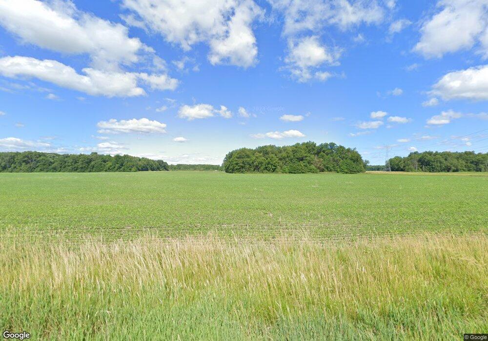
2030 N State Route 510 Vickery, OH 43464
Estimated Value: $55,000 - $80,000
--
Bed
--
Bath
--
Sq Ft
2
Acres
About This Home
This home is located at 2030 N State Route 510, Vickery, OH 43464 and is currently estimated at $67,500. 2030 N State Route 510 is a home located in Sandusky County with nearby schools including Fremont Ross High School.
Ownership History
Date
Name
Owned For
Owner Type
Purchase Details
Closed on
Jan 5, 2021
Sold by
Gibbs Robert L and Gibbs Rachel K
Bought by
Gibbs Robert L and Gibbs Rache K
Current Estimated Value
Purchase Details
Closed on
Jun 6, 2019
Sold by
Perry Karen L and Estate Of Joe R Perry
Bought by
Gibbs Robert L and Gibbs Jack B
Purchase Details
Closed on
Apr 24, 2019
Sold by
Wanke Nicole
Bought by
Perry Joe R and Estate Of Karen L Perry
Purchase Details
Closed on
May 27, 2011
Sold by
Gibson John H
Bought by
Perry Joe R
Purchase Details
Closed on
Jul 26, 2005
Sold by
Moore Karen L
Bought by
Perry Gene H and Gene H Perry Living Trust
Purchase Details
Closed on
Mar 1, 1985
Bought by
Perry Joe R
Create a Home Valuation Report for This Property
The Home Valuation Report is an in-depth analysis detailing your home's value as well as a comparison with similar homes in the area
Home Values in the Area
Average Home Value in this Area
Purchase History
| Date | Buyer | Sale Price | Title Company |
|---|---|---|---|
| Gibbs Robert L | -- | None Available | |
| Gibbs Robert L | $22,400 | None Available | |
| Perry Joe R | -- | None Available | |
| Perry Joe R | -- | First American | |
| Perry Gene H | $33,750 | -- | |
| Perry Joe R | -- | -- |
Source: Public Records
Tax History Compared to Growth
Tax History
| Year | Tax Paid | Tax Assessment Tax Assessment Total Assessment is a certain percentage of the fair market value that is determined by local assessors to be the total taxable value of land and additions on the property. | Land | Improvement |
|---|---|---|---|---|
| 2024 | $293 | $7,600 | $6,200 | $1,400 |
| 2023 | $293 | $7,600 | $6,200 | $1,400 |
| 2022 | $309 | $7,600 | $6,200 | $1,400 |
| 2021 | $318 | $7,600 | $6,200 | $1,400 |
| 2020 | $174 | $4,100 | $3,360 | $740 |
| 2019 | $174 | $4,100 | $3,360 | $740 |
| 2018 | $174 | $4,100 | $3,360 | $740 |
| 2017 | $170 | $3,990 | $3,360 | $630 |
| 2016 | $150 | $3,990 | $3,360 | $630 |
| 2015 | $148 | $3,990 | $3,360 | $630 |
| 2014 | -- | $2,030 | $1,330 | $700 |
| 2013 | $77 | $2,030 | $1,330 | $700 |
Source: Public Records
Map
Nearby Homes
- 1766 County Road 260 Elm St
- 0 County Rd 260 Rd Unit 5061556
- 2087 County Road 216
- 0 County Road 210
- 550 County Road 242
- 474 N Co Road 204
- 5943 County Road 279
- 0 Cr 214 Unit 20253055
- 2314 E Sr 20
- 1270 W Mcpherson Hwy
- V/L County Road 220
- 0 County Road 220
- 761 N Woodland Ave
- 0 W Mcpherson Hwy
- 0 Ohio 101
- 117 Nelson St
- 1337 E Sr 20
- 118 E Buckeye St
- 0 Ames St
- 625 Ames St
- 3854 County Road 247
- 1872 County Road 250
- 3916 County Road 247
- 3760 County Road 247
- 3877 County Road 247
- 1890 County Road 250
- 3980 County Road 247
- 4080 County Road 247
- 1646 N State Route 510
- 1888 N State Route 510
- 1583 N State Route 510
- 4147 County Road 247
- 1426 N State Route 510
- 2089 County Road 250
- 1414 N State Route 510
- 1427 Ohio 510
- 1427 N State Route 510
- 3490 County Road 247
- 4205 County Road 247
- 1378 N State Route 510
