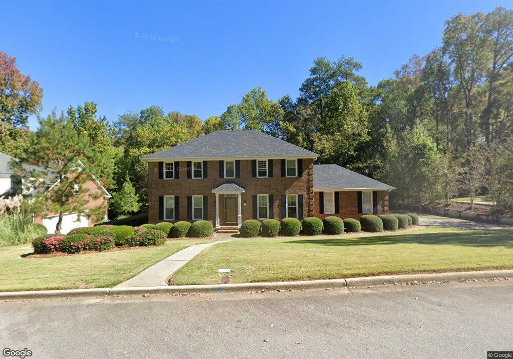
2030 Pheasant Creek Dr Augusta, GA 30907
Estimated Value: $410,562 - $507,000
4
Beds
3
Baths
3,070
Sq Ft
$150/Sq Ft
Est. Value
About This Home
This home is located at 2030 Pheasant Creek Dr, Augusta, GA 30907 and is currently estimated at $460,391, approximately $149 per square foot. 2030 Pheasant Creek Dr is a home located in Columbia County with nearby schools including Roosevelt Elementary School, Northmore Elementary School, and Stevens Creek Elementary School.
Ownership History
Date
Name
Owned For
Owner Type
Purchase Details
Closed on
Mar 31, 2025
Sold by
Peele William G
Bought by
Peele Karin H
Current Estimated Value
Purchase Details
Closed on
Nov 30, 2005
Sold by
Bahr Evan C
Bought by
Peele William G and Peele Karin H
Purchase Details
Closed on
May 13, 2003
Sold by
Bahr Evan C
Bought by
Bahr Evan C and Evan C Bahr Living Trust
Create a Home Valuation Report for This Property
The Home Valuation Report is an in-depth analysis detailing your home's value as well as a comparison with similar homes in the area
Home Values in the Area
Average Home Value in this Area
Purchase History
| Date | Buyer | Sale Price | Title Company |
|---|---|---|---|
| Peele Karin H | -- | -- | |
| Peele William G | $256,000 | -- | |
| Bahr Evan C | -- | -- |
Source: Public Records
Tax History Compared to Growth
Tax History
| Year | Tax Paid | Tax Assessment Tax Assessment Total Assessment is a certain percentage of the fair market value that is determined by local assessors to be the total taxable value of land and additions on the property. | Land | Improvement |
|---|---|---|---|---|
| 2025 | $1,243 | $157,544 | $31,304 | $126,240 |
| 2024 | $1,223 | $149,666 | $29,504 | $120,162 |
| 2023 | $1,223 | $141,170 | $29,504 | $111,666 |
| 2022 | $1,178 | $131,595 | $26,404 | $105,191 |
| 2021 | $1,151 | $122,072 | $22,804 | $99,268 |
| 2020 | $1,143 | $116,470 | $21,504 | $94,966 |
| 2019 | $1,063 | $107,955 | $22,904 | $85,051 |
| 2018 | $1,009 | $101,236 | $22,804 | $78,432 |
| 2017 | $1,035 | $102,950 | $19,204 | $83,746 |
| 2016 | $995 | $110,249 | $20,780 | $89,469 |
| 2015 | $905 | $99,826 | $20,280 | $79,546 |
| 2014 | $882 | $95,195 | $21,780 | $73,415 |
Source: Public Records
Map
Nearby Homes
- 2032 Pheasant Creek Dr
- 828 Mayo Ln
- 1119 Hampstead Place
- 1094 Hampstead Place
- 3244 Riverstone Dr
- 3038 Sterling Rd
- 820 Mitchell St
- 826 Mitchell St
- 2020 Autumn Chase
- 816 Brookfield Pkwy
- 307 Old Salem Way
- 705 Cool Brook Ct
- 2044 Bridgewater Dr
- 3555 Watervale Way
- 333 Old Salem Way
- 3503 Wakefield Ct
- 1001 Windsong Cir
- 2111 Turtle Ct
- 2108 Turtle Ct
- 408 Hastings Place
- 2028 Pheasant Creek Dr
- 490 Falcon Ct
- 2026 Pheasant Creek Dr
- 2027 Pheasant Creek Dr
- 2034 Pheasant Creek Dr
- 2029 Pheasant Creek Dr
- 2031 Pheasant Creek Dr
- 500 Falcon Dr
- 2025 Pheasant Creek Dr
- 498 Falcon Dr
- 2024 Pheasant Creek Dr
- 2033 Pheasant Creek Dr
- 486 Falcon Dr
- 492 Falcon Dr
- 484 Falcon Dr
- 2019 Red Fox Way
- 2035 Pheasant Creek Dr
- 461 Timber Wolf Trail
- 459 Timber Wolf Trail
- 2022 Pheasant Creek Dr