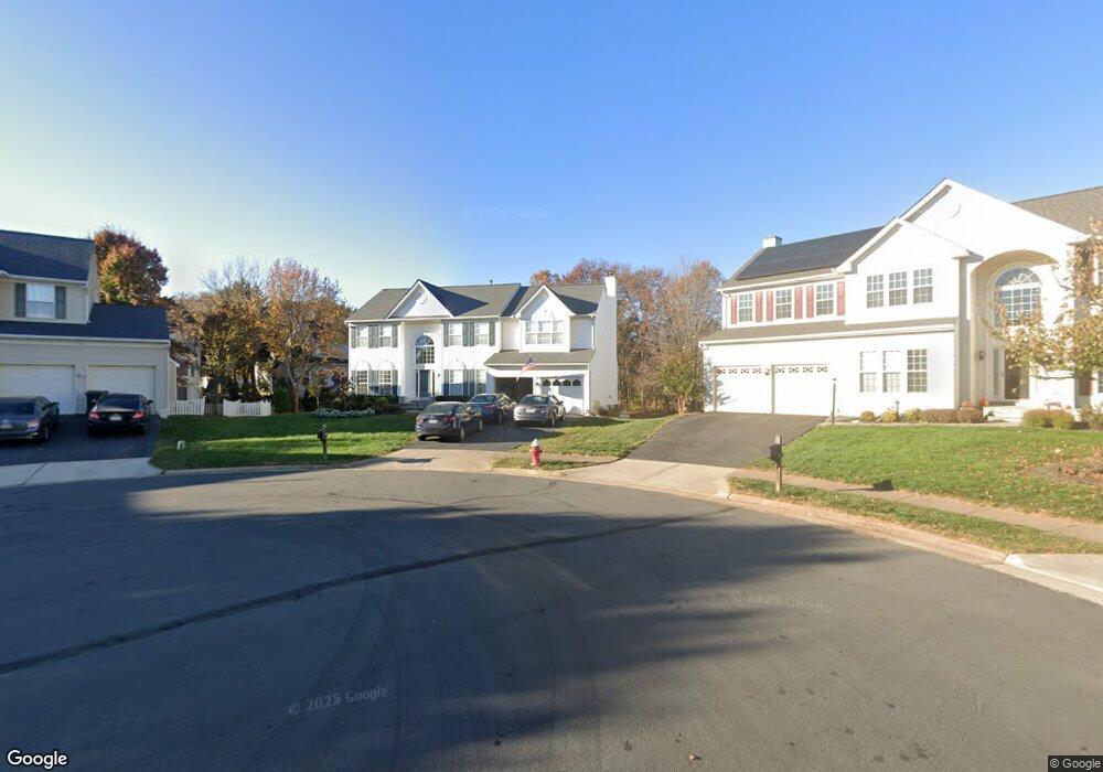
20307 Baymeadow Ct Ashburn, VA 20147
Estimated Value: $942,216 - $1,016,000
5
Beds
4
Baths
2,858
Sq Ft
$346/Sq Ft
Est. Value
About This Home
This home is located at 20307 Baymeadow Ct, Ashburn, VA 20147 and is currently estimated at $987,554, approximately $345 per square foot. 20307 Baymeadow Ct is a home located in Loudoun County with nearby schools including Cedar Lane Elementary School, Trailside Middle School, and Stone Bridge High.
Ownership History
Date
Name
Owned For
Owner Type
Purchase Details
Closed on
Oct 31, 1996
Sold by
Richmond American Homes Of Va
Bought by
Adams Andrew K and Adams Cynthia M
Current Estimated Value
Home Financials for this Owner
Home Financials are based on the most recent Mortgage that was taken out on this home.
Original Mortgage
$183,450
Outstanding Balance
$18,047
Interest Rate
8.07%
Mortgage Type
New Conventional
Estimated Equity
$969,507
Create a Home Valuation Report for This Property
The Home Valuation Report is an in-depth analysis detailing your home's value as well as a comparison with similar homes in the area
Home Values in the Area
Average Home Value in this Area
Purchase History
| Date | Buyer | Sale Price | Title Company |
|---|---|---|---|
| Adams Andrew K | $229,350 | Island Title Corp |
Source: Public Records
Mortgage History
| Date | Status | Borrower | Loan Amount |
|---|---|---|---|
| Open | Adams Andrew K | $183,450 |
Source: Public Records
Tax History Compared to Growth
Tax History
| Year | Tax Paid | Tax Assessment Tax Assessment Total Assessment is a certain percentage of the fair market value that is determined by local assessors to be the total taxable value of land and additions on the property. | Land | Improvement |
|---|---|---|---|---|
| 2025 | $7,250 | $900,600 | $299,800 | $600,800 |
| 2024 | $7,289 | $842,640 | $294,800 | $547,840 |
| 2023 | $7,072 | $808,220 | $294,800 | $513,420 |
| 2022 | $6,846 | $769,160 | $269,800 | $499,360 |
| 2021 | $6,618 | $675,320 | $219,800 | $455,520 |
| 2020 | $6,566 | $634,360 | $199,400 | $434,960 |
| 2019 | $6,502 | $622,220 | $199,400 | $422,820 |
| 2018 | $6,155 | $567,280 | $179,400 | $387,880 |
| 2017 | $6,230 | $553,750 | $179,400 | $374,350 |
| 2016 | $6,392 | $558,260 | $0 | $0 |
| 2015 | $6,023 | $351,250 | $0 | $351,250 |
| 2014 | $5,974 | $337,810 | $0 | $337,810 |
Source: Public Records
Map
Nearby Homes
- 20314 Snowpoint Place
- 20278 Glenrobin Terrace
- 20250 Millstead Dr
- 20331 Susan Leslie Dr
- 43878 Camellia St
- 43820 Laurel Ridge Dr
- 44049 Ferncliff Terrace
- 44005 Gala Cir
- 20231 Hidden Creek Ct
- 20576 Ashburn Rd
- 20153 Valhalla Square
- 20129 Valhalla Square
- 44094 Gala Cir
- 20044 Crew Square
- 44004 Florence Terrace
- 43582 Old Kinderhook Dr
- 43589 Edison Club Ct
- 44049 Florence Terrace
- 20624 Camptown Ct
- 20385 Medalist Dr
- 20311 Baymeadow Ct
- 20302 Baymeadow Ct
- 20278 Millstead Dr
- 20282 Millstead Dr
- 20315 Baymeadow Ct
- 20306 Baymeadow Ct
- 20286 Millstead Dr
- 20310 Baymeadow Ct
- 20197 Boxwood Place
- 20193 Boxwood Place
- 20201 Boxwood Place
- 20314 Baymeadow Ct
- 20205 Boxwood Place
- 20279 Millstead Dr
- 20275 Millstead Dr
- 20283 Millstead Dr
- 43885 Laurel Ridge Dr
- 43876 Laurel Ridge Dr
- 43881 Laurel Ridge Dr
- 43889 Laurel Ridge Dr