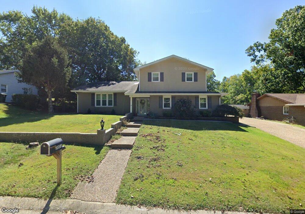
2031 Allen Dr Cape Girardeau, MO 63701
Estimated Value: $252,278 - $280,000
4
Beds
3
Baths
2,300
Sq Ft
$117/Sq Ft
Est. Value
About This Home
This home is located at 2031 Allen Dr, Cape Girardeau, MO 63701 and is currently estimated at $269,070, approximately $116 per square foot. 2031 Allen Dr is a home located in Cape Girardeau County with nearby schools including Alma Schrader Elementary School, Central Middle School, and Central Junior High School.
Ownership History
Date
Name
Owned For
Owner Type
Purchase Details
Closed on
Apr 16, 2008
Sold by
Thomas Paula R and Millering Benjamin
Bought by
Schmid Ella Kathleen Skaggs and The William Carl Skaggs Revocable Trust
Current Estimated Value
Home Financials for this Owner
Home Financials are based on the most recent Mortgage that was taken out on this home.
Original Mortgage
$95,900
Interest Rate
6%
Mortgage Type
Future Advance Clause Open End Mortgage
Create a Home Valuation Report for This Property
The Home Valuation Report is an in-depth analysis detailing your home's value as well as a comparison with similar homes in the area
Home Values in the Area
Average Home Value in this Area
Purchase History
| Date | Buyer | Sale Price | Title Company |
|---|---|---|---|
| Schmid Ella Kathleen Skaggs | -- | None Available |
Source: Public Records
Mortgage History
| Date | Status | Borrower | Loan Amount |
|---|---|---|---|
| Closed | Schmid Ella Kathleen Skaggs | $95,900 |
Source: Public Records
Tax History Compared to Growth
Tax History
| Year | Tax Paid | Tax Assessment Tax Assessment Total Assessment is a certain percentage of the fair market value that is determined by local assessors to be the total taxable value of land and additions on the property. | Land | Improvement |
|---|---|---|---|---|
| 2025 | $14 | $28,810 | $3,370 | $25,440 |
| 2024 | $14 | $27,440 | $3,210 | $24,230 |
| 2023 | $1,426 | $27,440 | $3,210 | $24,230 |
| 2022 | $1,315 | $25,290 | $2,960 | $22,330 |
| 2021 | $1,315 | $25,290 | $2,960 | $22,330 |
| 2020 | $1,319 | $25,290 | $2,960 | $22,330 |
| 2019 | $1,317 | $25,290 | $0 | $0 |
| 2018 | $1,314 | $25,290 | $0 | $0 |
| 2017 | $1,317 | $25,290 | $0 | $0 |
| 2016 | $1,312 | $25,290 | $0 | $0 |
| 2015 | $1,313 | $25,290 | $0 | $0 |
| 2014 | $1,320 | $25,290 | $0 | $0 |
Source: Public Records
Map
Nearby Homes
- 2085 Derbyshire Ln
- 2415 Perryville Rd
- 2528 Palomino Dr
- 2206 Derbyshire Ln
- 2519 Horseshoe Ridge
- 2520 Horseshoe Ridge
- 2137 Wood Hollow Ct
- 1966 Randol Ave
- 2062 Concord Place
- 1960 Briarwood Dr
- 1623 Lexington Ave
- 1910 Sherwood Dr
- 1938 Westwood Dr
- 1608 Lexington Ave
- 1705 Paul Revere Dr
- 2213 Crown Point Dr
- 1577 Saratoga St
- 2224 Heywood Meadows
- 2640 Walden Blvd
- 1572 Lexington Ave