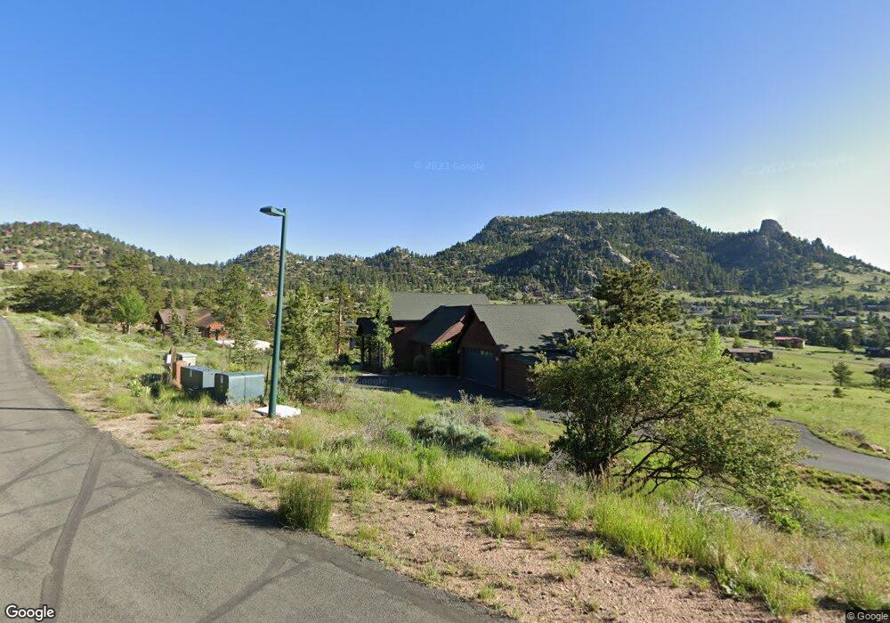
2031 Cherokee Dr Estes Park, CO 80517
Estimated Value: $995,002 - $1,294,000
3
Beds
3
Baths
3,021
Sq Ft
$382/Sq Ft
Est. Value
About This Home
This home is located at 2031 Cherokee Dr, Estes Park, CO 80517 and is currently estimated at $1,155,251, approximately $382 per square foot. 2031 Cherokee Dr is a home located in Larimer County with nearby schools including Estes Park K-5 School, Estes Park Middle School, and Estes Park High School.
Ownership History
Date
Name
Owned For
Owner Type
Purchase Details
Closed on
May 21, 2019
Sold by
Flanery Richard M and Flanery Sherry S
Bought by
Koelling Roger N and Koelling Lori L
Current Estimated Value
Home Financials for this Owner
Home Financials are based on the most recent Mortgage that was taken out on this home.
Original Mortgage
$484,350
Outstanding Balance
$424,103
Interest Rate
4%
Mortgage Type
New Conventional
Estimated Equity
$731,148
Purchase Details
Closed on
Jul 21, 2006
Sold by
Alpine Building & Development Llc
Bought by
Flanery Richard M and Flanery Sherry S
Home Financials for this Owner
Home Financials are based on the most recent Mortgage that was taken out on this home.
Original Mortgage
$481,600
Interest Rate
6.12%
Mortgage Type
Purchase Money Mortgage
Purchase Details
Closed on
Jan 11, 2006
Sold by
Griffith Harvey and Griffith Dale
Bought by
Alpine Building & Development Llc
Create a Home Valuation Report for This Property
The Home Valuation Report is an in-depth analysis detailing your home's value as well as a comparison with similar homes in the area
Home Values in the Area
Average Home Value in this Area
Purchase History
| Date | Buyer | Sale Price | Title Company |
|---|---|---|---|
| Koelling Roger N | $766,000 | None Available | |
| Flanery Richard M | $602,053 | None Available | |
| Alpine Building & Development Llc | $162,000 | None Available |
Source: Public Records
Mortgage History
| Date | Status | Borrower | Loan Amount |
|---|---|---|---|
| Open | Koelling Roger N | $484,350 | |
| Previous Owner | Flanery Richard M | $481,600 |
Source: Public Records
Tax History
| Year | Tax Paid | Tax Assessment Tax Assessment Total Assessment is a certain percentage of the fair market value that is determined by local assessors to be the total taxable value of land and additions on the property. | Land | Improvement |
|---|---|---|---|---|
| 2025 | $4,704 | $65,569 | $19,688 | $45,881 |
| 2024 | $4,624 | $67,911 | $21,105 | $46,806 |
| 2022 | $4,087 | $53,515 | $11,864 | $41,651 |
| 2021 | $4,196 | $55,055 | $12,205 | $42,850 |
| 2020 | $3,614 | $46,825 | $12,727 | $34,098 |
| 2019 | $3,594 | $46,825 | $12,727 | $34,098 |
| 2018 | $3,372 | $42,602 | $12,024 | $30,578 |
| 2017 | $3,390 | $42,602 | $12,024 | $30,578 |
| 2016 | $3,048 | $40,596 | $13,134 | $27,462 |
| 2015 | $3,080 | $40,590 | $13,130 | $27,460 |
| 2014 | $2,633 | $35,600 | $13,530 | $22,070 |
Source: Public Records
Map
Nearby Homes
- 200 Cherokee Ct
- 285 Indian Trail
- 1873 Ranch Cir
- 272 Solomon Dr
- 384 Prospect Estates Ct
- 303 Green Pine Ct
- 659 Peak View Dr
- 1615 Prospect Mountain Dr
- 0 Raven Rock Rd Unit IRE1053244
- 2151 Larkspur Ave
- 2441 Spruce Ave
- 2175 Carriage Dr
- 1267 Upper Venner Rd
- 2619 Ridge Ln
- 2630 Ridge Ln
- 0 Route 7
- 2625 Marys Lake Rd Unit 104
- 2625 Marys Lake Rd Unit S1
- 2625 Marys Lake Rd Unit 28C
- 2800 Marys Lake Rd
Your Personal Tour Guide
Ask me questions while you tour the home.