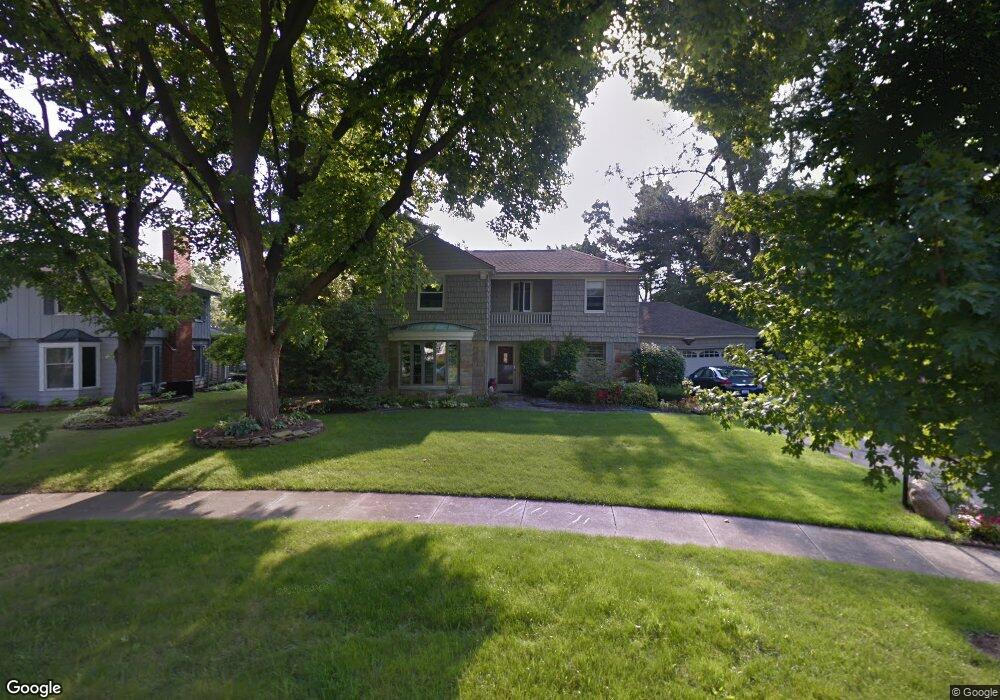
2031 Crooked Ln Unit Bldg-Unit Flint, MI 48503
Woodcroft Estates NeighborhoodEstimated Value: $270,000 - $306,000
4
Beds
4
Baths
2,180
Sq Ft
$130/Sq Ft
Est. Value
About This Home
This home is located at 2031 Crooked Ln Unit Bldg-Unit, Flint, MI 48503 and is currently estimated at $282,856, approximately $129 per square foot. 2031 Crooked Ln Unit Bldg-Unit is a home located in Genesee County with nearby schools including Durant-Tuuri-Mott Elementary School, Flint Southwestern Classical Academy, and St. Paul Lutheran School.
Ownership History
Date
Name
Owned For
Owner Type
Purchase Details
Closed on
Jun 1, 2022
Sold by
Campbell and Jennifer
Bought by
Steward Philip L and Steward Ellen K
Current Estimated Value
Home Financials for this Owner
Home Financials are based on the most recent Mortgage that was taken out on this home.
Original Mortgage
$218,700
Outstanding Balance
$207,797
Interest Rate
5.27%
Mortgage Type
New Conventional
Estimated Equity
$75,059
Purchase Details
Closed on
Jun 12, 2018
Sold by
Gomes Susan C and Powell Diane R
Bought by
Campbell Daniel and Campbell Jennie
Purchase Details
Closed on
May 18, 1999
Sold by
Gomes Susan C
Bought by
Gomes Susan C and Powell Diana R
Create a Home Valuation Report for This Property
The Home Valuation Report is an in-depth analysis detailing your home's value as well as a comparison with similar homes in the area
Home Values in the Area
Average Home Value in this Area
Purchase History
| Date | Buyer | Sale Price | Title Company |
|---|---|---|---|
| Steward Philip L | $243,000 | None Listed On Document | |
| Campbell Daniel | $180,000 | Mason Burgess Title Agency | |
| Gomes Susan C | -- | -- | |
| Gomes Susan C | $205,000 | First American Title |
Source: Public Records
Mortgage History
| Date | Status | Borrower | Loan Amount |
|---|---|---|---|
| Open | Steward Philip L | $218,700 |
Source: Public Records
Tax History Compared to Growth
Tax History
| Year | Tax Paid | Tax Assessment Tax Assessment Total Assessment is a certain percentage of the fair market value that is determined by local assessors to be the total taxable value of land and additions on the property. | Land | Improvement |
|---|---|---|---|---|
| 2025 | $5,616 | $110,200 | $0 | $0 |
| 2024 | $4,927 | $103,800 | $0 | $0 |
| 2023 | $4,746 | $95,600 | $0 | $0 |
| 2022 | $0 | $83,400 | $0 | $0 |
| 2021 | $4,124 | $76,500 | $0 | $0 |
| 2020 | $4,869 | $72,600 | $0 | $0 |
| 2019 | $4,672 | $68,900 | $0 | $0 |
| 2018 | $2,469 | $64,000 | $0 | $0 |
| 2017 | $2,394 | $0 | $0 | $0 |
| 2016 | $2,374 | $0 | $0 | $0 |
| 2015 | -- | $0 | $0 | $0 |
| 2014 | -- | $0 | $0 | $0 |
| 2012 | -- | $38,200 | $0 | $0 |
Source: Public Records
Map
Nearby Homes
- 3102 Westwood Pkwy
- 3401 Westwood Pkwy
- 3001 Yale St
- 2926 Yale St
- 3402 Brandon St
- 3305 Larchmont St
- 3506 Chicago Blvd
- 3214 Clairmont St
- 3217 Arlene Ave
- 1414 Knapp Ave
- 1326 Hughes Ave
- 1318 Knapp Ave
- 3813 Larchmont St
- 1516 Gainey Ave
- 1412 S Ballenger Hwy
- 1308 Barney Ave
- 1126 Clancy Ave
- 1202 Knapp Ave
- 1217 Barney Ave
- 3918 Larchmont St
- 2031 Crooked Ln
- 2039 Crooked Ln
- 2023 Crooked Ln
- 2015 Crooked Ln
- 3110 Westwood Pkwy
- 3120 Westwood Pkwy
- 3130 Westwood Pkwy
- 2020 Crooked Ln
- 3030 Westwood Pkwy
- 2002 Crooked Ln
- 2007 Crooked Ln
- 2038 Crooked Ln
- 2022 Oxford Ln
- 2014 Oxford Ln
- 2046 Crooked Ln
- 2034 Oxford Ln
- 2054 Crooked Ln
- 3211 Hawthorne Dr
- 3101 Hawthorne Dr
- 3202 Westwood Pkwy