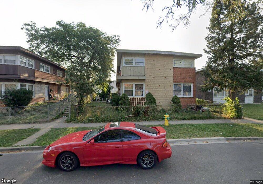
2031 Georgetown Ln Waukegan, IL 60085
Estimated Value: $135,000 - $176,000
3
Beds
2
Baths
1,240
Sq Ft
$123/Sq Ft
Est. Value
About This Home
This home is located at 2031 Georgetown Ln, Waukegan, IL 60085 and is currently estimated at $153,064, approximately $123 per square foot. 2031 Georgetown Ln is a home located in Lake County with nearby schools including Clearview Elementary School, Miguel Juarez Middle School, and Waukegan High School.
Ownership History
Date
Name
Owned For
Owner Type
Purchase Details
Closed on
Sep 25, 2008
Sold by
Wells Fargo Bank Mn Na
Bought by
Ichou Roger
Current Estimated Value
Purchase Details
Closed on
Apr 16, 2007
Sold by
Tormos Vincent
Bought by
Wells Fargo Bank Mn Na
Purchase Details
Closed on
Jul 22, 2005
Sold by
Tormos Vincent
Bought by
Itasca Bank & Trust Co and Trust #12181
Purchase Details
Closed on
Feb 7, 2005
Sold by
Bank Of Waukegan
Bought by
Tormos Vincent
Create a Home Valuation Report for This Property
The Home Valuation Report is an in-depth analysis detailing your home's value as well as a comparison with similar homes in the area
Home Values in the Area
Average Home Value in this Area
Purchase History
| Date | Buyer | Sale Price | Title Company |
|---|---|---|---|
| Ichou Roger | $26,000 | Regent Title Ins Agency Llc | |
| Wells Fargo Bank Mn Na | -- | None Available | |
| Itasca Bank & Trust Co | -- | -- | |
| Tormos Vincent | $408,000 | St |
Source: Public Records
Tax History Compared to Growth
Tax History
| Year | Tax Paid | Tax Assessment Tax Assessment Total Assessment is a certain percentage of the fair market value that is determined by local assessors to be the total taxable value of land and additions on the property. | Land | Improvement |
|---|---|---|---|---|
| 2024 | $2,555 | $33,220 | $3,041 | $30,179 |
| 2023 | $2,304 | $27,094 | $2,480 | $24,614 |
| 2022 | $2,304 | $23,572 | $1,847 | $21,725 |
| 2021 | $2,416 | $23,176 | $1,861 | $21,315 |
| 2020 | $2,447 | $21,591 | $1,734 | $19,857 |
| 2019 | $2,463 | $19,785 | $1,589 | $18,196 |
| 2018 | $2,575 | $19,399 | $1,730 | $17,669 |
| 2017 | $2,441 | $17,163 | $1,531 | $15,632 |
| 2016 | $2,305 | $14,914 | $1,197 | $13,717 |
| 2015 | $2,255 | $13,348 | $1,071 | $12,277 |
| 2014 | $1,648 | $9,742 | $1,175 | $8,567 |
| 2012 | $2,043 | $10,556 | $1,274 | $9,282 |
Source: Public Records
Map
Nearby Homes
- 2207 Williamsburg Dr
- 2008 Harding Ave
- 12352 W Atlantic Ave
- 2440 W Cheyenne Rd
- 1913 Chippewa Rd
- 12787 W Grove Ave
- 2105 W Grove Ave
- 1425 N Mcaree Rd
- 1038 Indiana Ave
- 1504 W Glen Flora Ave
- 2608 Menominee Rd
- 1117 Judge Ave
- 1019 N Lewis Ave
- 1023 N Elmwood Ave
- 1051 Glenwood Ave
- 1005 N Lewis Ave
- 2712 W Grove Ave
- 2810 W Atlantic Ave
- 1001 Judge Ave
- 1745 N Frolic Ave
- 2029 Georgetown Ln
- 2033 Georgetown Ln
- 2023 Georgetown Ln
- 2023 Georgetown Ln Unit 2023
- 2027 Georgetown Ln
- 2021 Georgetown Ln
- 2025 Georgetown Ln
- 2025 Georgetown Ln Unit 2025
- 2019 Georgetown Ln
- 2015 Georgetown Ln
- 2013 Georgetown Ln
- 2017 Georgetown Ln
- 2017 Georgetown Ln Unit 2017
- 2011 Georgetown Ln
- 2035-2045 Georgetown Ln
- 2035 Georgetown Ln
- 2005 Georgetown Ln
- 2003 Georgetown Ln
- 2007 Georgetown Ln
- 2001 Georgetown Ln