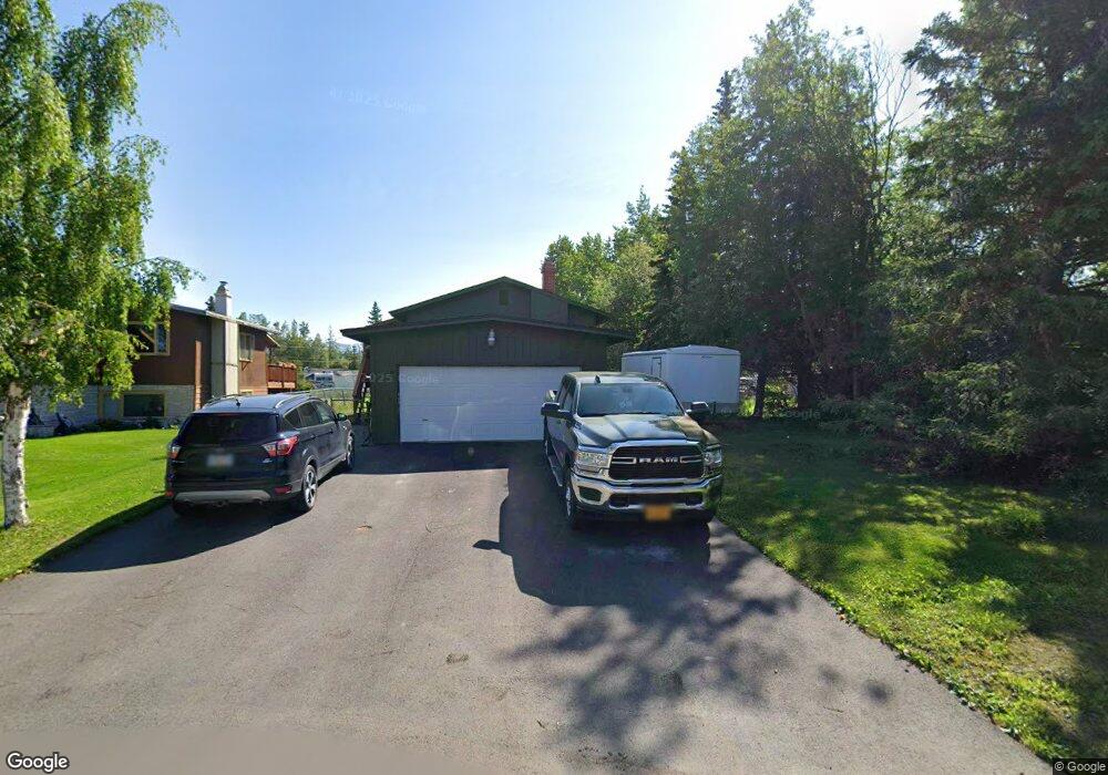
2031 Paxson Dr Anchorage, AK 99504
Northeast Anchorage NeighborhoodEstimated Value: $136,000 - $450,257
4
Beds
2
Baths
1,728
Sq Ft
$176/Sq Ft
Est. Value
About This Home
This home is located at 2031 Paxson Dr, Anchorage, AK 99504 and is currently estimated at $303,314, approximately $175 per square foot. 2031 Paxson Dr is a home located in Anchorage Municipality with nearby schools including Chester Valley Elementary School, Nicholas J. Begich Middle School, and Bartlett High School.
Ownership History
Date
Name
Owned For
Owner Type
Purchase Details
Closed on
Aug 8, 2001
Sold by
Selman Grandchildrens Trust and Selman Dennis Stanley
Bought by
Green Nathan T and Green Regina M
Current Estimated Value
Home Financials for this Owner
Home Financials are based on the most recent Mortgage that was taken out on this home.
Original Mortgage
$129,600
Outstanding Balance
$50,372
Interest Rate
7.1%
Mortgage Type
New Conventional
Estimated Equity
$252,942
Purchase Details
Closed on
Jul 31, 2001
Sold by
Selman Dennis Stanley and The Selman Grandchildrens Trus
Bought by
Green Nathan T and Green Regina M
Home Financials for this Owner
Home Financials are based on the most recent Mortgage that was taken out on this home.
Original Mortgage
$129,600
Outstanding Balance
$50,372
Interest Rate
7.1%
Mortgage Type
New Conventional
Estimated Equity
$252,942
Create a Home Valuation Report for This Property
The Home Valuation Report is an in-depth analysis detailing your home's value as well as a comparison with similar homes in the area
Home Values in the Area
Average Home Value in this Area
Purchase History
| Date | Buyer | Sale Price | Title Company |
|---|---|---|---|
| Green Nathan T | -- | -- | |
| Green Nathan T | -- | -- |
Source: Public Records
Mortgage History
| Date | Status | Borrower | Loan Amount |
|---|---|---|---|
| Open | Green Nathan T | $129,600 | |
| Closed | Green Nathan T | $129,600 |
Source: Public Records
Tax History Compared to Growth
Tax History
| Year | Tax Paid | Tax Assessment Tax Assessment Total Assessment is a certain percentage of the fair market value that is determined by local assessors to be the total taxable value of land and additions on the property. | Land | Improvement |
|---|---|---|---|---|
| 2025 | $5,885 | $386,400 | $129,300 | $257,100 |
| 2024 | $5,885 | $364,500 | $129,300 | $235,200 |
| 2023 | $5,840 | $342,900 | $129,300 | $213,600 |
| 2022 | $5,630 | $334,300 | $129,200 | $205,100 |
| 2021 | $5,455 | $302,700 | $129,200 | $173,500 |
| 2020 | $5,017 | $295,100 | $129,200 | $165,900 |
| 2019 | $4,834 | $295,500 | $129,200 | $166,300 |
| 2018 | $4,827 | $294,300 | $127,000 | $167,300 |
| 2017 | $4,656 | $297,300 | $120,500 | $176,800 |
| 2016 | $4,022 | $293,100 | $120,500 | $172,600 |
| 2015 | $4,022 | $288,100 | $109,700 | $178,400 |
| 2014 | $4,022 | $263,100 | $97,000 | $166,100 |
Source: Public Records
Map
Nearby Homes
- 7220 E 20th Ave
- 7110 Foothill Dr
- 7120 Chester Ct
- 1749 Skilak Cir
- 2441 Scarborough Dr
- 2020 Muldoon Rd Unit 350
- 1900 Muldoon Rd
- 1414 Marten St
- 7831 Wildbrook Ct
- 1749 Brink Dr
- 6911 Mink Ave
- 1406 Otter St
- Tr E Debarr Rd
- 000 Muldoon & Debarr Rd
- 1120 Ermine St
- 2558 Brookshire Loop Unit 32
- 1562 State St Unit A2
- 2221 Muldoon Rd Unit 370
- 2221 Muldoon Rd Unit 524
- 6124 E 21st Ave
- 2021 Paxson Dr
- 7211 E 21st Ave
- 2041 Paxson Dr
- 2041 Paxson Dr Unit D
- 2041 Paxson Dr Unit B
- 2011 Paxson Dr
- 7221 E 21st Ave Unit 1
- 7221 E 21st Ave
- 2020 Barboa Cir
- 2010 Barboa Cir
- 2030 Paxson Dr
- 2021 Patterson St
- 2020 Paxson Dr
- 7200 E 20th Ave
- 2040 Paxson Dr
- 7210 E 20th Ave
- 2021 Barboa Cir
- 7110 E 20th Ave
- 2052 Paxson Dr
- 2101 Paxson Dr Unit 250