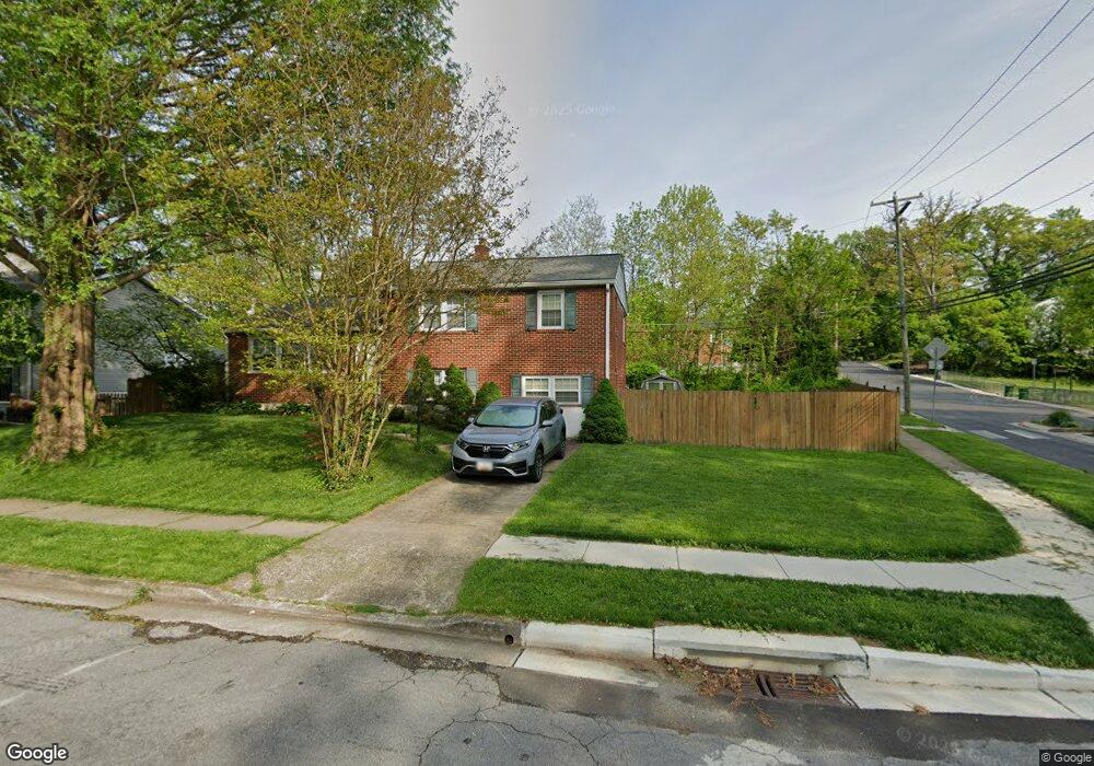
2031 Rollingwood Rd Catonsville, MD 21228
Estimated Value: $508,503 - $551,000
4
Beds
3
Baths
1,971
Sq Ft
$265/Sq Ft
Est. Value
About This Home
This home is located at 2031 Rollingwood Rd, Catonsville, MD 21228 and is currently estimated at $522,376, approximately $265 per square foot. 2031 Rollingwood Rd is a home located in Baltimore County with nearby schools including Westchester Elementary School, Catonsville Middle School, and Catonsville High School.
Ownership History
Date
Name
Owned For
Owner Type
Purchase Details
Closed on
May 8, 2009
Sold by
May David B
Bought by
Banchoy Thomas G
Current Estimated Value
Purchase Details
Closed on
Aug 4, 2004
Sold by
Engel Robert E
Bought by
May David B and Lising Laura J
Purchase Details
Closed on
Dec 19, 2000
Sold by
Faith Lawrence S
Bought by
Engel Robert E and Engel Christina A
Create a Home Valuation Report for This Property
The Home Valuation Report is an in-depth analysis detailing your home's value as well as a comparison with similar homes in the area
Home Values in the Area
Average Home Value in this Area
Purchase History
| Date | Buyer | Sale Price | Title Company |
|---|---|---|---|
| Banchoy Thomas G | $339,900 | -- | |
| May David B | $301,000 | -- | |
| May David B | $301,000 | -- | |
| Engel Robert E | $157,500 | -- |
Source: Public Records
Tax History Compared to Growth
Tax History
| Year | Tax Paid | Tax Assessment Tax Assessment Total Assessment is a certain percentage of the fair market value that is determined by local assessors to be the total taxable value of land and additions on the property. | Land | Improvement |
|---|---|---|---|---|
| 2025 | $5,090 | $402,133 | -- | -- |
| 2024 | $5,090 | $381,600 | $127,700 | $253,900 |
| 2023 | $2,463 | $368,133 | $0 | $0 |
| 2022 | $4,704 | $354,667 | $0 | $0 |
| 2021 | $4,423 | $341,200 | $127,700 | $213,500 |
| 2020 | $4,423 | $329,367 | $0 | $0 |
| 2019 | $4,228 | $317,533 | $0 | $0 |
| 2018 | $4,063 | $305,700 | $91,700 | $214,000 |
| 2017 | $3,871 | $296,867 | $0 | $0 |
| 2016 | $3,931 | $288,033 | $0 | $0 |
| 2015 | $3,931 | $279,200 | $0 | $0 |
| 2014 | $3,931 | $279,200 | $0 | $0 |
Source: Public Records
Map
Nearby Homes
- 231 Gralan Rd
- 1900 Lismore Ln
- 11 Clay Lodge Ln Unit 204
- 2110 Edmondson Ave
- 19 Clay Lodge Ln Unit 104
- 105 Oella Ave
- 302 Wessling Cir
- 311 Radstock Rd
- 8 Seminole Ave
- 2310 Rockwell Ave
- 627 Meyers Dr
- 627 Meyers Dr Unit PARCEL 108
- 2305 Rockwell Ave
- 2208 W Geipe Rd
- 1300 Rice Ave
- 230 N Beaumont Ave
- 343 N Beaumont Ave
- 353 N Beaumont Ave
- 2 Park Dr
- 332 Suter Rd
- 2029 Rollingwood Rd
- 200 Brookside Dr
- 2028 Rollingwood Rd
- 2027 Rollingwood Rd
- 202 Brookside Dr
- 2015 Devere Ln
- 2026 Rollingwood Rd
- 125 Hillside Rd
- 204 Brookside Dr
- 2025 Rollingwood Rd
- 2024 Rollingwood Rd
- 206 Brookside Dr
- 2022 Rollingwood Rd
- 2023 Rollingwood Rd
- 201 Brookside Dr
- 203 Brookside Dr
- 208 Brookside Dr
- 121 Hillside Rd
- 205 Brookside Dr
- 2005 Devere Ln