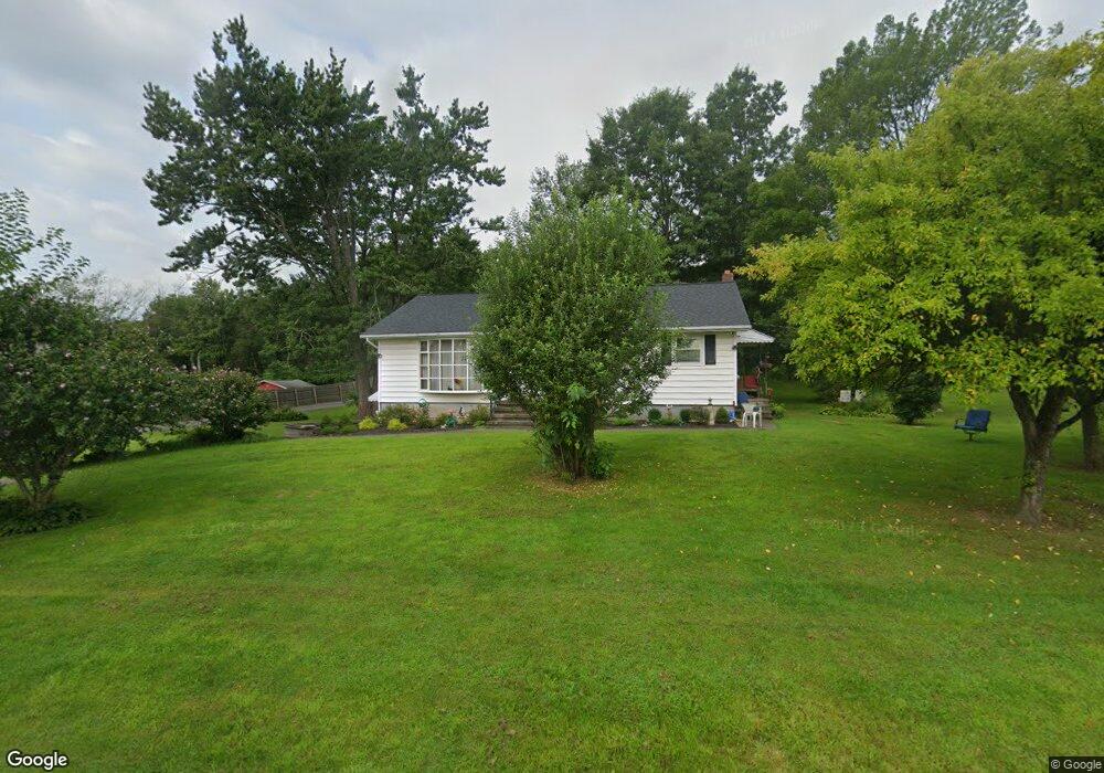
2031 Route 32 Saugerties, NY 12477
Estimated Value: $351,742 - $436,000
3
Beds
1
Bath
1,232
Sq Ft
$331/Sq Ft
Est. Value
About This Home
This home is located at 2031 Route 32, Saugerties, NY 12477 and is currently estimated at $407,686, approximately $330 per square foot. 2031 Route 32 is a home located in Ulster County with nearby schools including Saugerties Senior High School and St Mary Of The Snow School.
Ownership History
Date
Name
Owned For
Owner Type
Purchase Details
Closed on
Apr 2, 2020
Sold by
Mugnano Anthony
Bought by
Albano Ouellett
Current Estimated Value
Purchase Details
Closed on
Nov 26, 2019
Sold by
Giordano William and Giordano Eleanor C
Bought by
Mugnano Anthony
Home Financials for this Owner
Home Financials are based on the most recent Mortgage that was taken out on this home.
Original Mortgage
$228,937
Interest Rate
3.75%
Mortgage Type
FHA
Create a Home Valuation Report for This Property
The Home Valuation Report is an in-depth analysis detailing your home's value as well as a comparison with similar homes in the area
Home Values in the Area
Average Home Value in this Area
Purchase History
| Date | Buyer | Sale Price | Title Company |
|---|---|---|---|
| Albano Ouellett | $310,000 | None Available | |
| Mugnano Anthony | $250,000 | Wfg National Title Insurance |
Source: Public Records
Mortgage History
| Date | Status | Borrower | Loan Amount |
|---|---|---|---|
| Previous Owner | Mugnano Anthony | $228,937 |
Source: Public Records
Tax History Compared to Growth
Tax History
| Year | Tax Paid | Tax Assessment Tax Assessment Total Assessment is a certain percentage of the fair market value that is determined by local assessors to be the total taxable value of land and additions on the property. | Land | Improvement |
|---|---|---|---|---|
| 2024 | $3,620 | $308,000 | $59,000 | $249,000 |
| 2023 | $5,170 | $270,000 | $59,000 | $211,000 |
| 2022 | $5,024 | $230,500 | $59,000 | $171,500 |
| 2021 | $5,024 | $196,500 | $53,500 | $143,000 |
| 2020 | $2,170 | $177,000 | $48,000 | $129,000 |
| 2019 | $2,490 | $177,000 | $48,000 | $129,000 |
| 2018 | $2,617 | $171,500 | $48,000 | $123,500 |
| 2017 | $2,130 | $168,000 | $48,000 | $120,000 |
| 2016 | $2,553 | $168,000 | $48,000 | $120,000 |
| 2015 | -- | $168,000 | $54,500 | $113,500 |
| 2014 | -- | $168,000 | $54,500 | $113,500 |
Source: Public Records
Map
Nearby Homes
- 135 Hilltop Rd
- 2084 Route 32
- 2171 Route 32
- 2771 U S 9w
- 2693 Route 9w
- 2679 Route 9w
- 402 Commons Ln
- 510 Commons Ln
- 2294 Route 32
- 0 Tiger Maple Ln
- 45 Sugar Maple Ln Unit 1C
- 32 Red Maple Rd
- 18 Ridge Rd
- 126 Canterbury Dr
- 30 Glenerie Ln
- TBD Glenerie Ln
- 123 Barclay Ln
- 8 Stevens Ct
- 32 Redwood Rd
- 996 Dominican Ln
- 2035 Route 32
- 2025 Route 32
- 2044 Route 32
- 2029 Route 32
- 2024 Route 32
- 2043 Route 32
- 2017 New York 32
- 2038 Route 32
- 2017 Route 32
- 9 Quincy Stowell Ct
- 4 Quincy Stowell Ct
- 2047 Route 32
- 2042 Route 32
- 8 Quincy Stowell Ct
- 14 Cafaldo Dr
- 2016 Route 32
- 8 Cafaldo Dr
- 14 Quincy Stowell Ct
- 12 Cafaldo Dr
- 2051 Route 32