Estimated Value: $262,000 - $330,000
3
Beds
3
Baths
1,911
Sq Ft
$148/Sq Ft
Est. Value
About This Home
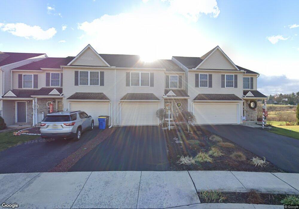
This home is located at 2031 Shaffer Cir Unit 55, Dover, PA 17315 and is currently estimated at $282,852, approximately $148 per square foot. 2031 Shaffer Cir Unit 55 is a home located in York County with nearby schools including Dover Area High School and Lighthouse Christian School.
Ownership History
Date
Name
Owned For
Owner Type
Purchase Details
Closed on
May 18, 2016
Sold by
Wisman James E
Bought by
Wisman James E and Wisman Richele B
Current Estimated Value
Purchase Details
Closed on
Sep 13, 2010
Sold by
Afw Development Inc
Bought by
Wisman James E
Home Financials for this Owner
Home Financials are based on the most recent Mortgage that was taken out on this home.
Original Mortgage
$70,000
Outstanding Balance
$46,387
Interest Rate
4.51%
Mortgage Type
New Conventional
Estimated Equity
$236,465
Create a Home Valuation Report for This Property
The Home Valuation Report is an in-depth analysis detailing your home's value as well as a comparison with similar homes in the area
Home Values in the Area
Average Home Value in this Area
Purchase History
| Date | Buyer | Sale Price | Title Company |
|---|---|---|---|
| Wisman James E | -- | None Available | |
| Wisman James E | $141,900 | None Available |
Source: Public Records
Mortgage History
| Date | Status | Borrower | Loan Amount |
|---|---|---|---|
| Open | Wisman James E | $70,000 |
Source: Public Records
Tax History Compared to Growth
Tax History
| Year | Tax Paid | Tax Assessment Tax Assessment Total Assessment is a certain percentage of the fair market value that is determined by local assessors to be the total taxable value of land and additions on the property. | Land | Improvement |
|---|---|---|---|---|
| 2025 | $5,494 | $167,450 | $33,640 | $133,810 |
| 2024 | $5,443 | $167,450 | $33,640 | $133,810 |
| 2023 | $5,443 | $167,450 | $33,640 | $133,810 |
| 2022 | $5,344 | $167,450 | $33,640 | $133,810 |
| 2021 | $5,042 | $167,450 | $33,640 | $133,810 |
| 2020 | $4,997 | $167,450 | $33,640 | $133,810 |
| 2019 | $4,935 | $167,450 | $33,640 | $133,810 |
| 2018 | $4,812 | $167,450 | $33,640 | $133,810 |
| 2017 | $4,812 | $167,450 | $33,640 | $133,810 |
| 2016 | $0 | $167,450 | $33,640 | $133,810 |
| 2015 | -- | $167,450 | $33,640 | $133,810 |
| 2014 | -- | $167,450 | $33,640 | $133,810 |
Source: Public Records
Map
Nearby Homes
- 3960 Sheppard Dr
- 3851 Country Dr
- 3847 Country Dr
- 1919 Deerfield Dr
- 46 Chipawa Ave
- 4008 Country Dr
- 1841 Wyatt Cir
- 3510 Carlisle Rd
- 4021 Country Dr
- 86 Cherokee Ave
- 143 Pawnee Ave
- 2113 Huntington Rd
- 140 Pawnee Ave
- 2602 Brownstone Dr
- 3471 Holly Rd
- 2031 Park St
- 2601 Village Rd
- 1951 Park St
- 2642 Victorian Dr
- 2670 Victorian Dr
- 2031 Shaffer Cir
- 2029 Shaffer Cir Unit 56
- 2029 Shaffer Cir
- 2027 Shaffer Cir Unit 57
- 2027 Shaffer Cir
- 2033 Shaffer Cir Unit 54
- 2033 Shaffer Cir
- 2035 Shaffer Cir Unit 53
- 2035 Shaffer Cir
- 2025 Shaffer Cir Unit 58
- 2025 Shaffer Cir
- 2023 Shaffer Cir Unit 59
- 2023 Shaffer Cir
- 2037 Shaffer Cir
- 2037 Shaffer Cir Unit 52
- 2039 Shaffer Cir Unit 51
- 2039 Shaffer Cir
- 2021 Shaffer Cir Unit 60
- 2021 Shaffer Cir
- 2041 Shaffer Cir Unit 50