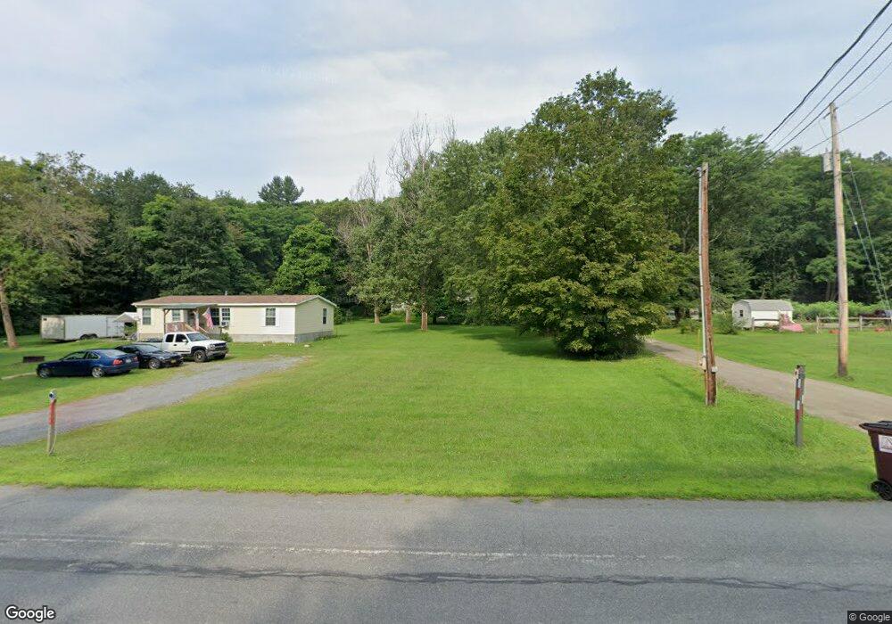
2031 State Route 22 Cambridge, NY 12816
Estimated Value: $182,000 - $245,000
3
Beds
3
Baths
1,560
Sq Ft
$142/Sq Ft
Est. Value
About This Home
This home is located at 2031 State Route 22, Cambridge, NY 12816 and is currently estimated at $221,109, approximately $141 per square foot. 2031 State Route 22 is a home located in Washington County with nearby schools including Cambridge Elementary School and Cambridge Junior/Senior High School.
Ownership History
Date
Name
Owned For
Owner Type
Purchase Details
Closed on
Aug 9, 2019
Sold by
Bates Mathew and Bates Bianca
Bought by
Crandall Rebecca L
Current Estimated Value
Home Financials for this Owner
Home Financials are based on the most recent Mortgage that was taken out on this home.
Original Mortgage
$85,129
Outstanding Balance
$76,582
Interest Rate
5.12%
Mortgage Type
FHA
Estimated Equity
$144,527
Purchase Details
Closed on
Jan 7, 2012
Sold by
Bates Matthew
Bought by
Bates Mathew
Purchase Details
Closed on
Sep 19, 2003
Sold by
Wilwol Muriel
Bought by
Bates Mathew
Create a Home Valuation Report for This Property
The Home Valuation Report is an in-depth analysis detailing your home's value as well as a comparison with similar homes in the area
Home Values in the Area
Average Home Value in this Area
Purchase History
| Date | Buyer | Sale Price | Title Company |
|---|---|---|---|
| Crandall Rebecca L | $86,700 | -- | |
| Bates Mathew | -- | D Alan Wrigley, Jr | |
| Bates Mathew | -- | John Imhof |
Source: Public Records
Mortgage History
| Date | Status | Borrower | Loan Amount |
|---|---|---|---|
| Open | Crandall Rebecca L | $85,129 |
Source: Public Records
Tax History Compared to Growth
Tax History
| Year | Tax Paid | Tax Assessment Tax Assessment Total Assessment is a certain percentage of the fair market value that is determined by local assessors to be the total taxable value of land and additions on the property. | Land | Improvement |
|---|---|---|---|---|
| 2024 | $2,469 | $100,000 | $24,200 | $75,800 |
| 2023 | $2,517 | $100,000 | $24,200 | $75,800 |
| 2022 | $2,988 | $100,000 | $24,200 | $75,800 |
| 2021 | $4,020 | $50,220 | $1,500 | $48,720 |
| 2020 | $4,081 | $50,220 | $1,500 | $48,720 |
| 2019 | $6,508 | $50,220 | $1,500 | $48,720 |
| 2018 | $6,508 | $50,220 | $1,500 | $48,720 |
| 2017 | $3,542 | $50,220 | $1,500 | $48,720 |
| 2016 | $3,441 | $50,220 | $1,500 | $48,720 |
| 2015 | -- | $50,220 | $1,500 | $48,720 |
| 2014 | -- | $50,220 | $1,500 | $48,720 |
Source: Public Records
Map
Nearby Homes
- 10 Spring Valley Ln
- L30 New York 22
- 77 Spring St
- 8 N Park St
- 4 Washington St
- 16 W Main St
- 24-26 Avenue A
- 33 S Union St
- 262 Ashgrove Rd
- 63 County Route 62
- 251 Turnpike Rd
- 1542 County Route 59
- 971 Turnpike Rd
- 236 Colfax Rd
- 669 Ashgrove Rd
- 667 Ashgrove Rd
- 763 Turnpike Rd
- 800 Chestnut Hill Rd
- 531 Sullivan Way
- 602 Turnpike Rd
- 2029 New York 22
- 2029 State Route 22
- 2037 State Route 22
- 2033 New York 22
- 2041 State Route 22
- 2014 N Route 22 N
- 2038 New York 22
- 2033 State Route 22
- 2061 State Route 22
- 2038 State Route 22
- 2012 State Route 22
- 2005 New York 22
- 2055 State Route 22
- 2055 New York 22
- 2012 New York 22
- 2005 State Route 22
- 0 Driscoll Way
- 2059 New York 22
- 8 Driscoll Way
- 2061 New York 22