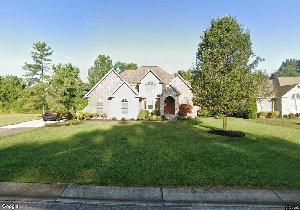
2031 Tall Pines Ln Cincinnati, OH 45244
Dry Run NeighborhoodEstimated Value: $571,000 - $773,710
4
Beds
6
Baths
4,518
Sq Ft
$158/Sq Ft
Est. Value
About This Home
This home is located at 2031 Tall Pines Ln, Cincinnati, OH 45244 and is currently estimated at $713,678, approximately $157 per square foot. 2031 Tall Pines Ln is a home located in Hamilton County with nearby schools including Summit Elementary School, Nagel Middle School, and Anderson High School.
Ownership History
Date
Name
Owned For
Owner Type
Purchase Details
Closed on
Dec 12, 2018
Sold by
Ross Michael J
Bought by
Henke Amy J and Henke William H
Current Estimated Value
Home Financials for this Owner
Home Financials are based on the most recent Mortgage that was taken out on this home.
Original Mortgage
$277,000
Outstanding Balance
$239,873
Interest Rate
4.37%
Mortgage Type
Adjustable Rate Mortgage/ARM
Estimated Equity
$473,805
Purchase Details
Closed on
Sep 21, 2006
Sold by
Clough Creek Farm Llc
Bought by
Ross Michael J
Home Financials for this Owner
Home Financials are based on the most recent Mortgage that was taken out on this home.
Original Mortgage
$525,000
Interest Rate
6.59%
Mortgage Type
Unknown
Create a Home Valuation Report for This Property
The Home Valuation Report is an in-depth analysis detailing your home's value as well as a comparison with similar homes in the area
Home Values in the Area
Average Home Value in this Area
Purchase History
| Date | Buyer | Sale Price | Title Company |
|---|---|---|---|
| Henke Amy J | $425,000 | None Available | |
| Ross Michael J | -- | None Available |
Source: Public Records
Mortgage History
| Date | Status | Borrower | Loan Amount |
|---|---|---|---|
| Open | Henke Amy J | $277,000 | |
| Previous Owner | Ross Michael J | $525,000 |
Source: Public Records
Tax History
| Year | Tax Paid | Tax Assessment Tax Assessment Total Assessment is a certain percentage of the fair market value that is determined by local assessors to be the total taxable value of land and additions on the property. | Land | Improvement |
|---|---|---|---|---|
| 2025 | $13,850 | $217,000 | $48,125 | $168,875 |
| 2024 | $13,754 | $217,000 | $48,125 | $168,875 |
| 2023 | $14,548 | $244,591 | $48,125 | $196,466 |
| 2022 | $9,948 | $148,751 | $49,438 | $99,313 |
| 2021 | $9,892 | $148,751 | $49,438 | $99,313 |
| 2020 | $9,781 | $148,751 | $49,438 | $99,313 |
| 2019 | $10,818 | $148,750 | $43,750 | $105,000 |
| 2018 | $13,788 | $202,202 | $43,750 | $158,452 |
| 2017 | $13,176 | $202,202 | $43,750 | $158,452 |
| 2016 | $14,795 | $219,594 | $44,625 | $174,969 |
| 2015 | $14,238 | $219,594 | $44,625 | $174,969 |
| 2014 | $14,224 | $219,594 | $44,625 | $174,969 |
| 2013 | $13,234 | $215,289 | $43,750 | $171,539 |
Source: Public Records
Map
Nearby Homes
- 2015 Tall Pines Ln
- 1757 Muskegon Dr
- 1676 Laval Dr
- 0 Clough Pike Unit 1861584
- 1748 Hilltree Dr
- 1847 Eight Mile Rd
- 4383 Wiborg Dr
- 1662 Hilltree Dr
- 2528 Teuton Ct
- 8320 Katies Ct
- 8602 Linderwood Ln
- 4353 Mount Carmel Tobasco Rd
- 530 Park Place
- 2256 Endovalley Dr
- 8146 Clough Pike
- 8175 Timbercreek Dr
- 498 Odin Dr
- 464 Glenrose Ln
- 1885 Wanninger Ln
- 4133 Brandonmore Dr
- 2039 Tall Pines Ln
- 3 Tall Pines Ln
- 2030 Harcourt Estates Dr
- 2030 Harcourt Dr
- 2030 Harcourt Dr Unit 24
- 2030 Tall Pines Ln
- 2022 Tall Pines Ln
- 2042 Tall Pines Ln
- 2042 Harcourt Estates Dr
- 2042 Harcourt Dr
- 2027 Harcourt Dr
- 2015 Harcourt Dr
- 2050 Tall Pines Ln
- Lot Tall Pines Ln
- 10 Tall Pines Ln
- 2011 Harcourt Estates Dr
- 2027 Harcourt Estates Dr
- 2054 Harcourt Dr
- 2054 Harcourt Estates Dr
- 8676 Clough Pike
Your Personal Tour Guide
Ask me questions while you tour the home.