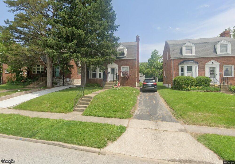
2032 Bland Place Saint Louis, MO 63143
Estimated Value: $248,000 - $280,572
2
Beds
1
Bath
1,220
Sq Ft
$220/Sq Ft
Est. Value
About This Home
This home is located at 2032 Bland Place, Saint Louis, MO 63143 and is currently estimated at $268,143, approximately $219 per square foot. 2032 Bland Place is a home located in St. Louis County with nearby schools including Maplewood Richmond Heights Elementary School, Maplewood Richmond Heights Middle School, and Maplewood-Richmond Heights High School.
Ownership History
Date
Name
Owned For
Owner Type
Purchase Details
Closed on
May 9, 2012
Sold by
Stephens George D and Stephens Donald O
Bought by
Im Holdings Llc
Current Estimated Value
Create a Home Valuation Report for This Property
The Home Valuation Report is an in-depth analysis detailing your home's value as well as a comparison with similar homes in the area
Home Values in the Area
Average Home Value in this Area
Purchase History
| Date | Buyer | Sale Price | Title Company |
|---|---|---|---|
| Im Holdings Llc | $106,000 | Title Partners Agency Llc |
Source: Public Records
Tax History Compared to Growth
Tax History
| Year | Tax Paid | Tax Assessment Tax Assessment Total Assessment is a certain percentage of the fair market value that is determined by local assessors to be the total taxable value of land and additions on the property. | Land | Improvement |
|---|---|---|---|---|
| 2025 | $3,853 | $54,650 | $31,600 | $23,050 |
| 2024 | $3,853 | $46,670 | $19,670 | $27,000 |
| 2023 | $3,853 | $46,670 | $19,670 | $27,000 |
| 2022 | $3,551 | $40,720 | $19,670 | $21,050 |
| 2021 | $3,523 | $40,720 | $19,670 | $21,050 |
| 2020 | $3,511 | $38,380 | $16,850 | $21,530 |
| 2019 | $3,489 | $38,380 | $16,850 | $21,530 |
| 2018 | $3,227 | $32,100 | $11,480 | $20,620 |
| 2017 | $3,168 | $32,100 | $11,480 | $20,620 |
| 2016 | $2,904 | $28,350 | $10,530 | $17,820 |
| 2015 | $2,743 | $28,350 | $10,530 | $17,820 |
| 2014 | $2,890 | $30,610 | $6,750 | $23,860 |
Source: Public Records
Map
Nearby Homes
- 2030 Bland Place
- 7555 Alicia Ave
- 7590 W Bruno Ave
- 7635 Folk Ave
- 7562 Folk Ave
- 1723 Mccready Ave
- 7765 Weston Place
- 7638 Weaver Ave
- 7736 W Ranken Ave
- 7735 Saint Albans Ave
- 1733 Del Norte Ave
- 7400 Williams Ave
- 7715 Dale Ave
- 7723 Dale Ave
- 7716 Lovella Ave
- 7264 Richmond Place
- 1262 Moorlands Dr
- 1501 Stockard Ave
- 1510 Banneker Ave
- 1241 Strassner Dr Unit 1308
- 2036 Bland Place
- 2040 Bland Place
- 2028 Bland Place
- 2035 Hiawatha Ave
- 2043 Hiawatha Ave
- 2033 Hiawatha Ave
- 2031 Hiawatha Ave
- 2027 Hiawatha Ave
- 2022 Bland Place
- 2031 Bland Place
- 2029 Bland Place
- 2035 Bland Place
- 2023 Hiawatha Ave
- 7616 Williams Ave
- 7620 Williams Ave
- 7614 Williams Ave
- 2037 Bland Place
- 7624 Williams Ave
- 7610 Williams Ave
- 2025 Bland Place