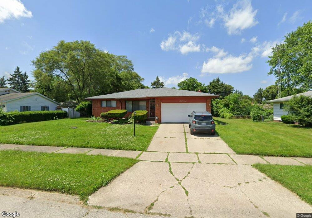
2032 Chelan St Flint, MI 48503
South Parks NeighborhoodEstimated Value: $102,000 - $132,000
3
Beds
2
Baths
1,368
Sq Ft
$87/Sq Ft
Est. Value
About This Home
This home is located at 2032 Chelan St, Flint, MI 48503 and is currently estimated at $118,356, approximately $86 per square foot. 2032 Chelan St is a home located in Genesee County with nearby schools including Freeman Elementary School, Flint Southwestern Classical Academy, and International Academy of Flint (K-12).
Ownership History
Date
Name
Owned For
Owner Type
Purchase Details
Closed on
Jul 19, 2010
Sold by
Wynne Onie Jean and Wynne Roger E
Bought by
Wynne Onie Jean and Wynne Crystal
Current Estimated Value
Purchase Details
Closed on
Aug 10, 2001
Sold by
Kimble Craig A and Kimble Kim
Bought by
Wynne Roger E and Wynne Onie Jean
Home Financials for this Owner
Home Financials are based on the most recent Mortgage that was taken out on this home.
Original Mortgage
$79,500
Interest Rate
6.97%
Create a Home Valuation Report for This Property
The Home Valuation Report is an in-depth analysis detailing your home's value as well as a comparison with similar homes in the area
Home Values in the Area
Average Home Value in this Area
Purchase History
| Date | Buyer | Sale Price | Title Company |
|---|---|---|---|
| Wynne Onie Jean | -- | None Available | |
| Wynne Roger E | $106,000 | Lawyers Title |
Source: Public Records
Mortgage History
| Date | Status | Borrower | Loan Amount |
|---|---|---|---|
| Previous Owner | Wynne Roger E | $79,500 |
Source: Public Records
Tax History
| Year | Tax Paid | Tax Assessment Tax Assessment Total Assessment is a certain percentage of the fair market value that is determined by local assessors to be the total taxable value of land and additions on the property. | Land | Improvement |
|---|---|---|---|---|
| 2025 | $1,762 | $57,400 | $0 | $0 |
| 2024 | $1,618 | $50,200 | $0 | $0 |
| 2023 | $1,570 | $42,500 | $0 | $0 |
| 2022 | $0 | $38,200 | $0 | $0 |
| 2021 | $1,599 | $32,300 | $0 | $0 |
| 2020 | $1,456 | $25,800 | $0 | $0 |
| 2019 | $1,412 | $23,700 | $0 | $0 |
| 2018 | $1,435 | $22,900 | $0 | $0 |
| 2017 | $1,394 | $0 | $0 | $0 |
| 2016 | $1,383 | $0 | $0 | $0 |
| 2015 | -- | $0 | $0 | $0 |
| 2014 | -- | $0 | $0 | $0 |
| 2012 | -- | $22,200 | $0 | $0 |
Source: Public Records
Map
Nearby Homes
- 2033 Seymour Ave
- 1930 Owen St
- 9211 Owen St
- 1840 Mcphail St
- 1851 Seymour Ave
- 1814 Mcphail St
- 2029 Winans Ave
- 2221 Howard Ave
- 2010 Crocker Ave
- 1925 Gilmartin St
- 2224 Crocker Ave
- 3373 Kent St
- 2910 Shawnee Ave
- 1856 Tebo St
- 1828 Tebo St
- 1510 S Franklin Ave
- 3009 Menominee Ave
- 2050 Ferris Ave
- 1840 S Averill Ave
- 3110 Menominee Ave
- 2022 Chelan St
- 2036 Chelan St
- 2025 Whittlesey St
- 2031 Whittlesey St
- 2018 Chelan St
- 2040 Chelan St
- 2021 Whittlesey St
- 2035 Whittlesey St
- 2017 Whittlesey St
- 2025 Chelan St
- 2039 Whittlesey St
- 2014 Chelan St
- 2021 Chelan St
- 2035 Chelan St
- 2048 Chelan St
- 2013 Whittlesey St
- 2017 Chelan St
- 2031 Chelan St
- 2039 Chelan St
- 2043 Whittlesey St
Your Personal Tour Guide
Ask me questions while you tour the home.