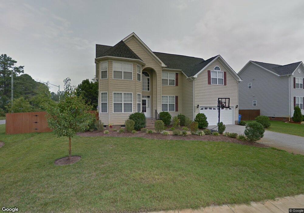
2032 Kinston Waters Ct Chesapeake, VA 23323
Deep Creek NeighborhoodEstimated Value: $642,000 - $660,201
5
Beds
4
Baths
2,916
Sq Ft
$224/Sq Ft
Est. Value
About This Home
This home is located at 2032 Kinston Waters Ct, Chesapeake, VA 23323 and is currently estimated at $651,800, approximately $223 per square foot. 2032 Kinston Waters Ct is a home located in Chesapeake City with nearby schools including Grassfield Elementary School, Hugo a Owens Middle, and Grassfield High School.
Ownership History
Date
Name
Owned For
Owner Type
Purchase Details
Closed on
Mar 26, 2008
Sold by
M C Q Builders
Bought by
Cuttle Patrick F
Current Estimated Value
Home Financials for this Owner
Home Financials are based on the most recent Mortgage that was taken out on this home.
Original Mortgage
$311,920
Outstanding Balance
$198,514
Interest Rate
6.06%
Mortgage Type
New Conventional
Estimated Equity
$453,286
Create a Home Valuation Report for This Property
The Home Valuation Report is an in-depth analysis detailing your home's value as well as a comparison with similar homes in the area
Home Values in the Area
Average Home Value in this Area
Purchase History
| Date | Buyer | Sale Price | Title Company |
|---|---|---|---|
| Cuttle Patrick F | $389,900 | -- |
Source: Public Records
Mortgage History
| Date | Status | Borrower | Loan Amount |
|---|---|---|---|
| Open | Cuttle Patrick F | $311,920 |
Source: Public Records
Tax History Compared to Growth
Tax History
| Year | Tax Paid | Tax Assessment Tax Assessment Total Assessment is a certain percentage of the fair market value that is determined by local assessors to be the total taxable value of land and additions on the property. | Land | Improvement |
|---|---|---|---|---|
| 2025 | $5,695 | $610,400 | $200,000 | $410,400 |
| 2024 | $5,695 | $563,900 | $180,000 | $383,900 |
| 2023 | $5,493 | $543,900 | $155,000 | $388,900 |
| 2022 | $4,831 | $478,300 | $145,000 | $333,300 |
| 2021 | $4,537 | $432,100 | $120,000 | $312,100 |
| 2020 | $4,237 | $403,500 | $105,000 | $298,500 |
| 2019 | $4,016 | $382,500 | $105,000 | $277,500 |
| 2018 | $3,655 | $348,100 | $105,000 | $243,100 |
| 2017 | $3,787 | $360,700 | $100,000 | $260,700 |
| 2016 | $3,787 | $360,700 | $100,000 | $260,700 |
| 2015 | $3,787 | $360,700 | $100,000 | $260,700 |
| 2014 | $3,670 | $349,500 | $100,000 | $249,500 |
Source: Public Records
Map
Nearby Homes
- 2014 Millville Rd
- 1949 Lemonwood Rd
- 2219 Angler Ln
- 1918 Mccoy Rd
- 2084 Millville Rd
- 1908 Mccoy Rd
- 1916 Mccoy Rd
- 1917 Mccoy Rd
- 1725 Burson Dr
- 2000 Kelsey Bay Ct
- 2001 Kelsey Bay Ct
- 1949 Rockwood Dr
- 1928 Moses Grandy Trail
- 1860 Millville Rd
- 1653 Shipyard Rd
- 1920 Lancing Crest Ln
- 2029 Shipyard Rd
- 2152 Millville Rd
- .181AC Shipyard Rd
- 2115 Tall Pine Dr
- 2028 Kinston Waters Ct
- 2031 Kinston Waters Ct
- 2027 Kinston Waters Ct
- 2017 Millville Rd
- 2012 Millville Rd
- 2000 Millville Rd
- 2020 Kinston Waters Ct
- 1845 Burson Dr
- 1853 Burson Dr
- 2019 Millville Rd
- 1841 Burson Dr
- 2023 Kinston Waters Ct
- 1851 Burson Dr
- 1857 Burson Dr
- 1861 Burson Dr
- 2021 Millville Rd
- MM Appomattox Burson Dr
- MM Ashland Burson Dr
- MM Charlotte Burson Dr
- MM Caramel Burson Dr