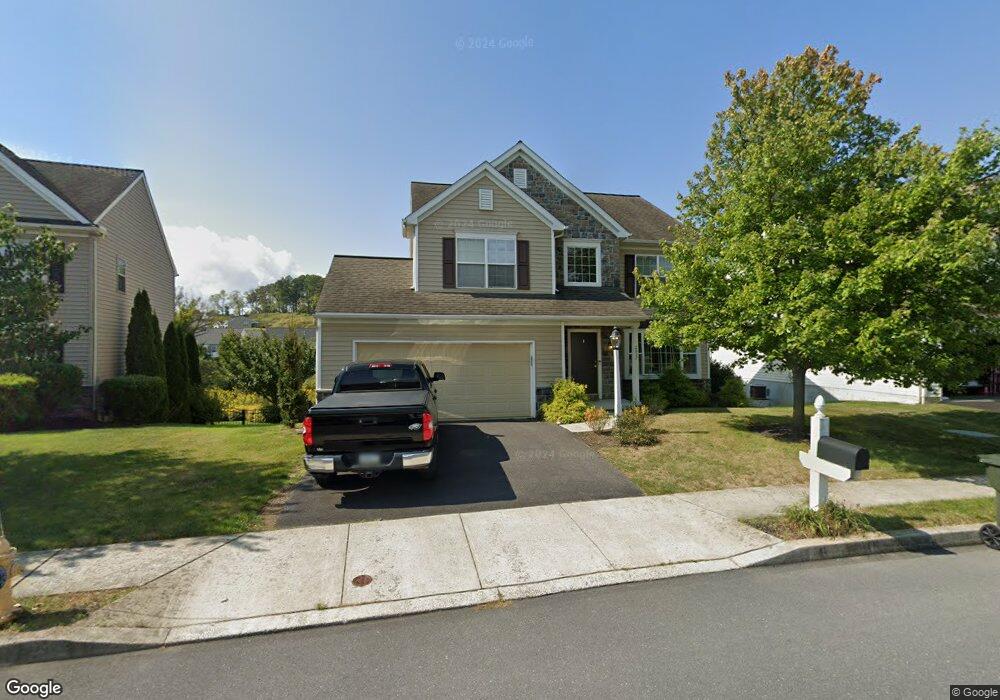
2032 Liberty Dr Unit 130 Mechanicsburg, PA 17055
Upper Allen Township NeighborhoodEstimated Value: $508,346 - $572,000
4
Beds
3
Baths
2,577
Sq Ft
$210/Sq Ft
Est. Value
About This Home
This home is located at 2032 Liberty Dr Unit 130, Mechanicsburg, PA 17055 and is currently estimated at $540,837, approximately $209 per square foot. 2032 Liberty Dr Unit 130 is a home located in Cumberland County with nearby schools including Mechanicsburg Middle School, Mechanicsburg Area Senior High School, and West Shore Christian Academy.
Ownership History
Date
Name
Owned For
Owner Type
Purchase Details
Closed on
Nov 3, 2018
Sold by
Correa Mark A and Correa Davohn Lee
Bought by
Harrold Walton E and Harrold Teresa K
Current Estimated Value
Home Financials for this Owner
Home Financials are based on the most recent Mortgage that was taken out on this home.
Original Mortgage
$305,910
Outstanding Balance
$267,881
Interest Rate
4.6%
Mortgage Type
New Conventional
Estimated Equity
$272,956
Purchase Details
Closed on
Feb 22, 2016
Sold by
Aves Michael S and Aves Maria L
Bought by
Correa Mark A and Correa Davohn Lee
Home Financials for this Owner
Home Financials are based on the most recent Mortgage that was taken out on this home.
Original Mortgage
$315,000
Interest Rate
3.79%
Mortgage Type
New Conventional
Purchase Details
Closed on
Nov 23, 2010
Sold by
Upper Allen Partners Lp
Bought by
Ares Michael S
Home Financials for this Owner
Home Financials are based on the most recent Mortgage that was taken out on this home.
Original Mortgage
$248,750
Interest Rate
4.23%
Mortgage Type
New Conventional
Create a Home Valuation Report for This Property
The Home Valuation Report is an in-depth analysis detailing your home's value as well as a comparison with similar homes in the area
Home Values in the Area
Average Home Value in this Area
Purchase History
| Date | Buyer | Sale Price | Title Company |
|---|---|---|---|
| Harrold Walton E | $339,900 | Teampete Settlement Svcs Llc | |
| Correa Mark A | $315,000 | None Available | |
| Ares Michael S | $310,950 | -- |
Source: Public Records
Mortgage History
| Date | Status | Borrower | Loan Amount |
|---|---|---|---|
| Open | Harrold Walton E | $305,910 | |
| Previous Owner | Correa Mark A | $315,000 | |
| Previous Owner | Ares Michael S | $248,750 |
Source: Public Records
Tax History Compared to Growth
Tax History
| Year | Tax Paid | Tax Assessment Tax Assessment Total Assessment is a certain percentage of the fair market value that is determined by local assessors to be the total taxable value of land and additions on the property. | Land | Improvement |
|---|---|---|---|---|
| 2025 | $6,821 | $310,900 | $65,000 | $245,900 |
| 2024 | $6,573 | $310,900 | $65,000 | $245,900 |
| 2023 | $6,286 | $310,900 | $65,000 | $245,900 |
| 2022 | $6,117 | $310,900 | $65,000 | $245,900 |
| 2021 | $5,928 | $310,900 | $65,000 | $245,900 |
| 2020 | $5,780 | $310,900 | $65,000 | $245,900 |
| 2019 | $5,637 | $310,900 | $65,000 | $245,900 |
| 2018 | $5,539 | $310,900 | $65,000 | $245,900 |
| 2017 | $5,429 | $310,900 | $65,000 | $245,900 |
| 2016 | -- | $310,900 | $65,000 | $245,900 |
| 2015 | -- | $310,900 | $65,000 | $245,900 |
| 2014 | -- | $310,900 | $65,000 | $245,900 |
Source: Public Records
Map
Nearby Homes
- 2069 Spring Wood Ln
- 917 Macoun Dr
- 709 Jonathan Ct
- 1810 Shady Ln
- 2030 N Fall Harvest Dr
- 1842 Shady Ln
- 2034 N Fall Harvest Dr
- 2034 N Fall Harvest Dr Unit 56
- 1771 Shady Ln
- 2040 Fall Harvest Dr
- 1730 Fairbank Ln
- 584 Smoke House Dr
- Maddox Plan at Autumn Chase - Estates
- Monroe Plan at Autumn Chase - Estates
- Everett Plan at Autumn Chase - Estates
- Davenport Plan at Autumn Chase - Estates
- Cooper Plan at Autumn Chase - Estates
- Nottingham Plan at Autumn Chase - Estates
- Mackenzie Plan at Autumn Chase - Estates
- Dalton Plan at Autumn Chase - Estates
- 2032 Liberty Dr
- 2034 Liberty Dr
- 2030 Liberty Dr
- 2036 Liberty Dr
- Lot 238 Liberty Dr
- Lot 237 Liberty Dr
- Lot 239 Liberty Dr
- Lot 400 Liberty Dr
- 2031 Liberty Dr
- 2033 Liberty Dr
- 2028 Liberty Dr
- 2029 Liberty Dr
- 2038 Liberty Dr
- 2027 Liberty Dr
- 2037 Liberty Dr
- 2026 Liberty Dr Unit 127
- 2026 Liberty Dr
- 2040 Liberty Dr
- 700 Macoun Dr
- 2025 Liberty Dr