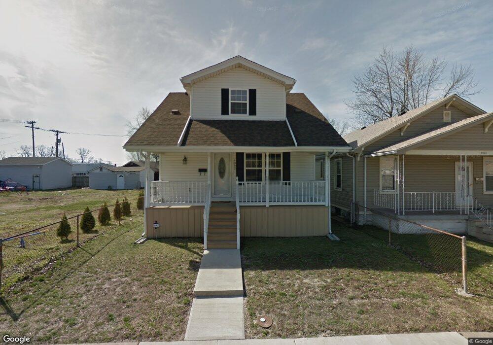
2032 Mccasland Ave Madison, IL 62060
Estimated Value: $63,052 - $166,000
2
Beds
1
Bath
672
Sq Ft
$159/Sq Ft
Est. Value
About This Home
This home is located at 2032 Mccasland Ave, Madison, IL 62060 and is currently estimated at $106,513, approximately $158 per square foot. 2032 Mccasland Ave is a home located in Madison County with nearby schools including Bernard Long Elementary School, Madison Senior High School, and Rivers of Life Christian School.
Ownership History
Date
Name
Owned For
Owner Type
Purchase Details
Closed on
Jul 26, 2010
Sold by
Jellen Norma
Bought by
Williams Monisha
Current Estimated Value
Home Financials for this Owner
Home Financials are based on the most recent Mortgage that was taken out on this home.
Original Mortgage
$81,810
Outstanding Balance
$54,818
Interest Rate
4.81%
Mortgage Type
FHA
Estimated Equity
$51,695
Purchase Details
Closed on
May 21, 2009
Sold by
Jlm Propertys Inc
Bought by
Jellen Norma
Create a Home Valuation Report for This Property
The Home Valuation Report is an in-depth analysis detailing your home's value as well as a comparison with similar homes in the area
Home Values in the Area
Average Home Value in this Area
Purchase History
| Date | Buyer | Sale Price | Title Company |
|---|---|---|---|
| Williams Monisha | $83,000 | Pontoon Title Co | |
| Jellen Norma | $3,000 | Pontoon Title Co |
Source: Public Records
Mortgage History
| Date | Status | Borrower | Loan Amount |
|---|---|---|---|
| Open | Williams Monisha | $81,810 |
Source: Public Records
Tax History
| Year | Tax Paid | Tax Assessment Tax Assessment Total Assessment is a certain percentage of the fair market value that is determined by local assessors to be the total taxable value of land and additions on the property. | Land | Improvement |
|---|---|---|---|---|
| 2024 | $2,019 | $22,880 | $1,030 | $21,850 |
| 2023 | $2,019 | $19,930 | $900 | $19,030 |
| 2022 | $1,787 | $18,090 | $820 | $17,270 |
| 2021 | $1,600 | $17,200 | $780 | $16,420 |
| 2020 | $1,561 | $16,640 | $750 | $15,890 |
| 2019 | $1,431 | $15,820 | $810 | $15,010 |
| 2018 | $1,333 | $14,920 | $770 | $14,150 |
| 2017 | $1,192 | $14,920 | $770 | $14,150 |
| 2016 | $1,163 | $14,920 | $770 | $14,150 |
| 2015 | $1,205 | $14,970 | $770 | $14,200 |
| 2014 | $1,205 | $14,970 | $770 | $14,200 |
| 2013 | $1,205 | $15,390 | $790 | $14,600 |
Source: Public Records
Map
Nearby Homes
- 2013 Beckwith Ave
- 2032 Milan Ave
- 1907 Rhodes St
- 1845 Rhodes St
- 2020 6th St
- 2013 4th St
- 1735 Rhodes St
- 1036 Greenwood St
- 805 Iowa St
- 1638 4th St
- 1348 Madison Ave
- 1608 3rd St
- 1437 Grand Ave
- 1808 State St
- 2108 Washington Ave
- 2013 Grand Ave Unit A,B,A,B
- 2208 Iowa St
- 2225 Iowa St
- 1909 Grand Ave
- 1911 Benton St
- 2030 Mccasland Ave
- 2036 Mccasland Ave
- 2024 Mccasland Ave
- 2038 Mccasland Ave
- 2035 Beckwith Ave
- 2031 Beckwith Ave
- 2020 Mccasland Ave
- 2039 Beckwith Ave
- 2025 Beckwith Ave
- 2041 Beckwith Ave
- 2043 Beckwith Ave
- 2018 Mccasland Ave
- 2033 Mccasland Ave
- 2035 Mccasland Ave
- 2029 Mccasland Ave
- 2023 Mccasland Ave
- 2037 Mccasland Ave
- 2019 Beckwith Ave
- 2021 Mccasland Ave
- 2014 Mccasland Ave
Your Personal Tour Guide
Ask me questions while you tour the home.